

Some Storms Continue
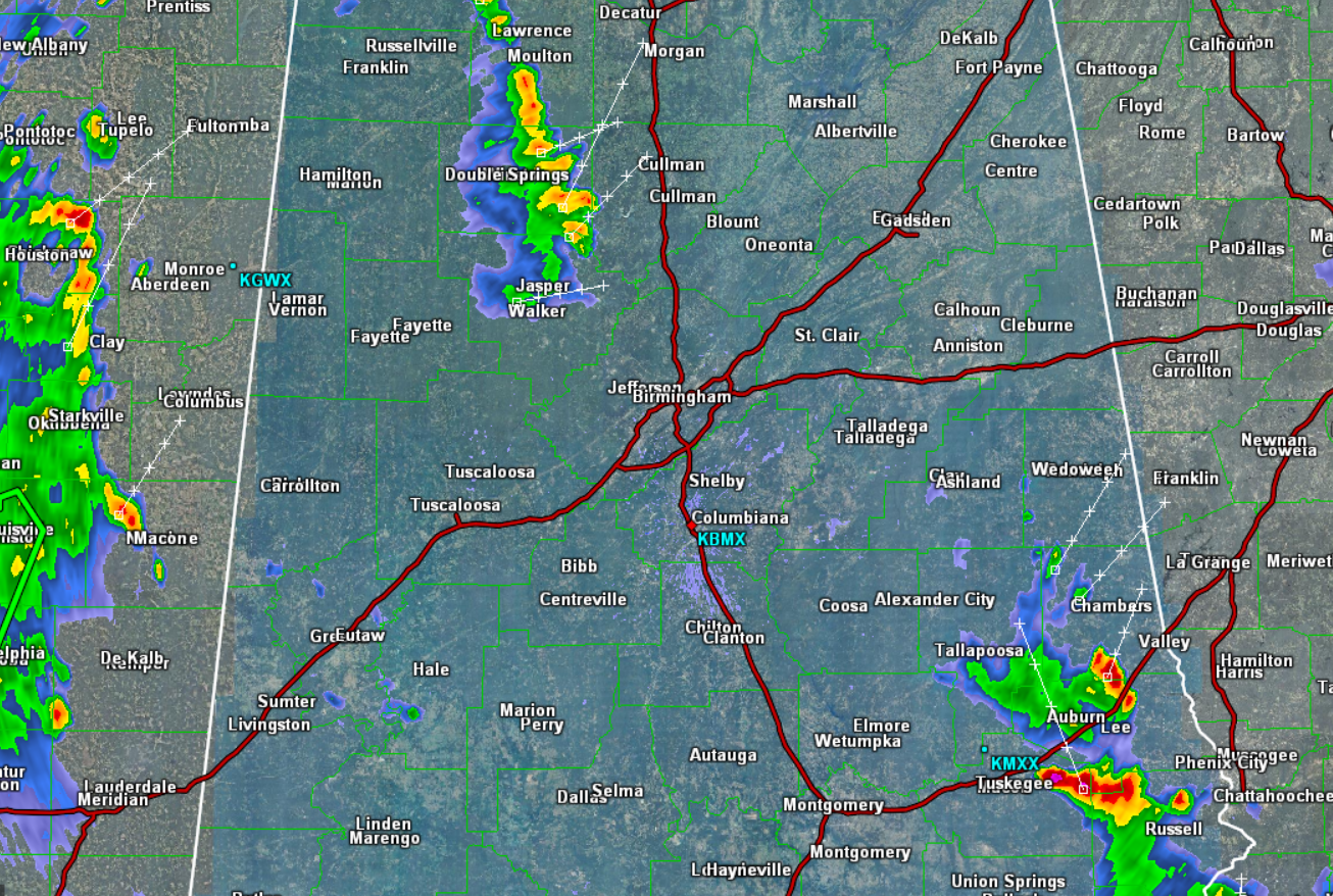
Most of the thunderstorm activity across the state has dissipated this evening. We still have two main clusters of storms affecting counties in Central Alabama. The first area is around Smith Lake and is impacting portions of Winston, Cullman, and Walker Counties. To the southeast, additional strong storms are affecting parts of Lee, Chambers, Russell, and Macon Counties.
All convection continues to move off to the north-northeast. None of these storms are currently severe, but they are producing frequent and dangerous lightning, very heavy rainfall, gusty winds, and some hail.
There have been some isolated reports of tree and power line damage with some of these storms today, so they are definitely packing a punch. The storms should continue to wind down the next couple of hours, but as warm and humid as the air over Alabama is, we could see a few scattered storms during the overnight hours as well.
Click image to enlarge.
Category: Alabama's Weather
About the Author (Author Profile)
Macon, Georgia Television Chief Meteorologist, Birmingham native, and long time Contributor on AlabamaWX. Stormchaser. I did not choose Weather, it chose Me. College Football Fanatic. @Ryan_StinnetSubscribe
If you enjoyed this article, subscribe to receive more just like it.


