

Lunchtime Radar Check
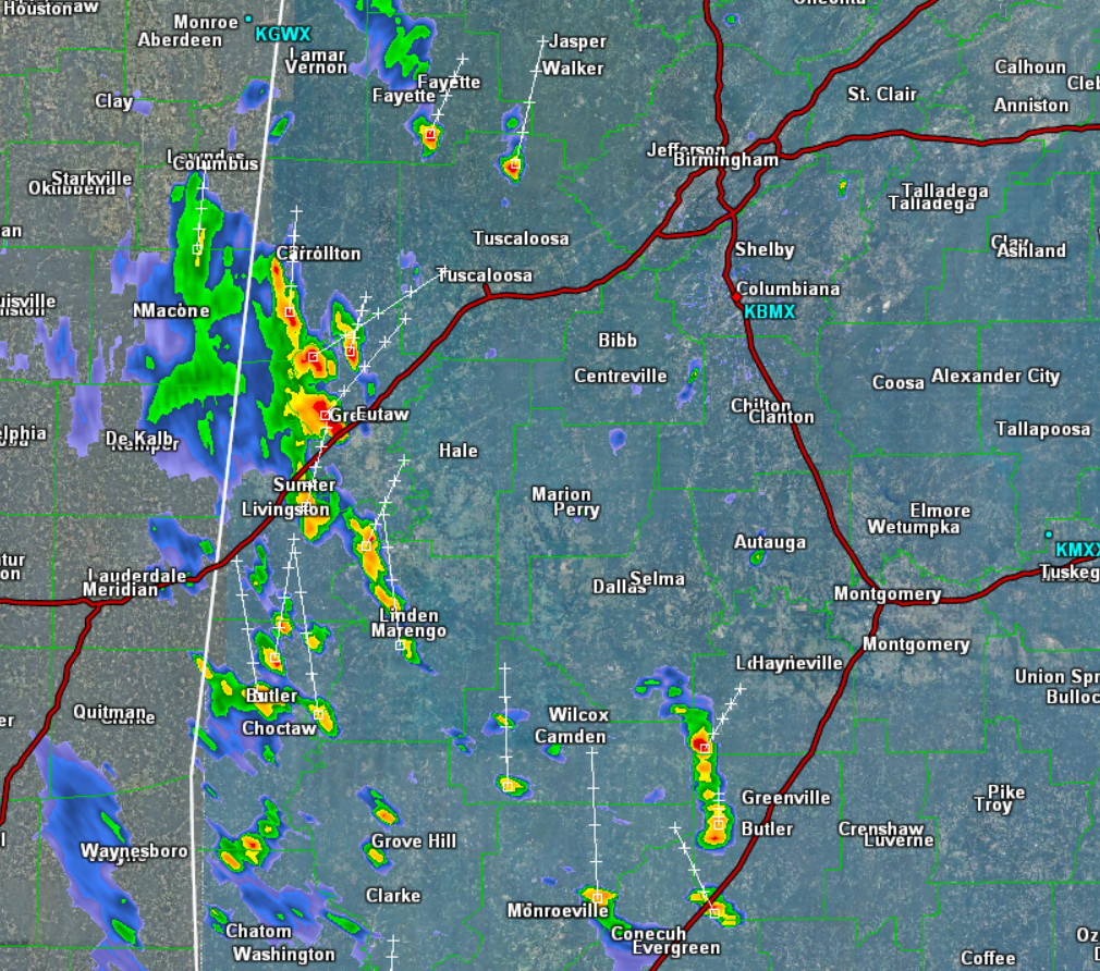
Once again, we are seeing showers and storms developing across the state as an upper-level low inches closer from the west. At this time, the majority of the convective activity is west of Interstate 65. It continues to lift mostly towards the north, but there is a bit of an eastward component.
With this convection, gusty winds are possible, as well as heavy rainfall, perhaps some small hail, and of course a lot of lightning. Through the afternoon and evening hours, we will see additional storms develop and lift north across the state. None of the storms in the state are currently severe, and for the most part they should remain below severe limits, but we cannot rule out an isolated severe cell.
Not every location will see the rain and storms today. The best chances are across the western portions of the state as it is closer to the forcing from the upper-level feature.
Click image to enlarge.
Category: Alabama's Weather
About the Author (Author Profile)
Macon, Georgia Television Chief Meteorologist, Birmingham native, and long time Contributor on AlabamaWX. Stormchaser. I did not choose Weather, it chose Me. College Football Fanatic. @Ryan_StinnetSubscribe
If you enjoyed this article, subscribe to receive more just like it.


