Blanket Of Moist Air Hangs Around
An all new edition of the ABC 33/40 Weather Xtreme video is available in the player on the right sidebar of the blog. You can subscribe to the Weather Xtreme video on iTunes by clicking here.
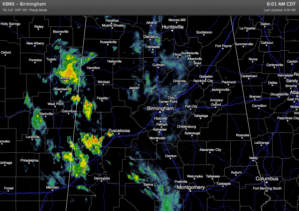
AT DAYBREAK: We begin the day with clouds and some rain in scattered pockets, especially over the western half of the state…
The overall synoptic pattern really isn’t much different today; there is an upper low over far southern Arkansas, and we are in a very moist airmass, so the weather won’t change much. Mostly cloudy, occasional showers and possibly a thunderstorm. The high today will be in the low 80s in most places; some communities won’t get out of the 70s.
OUR WEEKEND: The upper low will drift west and weaken, and we stay in moist air. We expect a mix of sun and clouds tomorrow and Sunday, and scattered showers and thunderstorms are likely both days. But, it won’t rain all weekend as the showers become more widely spaced. The high should be generally in the mid 80s tomorrow and Sunday.
NEXT WEEK: We begin meteorological summer with a classic weather pattern; partly sunny, warm days with the risk of scattered, mostly afternoon and evening showers and thunderstorms. Highs will be in the upper 80s Monday and Tuesday, and we should be around 90 degrees by Wednesday and Thursday as an upper high noses into the state from the west. Showers should also become fewer in number by mid-week.
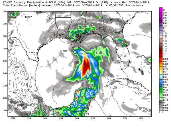
To the south, the GFS continues to develop some type of tropical feature in the Gulf of Mexico toward the end of the week. We note the Euro (ECMWF) does the same thing…
Both models leave it meandering around in the Gulf out to at least 240 hours with weak steering currents. Seems like a decent chance it becomes our first depression or storm of the season, but it remains to be seen if it will impact Alabama. See the Weather Xtreme video for more maps, graphics, and details.
AT THE BEACH: Showers and storms remain likely today and tomorrow on the Gulf Coast from Panama City over to Gulf Shores; in fact a flash flood watch remains in effect. But, showers thin out greatly Sunday and through much of next week with increasing amounts of sunshine. Sea water temperatures are mostly in the 77-81 degree range.
WEATHER BRAINS: Don’t forget you can listen to our weekly 90 minute netcast anytime on the web, or on iTunes. This is the show all about weather featuring many familiar voices, including our meteorologists here at ABC 33/40. Scroll down for the show notes on the new episode we recorded last night.
CONNECT: You can find me on all of the major social networks…
Facebook
Twitter
Google Plus
Instagram
Look for the next Weather Xtreme video here by 4:00 or so this afternoon… enjoy the day!
Category: Alabama's Weather


