

Weather Update at 1:00 PM
A severe thunderstorm watch remains in effect for the afternoon for much of Alabama. Some of the western sections of Central Alabama have been cleared from the watch area, but rain with some embedded thunderstorms will still continue in that area. A flash flood watch is also in effect for much of the Northwest Quadrant of Alabama.
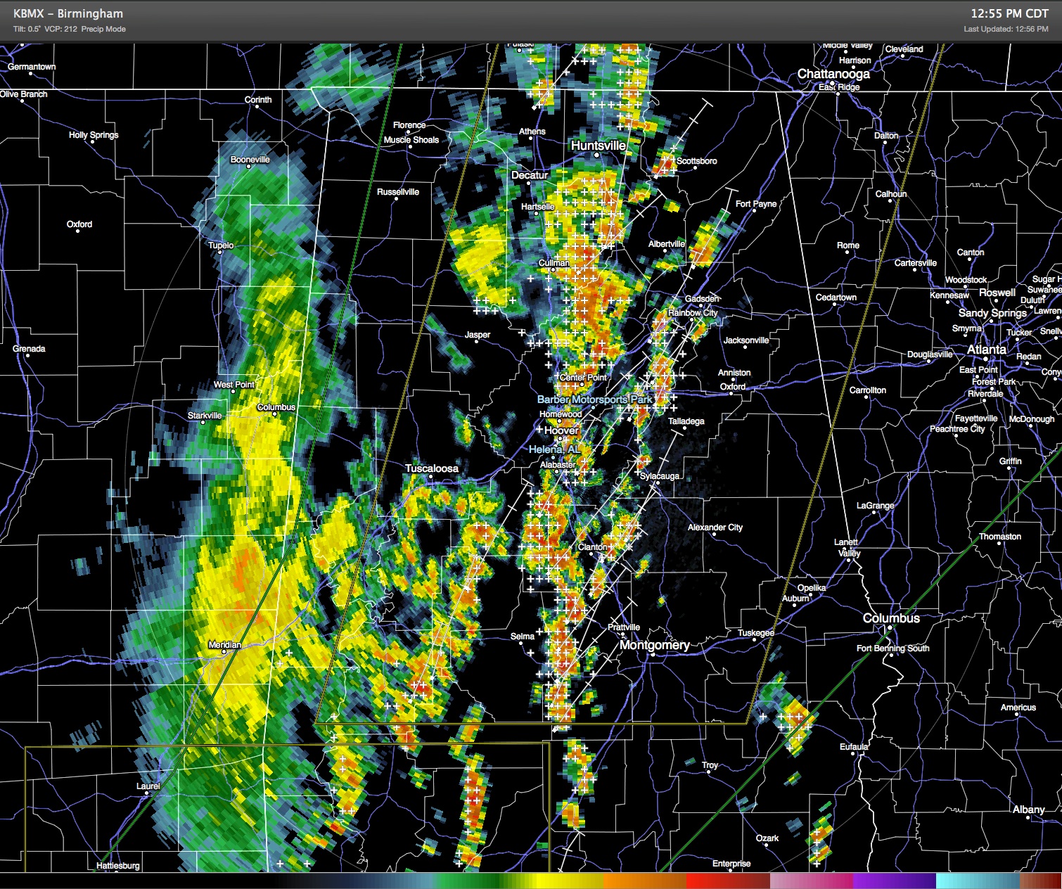
As the radar image below shows, thunderstorms were lined up in a broken line of cells extending from Huntsville southward through Birmingham to just west of Montgomery. This is approximately along Interstate 65.
The main risk for the afternoon will be damaging wind and large hail, but as we’ve noted, the rather dynamic nature to the atmosphere with the upper closed low over Missouri keeps this from being your typical afternoon thunderstorms. Lightning is also a big danger, so please don’t take any unnecessary chances when thunder is occurring in your area.
While tornadoes are not the main threat, the wind profile from the upper air sounding this morning at the Shelby County Airport along with the moisture profile suggested that an isolated tornado or two may be possible. Heavy rains over the last several days have kept the risk of flash flooding in the heavy downpours high. Don’t drive into areas where water covers the road – Turn Around – Don’t Drown!
-Brian-
Category: Alabama's Weather, Severe Weather
About the Author (Author Profile)
Brian Peters is one of the television meteorologists at ABC3340 in Birmingham and a retired NWS Warning Coordination Meteorologist. He handles the weekend Weather Xtreme Videos and forecast discussion and is the Webmaster for the popular WeatherBrains podcast.Subscribe
If you enjoyed this article, subscribe to receive more just like it.


