Showers/Storms Increase Tomorrow
An all new edition of the ABC 33/40 Weather Xtreme video is available in the player on the right sidebar of the blog. You can subscribe to the Weather Xtreme video on iTunes by clicking here.
RADAR CHECK: We have just a few isolated showers over East Alabama this afternoon… a large percentage of Alabama is rain-free for a change. Temperatures are mostly in the mid 80s.
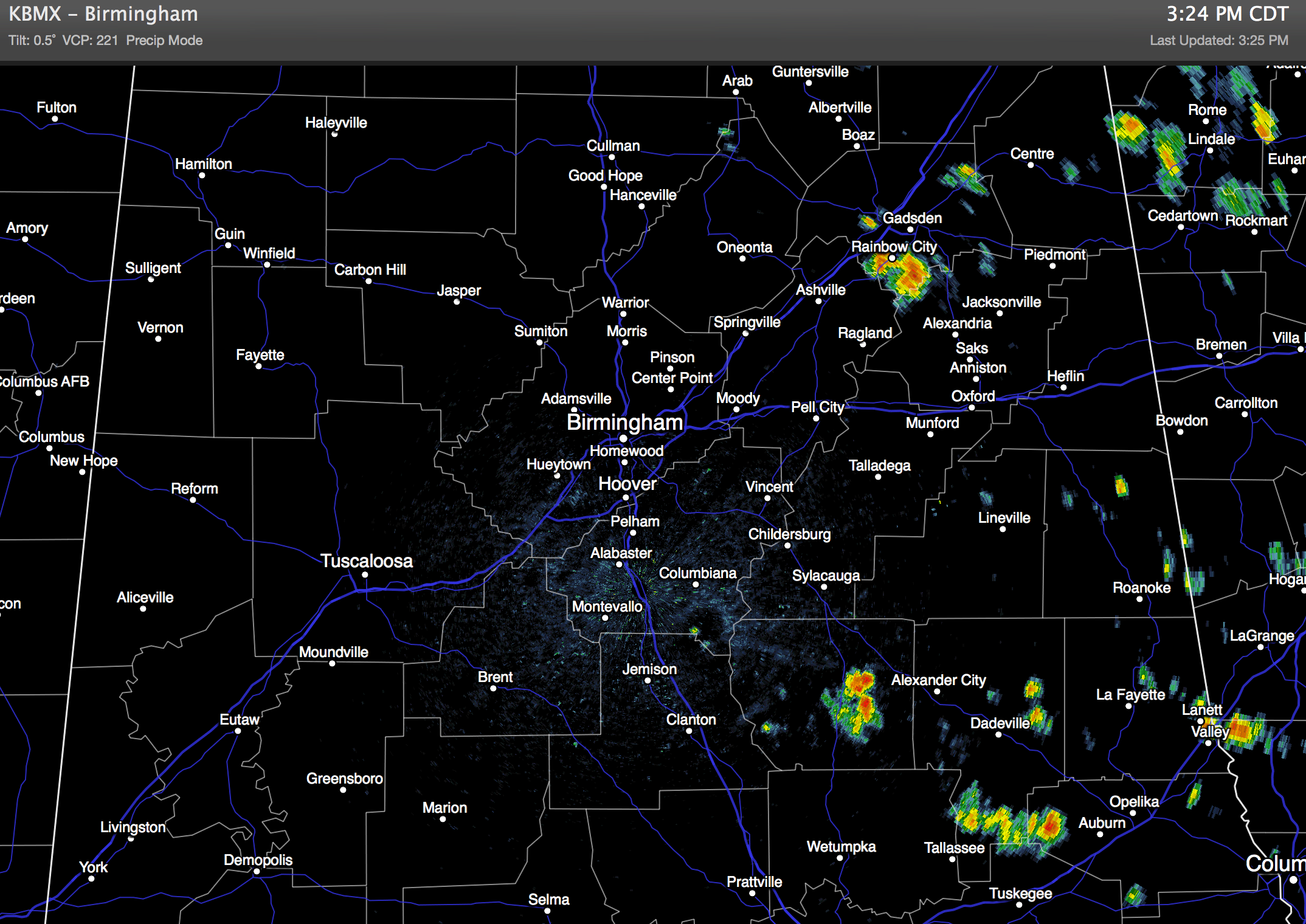
The showers over East Alabama will end this evening.
TO THE WEST: SPC maintains the standard “slight risk” of severe weather through tonight from Mississippi to Texas, where a short wave will bring strong to severe storms. These storms will likely enter West Alabama very early tomorrow morning, possibly before daybreak.
Tomorrow will feature a mostly cloudy sky, with a few showers and storms likely. It could very well be a situation where the best chance of rain will come during the morning hours, but we will carry the chance of showers through the afternoon. While a few strong storms are possible, organized severe weather is not expected, and rain amounts of around 1/2 to 3/4 inch are likely with a high in the low to mid 80s.
THE ALABAMA WEEKEND: Our weather is looking generally dry Saturday and Sunday. Partly to mostly sunny both days with only isolated afternoon showers and thunderstorms. Chance of any one spot getting wet both days is only about one in eight, and the high will be mostly in the upper 80s.
NEXT WEEK: The GFS model is suggesting the upper high will form around the North Carolina coast, and here in Alabama we will roll with a typical summer forecast for the first half of the week. Mixed sun and clouds each day Monday through Wednesday with the risk of “scattered, mostly afternoon and evening showers and thunderstorms”. Highs will be in the 87-90 degree range.
Showers and storms should increase late in the week on Thursday and Friday as a surface boundary approaches from the north. See the Weather Xtreme video for the maps, graphics, and details.
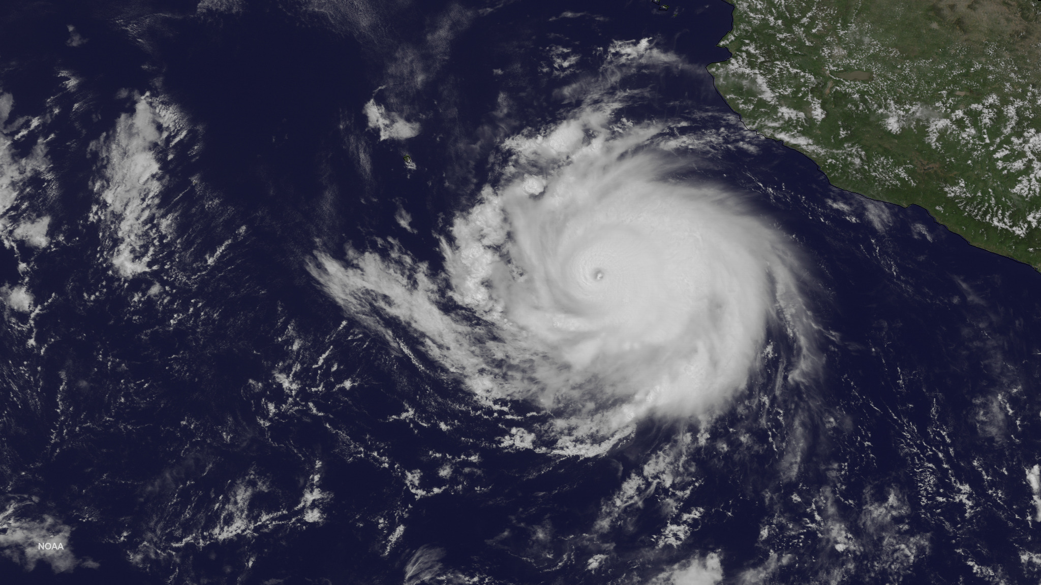
TROPICS: The Atlantic basin is quiet, but over in the East Pacific Hurricane Cristina, off the coast of Mexico, is packing sustained winds of 150 mph. It will not impact any land area, and will weaken this weekend as it moves over colder water.
GULF COAST WEATHER: About 6 to 8 hours of sunshine each day through the weekend, with a few scattered showers and storms possible. Showers will thin out Saturday and Sunday… highs will remain in the 80s, and sea water temperatures are mostly in the low 80s.
WEATHER BRAINS: Don’t forget you can listen to our weekly 90 minute netcast anytime on the web, or on iTunes. This is the show all about weather featuring many familiar voices, including our meteorologists here at ABC 33/40.
CONNECT: You can find me on all of the major social networks…
Facebook
Twitter
Google Plus
Instagram
Look for the next Weather Xtreme video here by 7:00 a.m. tomorrow….
Category: Alabama's Weather
About the Author (Author Profile)
James Spann is one of the most recognized and trusted television meteorologists in the industry. He holds the AMS CCM designation and television seals from the AMS and NWA. He is a past winner of the Broadcast Meteorologist of the Year from both professional organizations.Subscribe
If you enjoyed this article, subscribe to receive more just like it.


