Heavy Rains Falling over Northeast Alabama
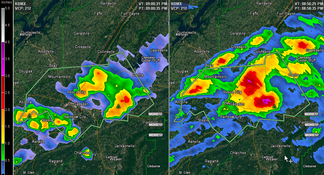
Persistent thunderstorms over Northeast Alabama are producing th epotential for flooding tonight.
They have been heavy tonight from eastern Blount County across much of Etowah County into Cherokee County tonight.
The NWS has issued an areal flood advisory for parts of the area outlined in green.
Radar estimates of 1 to 3 inches are showing up on radar tonight from northeast of Reece City to near and north of Hokes Bluff.
Be alert to potential flooding and always remember, turn around, don’t drown.
Storms over northern Mississippi and southern Tennessee have weakened over the past hour or so and there are no severe thunderstorm watches or warnings in effect right now.
Category: Alabama's Weather
About the Author (Author Profile)
Bill Murray is the President of The Weather Factory. He is the site's official weather historian and a weekend forecaster. He also anchors the site's severe weather coverage. Bill Murray is the proud holder of National Weather Association Digital Seal #0001 @wxhistorianSubscribe
If you enjoyed this article, subscribe to receive more just like it.


