Heat Levels Rising In Coming Days
An all new edition of the ABC 33/40 Weather Xtreme video is available in the player on the right sidebar of the blog. You can subscribe to the Weather Xtreme video on iTunes by clicking here.
SUMMER HEAT FINALLY ARRIVING: This summer has featured below average temperatures, and a number of mornings with record lows across Alabama and the Deep South, but we all know that good ole summer heat and humidity would clobber us at least once before the fall sets in, and sure enough an upper high will build across the Deep South in coming days bringing some of the hottest weather so far this summer.
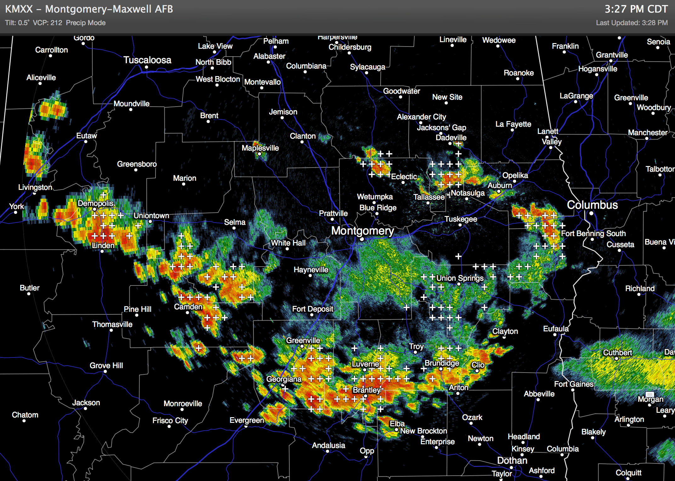
Radar today shows most of showers and storms over the southern half of the state this afternoon; they are moving southeast.
TOMORROW THROUGH FRIDAY: We rise into the mid 90s tomorrow, and upper 90s Thursday and Friday afternoon. Lots of hazy sunshine each day, and while an afternoon thunderstorm is certainly possible, they will become fewer in number, and more widely spaced.
THE ALABAMA WEEKEND: A 5910 meter 500 mb upper high will be parked over Alabama and the Deep South, so the weather won’t change much. Hot, hazy, and humid with highs in the upper 90s and only isolated afternoon thunderstorms.
NEXT WEEK: Heat levels begin to come down over the latter part of next week as the upper high weakens and the air aloft becomes colder. See the Weather Xtreme video for maps, graphics, and more details.
GULF COAST WEATHER: Mostly sunny days, fair nights tomorrow through the weekend with only isolated thunderstorms. Highs 87-90, sea water temperatures from Panama City to Gulf Shores mostly in the mid 80s.
TROPICS: NHC has now has a 30 percent probability of a wave developing over the Atlantic; this wave should enter the Caribbean later this week. Social media and blogs are buzzing after the 12Z GFS model developed this into a hurricane, moving it toward Mobile Bay next week. But, this is nothing more than hype and voodoo; there is no skill in a tropical forecast 7-10 days out. We don’t even know if this can survive the dry air environment in the short term. Just something to watch; see the Weather Xtreme video for a detailed discussion and a look at the maps.
WEATHER BRAINS: Don’t forget you can listen to our weekly 90 minute netcast anytime on the web, or on iTunes. This is the show all about weather featuring many familiar voices, including our meteorologists here at ABC 33/40. Scroll down for the show notes on the new episode we recorded last night with Dave Brown of WMC-TV in Memphis.
CONNECT: You can find me on all of the major social networks…
Facebook
Twitter
Google Plus
Instagram
I really enjoyed seeing the kids at the RISE School in Tuscaloosa this morning…. be looking for them on the Pepsi KIDCAM today at 5:00 on ABC 33/40 News. The next Weather Xtreme video will be posted here by 7:00 a.m. tomorrow….
Category: Alabama's Weather
About the Author (Author Profile)
James Spann is one of the most recognized and trusted television meteorologists in the industry. He holds the AMS CCM designation and television seals from the AMS and NWA. He is a past winner of the Broadcast Meteorologist of the Year from both professional organizations.Subscribe
If you enjoyed this article, subscribe to receive more just like it.


