Just A Few Isolated Showers Today
An all new edition of the ABC 33/40 Weather Xtreme video is available in the player on the right sidebar of the blog. You can subscribe to the Weather Xtreme video on iTunes by clicking here.
RADAR CHECK: The high resolution NAM model yesterday hinted at showers over North Alabama early this morning, and sure enough we have a few on radar this morning; they are moving southeast.
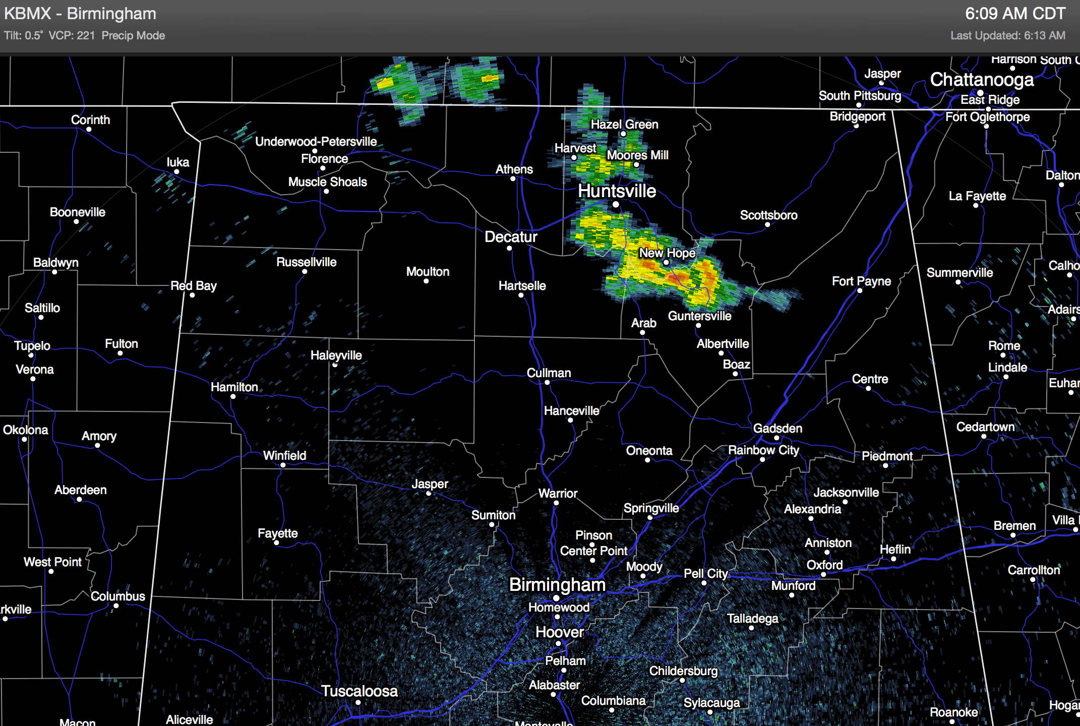
We will mention the risk of a few widely scattered showers today, but the most widespread rain should be west of the state over Mississippi/Louisiana/Arkansas, closer to a wave in the northwest flow aloft across the Mid-South. The chance of any one spot seeing a shower today is about one in five across north and central Alabama… otherwise the day will feature a mix of sun and clouds with a high in the mid 80s.
TOMORROW: Most of the state will have a partly sunny and warm day, but for those of you near the Georgia border, a cold air damming (CAD) pattern could bring clouds in for much of the day from the east, and maybe even a shower or two. The best chance of a shower will be near and east of U.S. 431, and even there they will be widely spaced. Tomorrow’s high will be in the 80s for most of the state, but communities near the Georgia border would hold in the 70s through the day.
THE ALABAMA WEEKEND: Saturday will be a mostly sunny day with a high in the mid 80s; the weather stays dry during the day Sunday, but we will introduce the chance of a shower Sunday night ahead of a cold front approaching from the north.
We will maintain the threat of a shower Monday as the front passes down through the state, then cooler and drier air arrives for Tuesday and Wednesday; it could be the coolest air we have seen so far this fall with highs in the 78-81 degree range, and lows in the 50s. See the Weather Xtreme video for maps, graphics, and more details.
FOOTBALL WEATHER: For tonight’s Auburn/Kansas State football game in Manhattan, Kansas (6:30p CT kickoff)… the sky will be mostly fair, the temperature will fall from around 77 degrees at kickoff, into the low 70s by the final whistle.
For the high school football games tonight and tomorrow night across Alabama, most stadiums will be dry, but we will mention a slight risk of a shower during the first half. Temperatures will fall through the 70s.
Alabama will host Florida at Bryant-Denny Stadium in Tuscaloosa Saturday afternoon (2:30p CT kickoff)… the sky will be mostly sunny with a kickoff temperature near 85 degrees, falling into the upper 70s by the final whistle.
TROPICS: Hurricane Edouard is moving east through the open Atlantic with winds of 85 mph… it will weaken and dissipate early next week far from land. A few wave has emerged off the coast of Africa, but shows little organization.
GULF COAST WEATHER: Expect mostly sunny days and fair nights on the Gulf Coast from Panama City to Gulf Shores through the weekend with only isolated showers; highs will remain in the mid to upper 80s. The sea water temperature early this morning at the Dauphin Island Sea Lab is 85 degrees.
WEATHER BRAINS: Don’t forget you can listen to our weekly 90 minute netcast anytime on the web, or on iTunes. This is the show all about weather featuring many familiar voices, including our meteorologists here at ABC 33/40.
CONNECT: You can find me on all of the major social networks…
Facebook
Twitter
Google Plus
Instagram
I will be doing a severe weather safety program this morning at Alabama Power in downtown Birmingham… look for the next Weather Xtreme video here by 4:00 or so this afternoon. Enjoy the day!
Category: Alabama's Weather
About the Author (Author Profile)
James Spann is one of the most recognized and trusted television meteorologists in the industry. He holds the AMS CCM designation and television seals from the AMS and NWA. He is a past winner of the Broadcast Meteorologist of the Year from both professional organizations.Subscribe
If you enjoyed this article, subscribe to receive more just like it.


