Radar Check
Click image to enlarge.
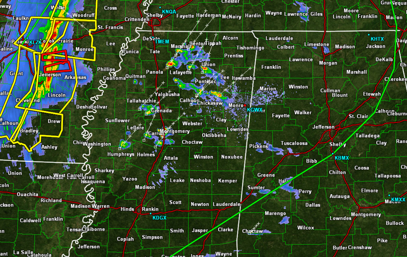
Most of the activity across the state has weakened and dissipated this evening. There are a few showers across northern Mississippi, but those are lifting north. The bulk of the activity continues to be west of the Mississippi River. Much of North-Central Alabama remains under a “slight risk” for severe weather through 7 AM tomorrow morning.
The line of storms will continue eastward through the overnight hours, and should be approaching the northwestern counties during the early morning hours. Gusty winds, frequent lightning, heavy rainfall, and hail will be possible. The line of storms should be weakening as it approaches the state, but there will still be a chance for a few isolated severe storms, mainly north of Interstate 59.
With this line of storms, quite a bit of damage has being reported from Arkansas and Texas. There are numerous severe cells and even a few tornado warned storms, but once again, these storms should be slowly weakening as they approach Alabama.
Category: Alabama's Weather, Severe Weather
About the Author (Author Profile)
Macon, Georgia Television Chief Meteorologist, Birmingham native, and long time Contributor on AlabamaWX. Stormchaser. I did not choose Weather, it chose Me. College Football Fanatic. @Ryan_StinnetSubscribe
If you enjoyed this article, subscribe to receive more just like it.


