Severe Thunderstorm Warning: Jefferson, Bibb and Shelby

UPDATE 3:55 AM
The highest potential for damaging winds is pushing across northern Shelby County and extreme southern Jefferson County. Areas from near Hoover/Meadowbrook south through Alabaster to Calera should be especially alert. The strong winds will push northeast toward Chelsea and Harpersville.
ORIGINAL POST
Storms from North Johns to West Blocton are potentially severe this morning, prompting the NWS to issue a Severe Thunderstorm Warning.
These storms will move northeast across much of the Birmingham Metro area.
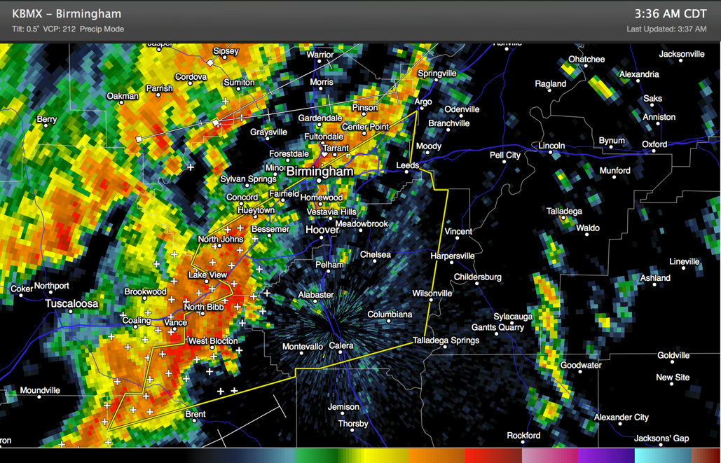
Be alert for the potential for damaging winds as these storms pass.
There will also be torrential rains, deadly lighting and even some hail.
THE NATIONAL WEATHER SERVICE IN BIRMINGHAM HAS ISSUED A
* SEVERE THUNDERSTORM WARNING FOR…
NORTHERN BIBB COUNTY IN ALABAMA…
SOUTHERN JEFFERSON COUNTY IN ALABAMA…
SHELBY COUNTY IN ALABAMA…
* UNTIL 430 AM CDT
* AT 331 AM CDT…THE NATIONAL WEATHER SERVICE INDICATED A LINE OF
SEVERE THUNDERSTORMS CAPABLE OF PRODUCING DAMAGING WINDS IN EXCESS
OF 60 MPH. THESE STORMS WERE LOCATED ALONG A LINE EXTENDING FROM
ALABAMA ADVENTURE TO MERTZ…AND MOVING EAST AT 45 MPH.
* LOCATIONS IMPACTED INCLUDE…
HUEYTOWN…BESSEMER…FAIRFIELD…HOMEWOOD…BIRMINGHAM…VESTAVIA
HILLS…HOOVER AND MOUNTAIN BROOK.
THIS INCLUDES…
INTERSTATE 65 EXIT NUMBERS 228 THROUGH 262…
INTERSTATE 459 EXIT NUMBERS 1 THROUGH 33…
INTERSTATE 20 EXIT NUMBERS 104 THROUGH 140…
INTERSTATE 59 EXIT NUMBERS 130 THROUGH 143…
Category: Alabama's Weather, Severe Weather
About the Author (Author Profile)
Subscribe
If you enjoyed this article, subscribe to receive more just like it.


