

Several Flash Flood Warnings

Heavy rain continues across much of Alabama east of I-65 north of Birmingham and I-59 southwest of Birmingham. Rainfall amounts have been heavy, as evidenced by the storm total rainfall amounts displayed on the right side of the radar image below.
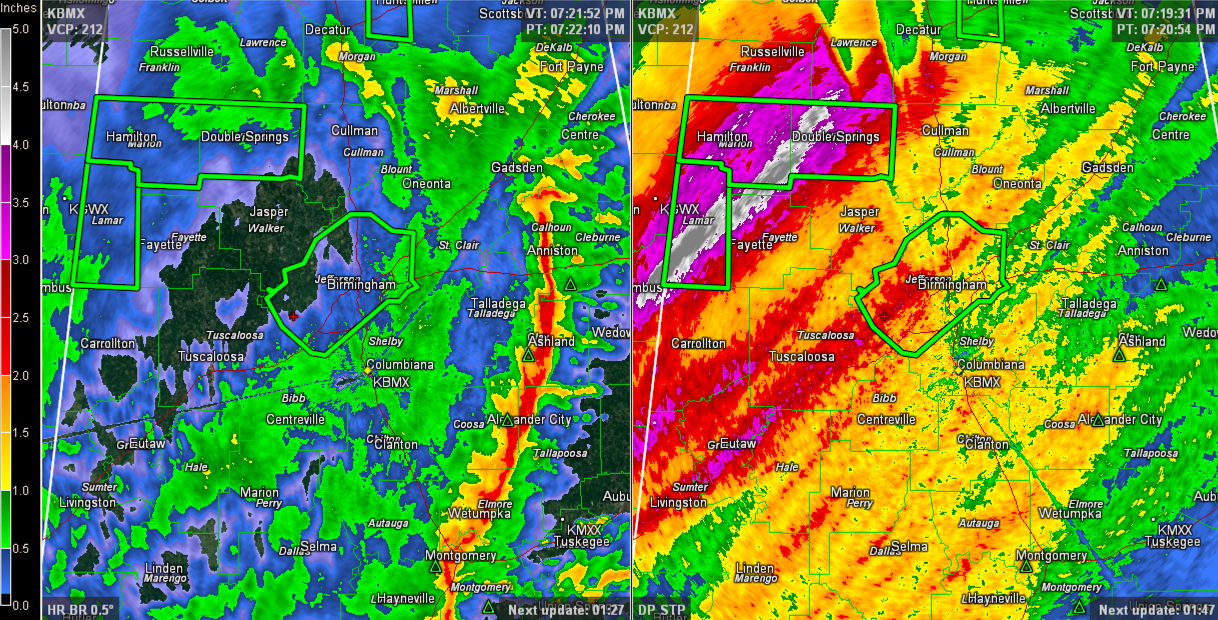
Some of the heaviest amounts have been across Lamar, Fayette, Marion and Winston Counties where over four inches of rain is estimated to have fallen across a wide swath.
Several flash flood warnings have been issued, including:
…Jefferson until 9:30 p.m.
…Lamar until 9:30 p.m.
10-15 roads are repotedly impassable across Lamar County.
…Marion and Winston until 10 p.m.
Additional flooding is reported in Jasper and near Akron in Hale COunty.
Areal flood advisories continue for many other counties.
The NWS is clearing counties already from the tornado watch:
Tornado Watch is canceled for Bibb, Chilton, Dallas, Jefferson and Shelby.
The Tornado Watch contiues for for Autauga, Barbour, Bullock, Chambers, Clay, Coosa, Elmore, Lee, Lowndes, Macon, Montgomery, Pike, Randolph, Russell, Talladega, Tallapoosa [AL] till 11:00 PM CST
Category: Alabama's Weather, Severe Weather
About the Author (Author Profile)
Subscribe
If you enjoyed this article, subscribe to receive more just like it.


