

Cold Night Ahead
An all new edition of the ABC 33/40 Weather Xtreme video is available in the player on the right sidebar of the blog. You can subscribe to the Weather Xtreme video on iTunes by clicking here.
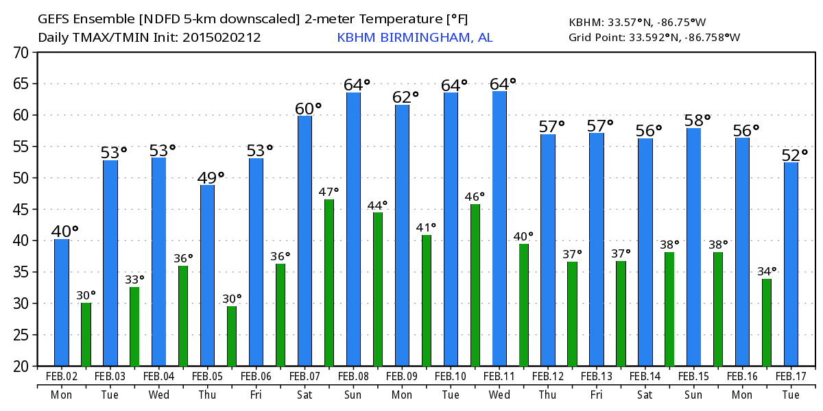
COLD, BLUSTERY DAY: Temperatures are only in the mid to upper 30s across much of North Alabama at mid-afternoon, with a gusty north wind making it feel colder. The sky is clearing, and any lingering clouds will fade away over the next few hours.
Tonight will be clear and cold with diminishing wind; most places will see a low between 21 and 26 degrees; colder valleys across North Alabama have a chance of reaching the upper teens.
TOMORROW: Expect sunshine in full supply, and a warming trend begins tomorrow afternoon with a high around 50 degrees.
WEDNESDAY/THURSDAY: Our weather stays dry during the day Wednesday, with a mix of sun and clouds and a high between 56 and 59. Clouds thicken Wednesday night, and a little light rain is possible as far north as I-20, but the best chance of rain will come over the southern half of Alabama with a surface low moving through the Gulf of Mexico.
Another disturbance in the northern branch of the jet stream could bring a few snow flurries to the Tennessee Valley of North Alabama late Wednesday night or early Thursday morning, but with very limited moisture we expect no impact if we do see snow flakes.
Thursday will be colder with gradual clearing and a high in the mid 40s.
FRIDAY AND THE WEEKEND: A nice warm-up headlines the forecast. Friday will be a bright, sunny day with a high in the mid 50s; then on Saturday with a partly sunny sky the high will be in the low 60s. A clipper type system will bring some clouds Sunday, and maybe even a shower over Northeast Alabama, but with limited moisture and weak dynamics any rain should be light and spotty Sunday afternoon. The GFS is printing a high of 63 for Birmingham Sunday afternoon.
LONG RANGE: Still no sign of any long lasting outbreak of bitterly cold air air for Alabama and the Deep South through mid-February… see the Weather Xtreme video for maps, graphics, and more details.
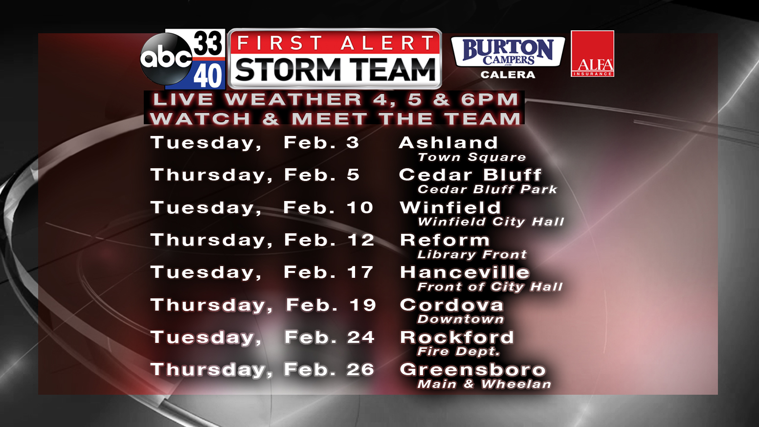
FIRST ALERT STORM TEAM WEATHER TOUR: We kick off this year’s road show in Ashland tomorrow evening, and Cedar Bluff Thursday evening. We will be at each stop from 4:00 until 6:30 p.m… just come by anytime and say hello. We will program your weather radio if you want.
WEATHER BRAINS: Don’t forget you can listen to our weekly 90 minute netcast anytime on the web, or on iTunes. This is the show all about weather featuring many familiar voices, including our meteorologists here at ABC 33/40. We will produce this week’s show tonight at 8:30 CT… you can watch it on “James Spann 24/7” on cable systems around the state, or on the web here.
CONNECT: You can find me on all of the major social networks…
Facebook
Twitter
Google Plus
Instagram
I had a great time today seeing the second graders at Trace Crossings Elementary in Hoover… be looking for them on the Pepsi KIDCAM today at 5:00 on ABC 33/40 News! The next Weather Xtreme video will be posted here by 7:00 a.m. tomorrow…
Category: Alabama's Weather
About the Author (Author Profile)
James Spann is one of the most recognized and trusted television meteorologists in the industry. He holds the AMS CCM designation and television seals from the AMS and NWA. He is a past winner of the Broadcast Meteorologist of the Year from both professional organizations.Subscribe
If you enjoyed this article, subscribe to receive more just like it.


