Friday Night Notes
New model data is trickling in, and we are still on track for a significant winter storm for the northern half of Alabama late Sunday night into at least Monday.
ROUND ONE…
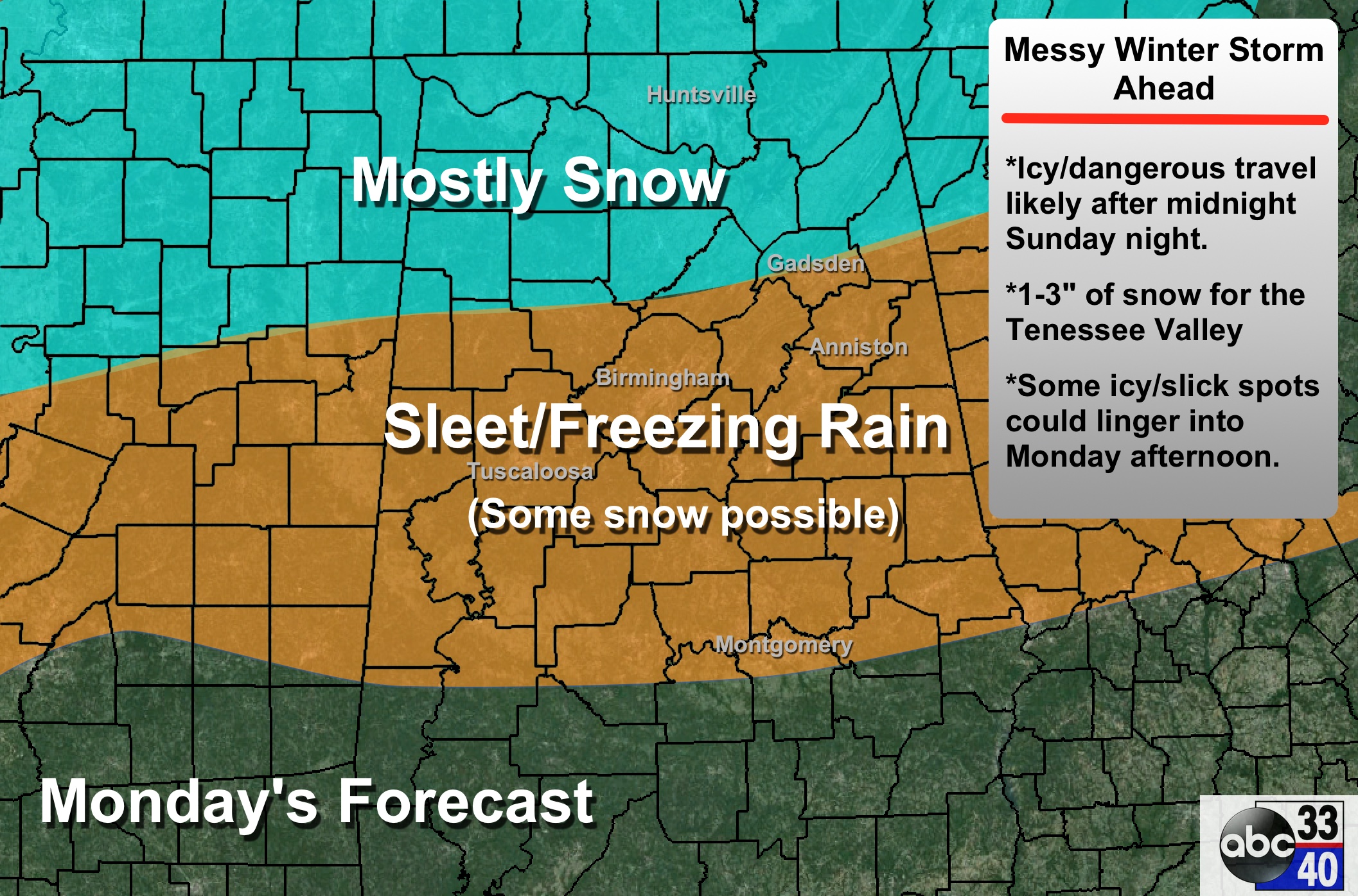
TIMING: Snow and sleet will move into Northwest Alabama around midnight Sunday night, and will expand and become widespread during the pre-dawn hours Monday. Travel will become very difficult between 2 and 5 a.m. Icy travel will continue at least through midday; some slow improvement is possible Monday afternoon, but some of the latest guidance we are seeing suggests icy patches could linger through much of the day.
ACCUMULATION POTENTIAL: Snow amounts of 1 to 3 inches are likely along and north of a line from Vernon to Jasper to Oneonta to Gadsden. To the south, it will be mostly sleet and freezing rain for places like Birmingham, Tuscaloosa, and Anniston. Ice accumulation could exceed 1/10 of an inch in places; this doesn’t sound like much, but it can bring serious driving problems.
IMPACT: Bridges will become icy quick Monday morning with temperatures in the 20s, and some secondary roads (away from bridges) could become icy as well. Travel will be difficult over North and Central Alabama. And, for now, we don’t expect enough ice accumulation for power outages.
CONFIDENCE: This is a fairly high confidence forecast. If anything, we might be underestimating the impact of this storm system, but we will need to see new data before making any changes.
ROUND TWO…
A cold rain is likely Monday night, but on Tuesday a surface low passes just to the south, and more cold air begins to move southward. The GFS (the primary American global model) continues to hint the rain will change to snow over the northern half of the state during the day Tuesday.
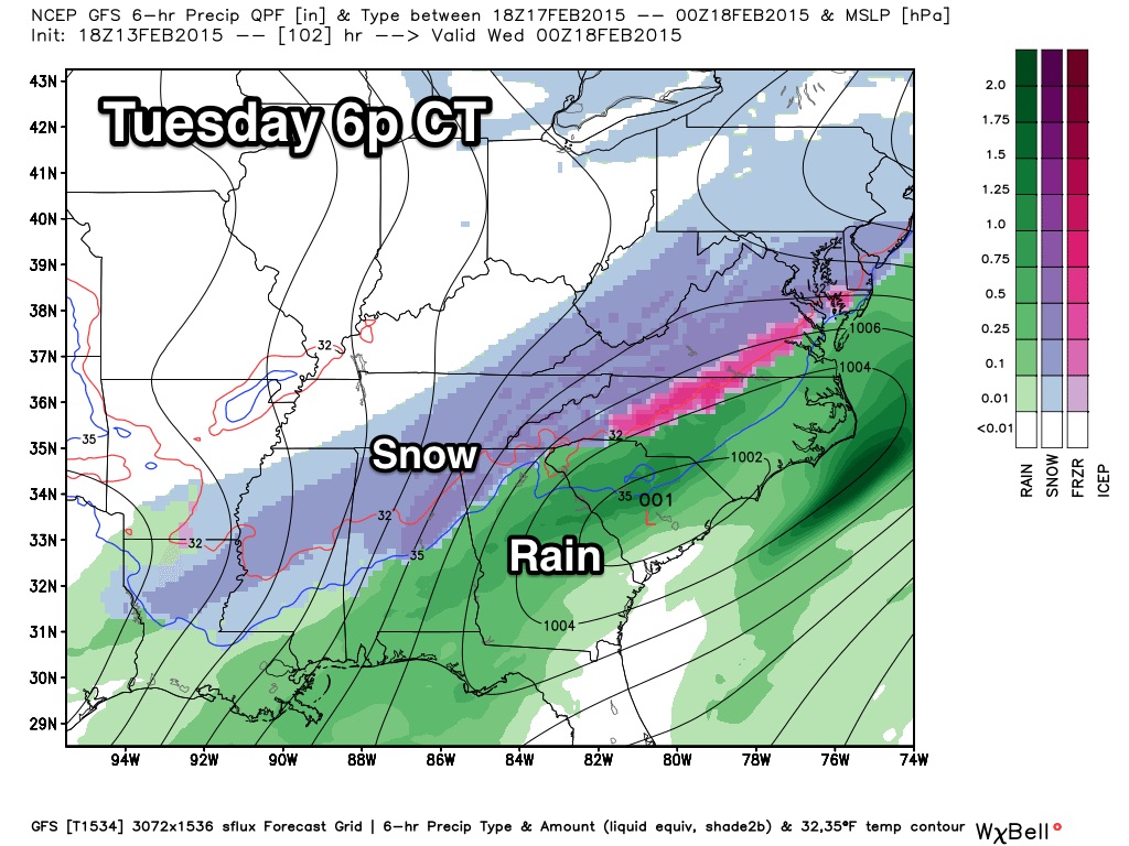
If this indeed happens, we will see more travel problems Tuesday afternoon, Tuesday night, and possibly into Wednesday morning. Seems like the main window for snow will come from about 2:00 p.m. until 8:00 p.m. Tuesday, with potential accumulation of 1-3 inches across North/Central Alabama, including Birmingham, Anniston, Gadsden, and Tuscaloosa.
Confidence is much lower on “round two”, but it is gaining since models have been fairly consistent in recent runs.
We will have forecast updates throughout the weekend… stay tuned!
Category: Alabama's Weather
About the Author (Author Profile)
James Spann is one of the most recognized and trusted television meteorologists in the industry. He holds the AMS CCM designation and television seals from the AMS and NWA. He is a past winner of the Broadcast Meteorologist of the Year from both professional organizations.Subscribe
If you enjoyed this article, subscribe to receive more just like it.


