Concerning Tomorrow Morning
The NWS in Huntsville continues a winter weather advisory for the counties in the Tennessee Valley of far North Alabama. A clipper type system will bring snow showers/flurries to Alabama early tomorrow morning; this is the HRRR model output valid at 6:00 a.m. tomorrow…
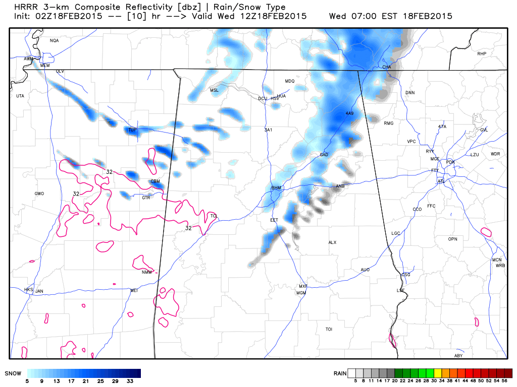
While this isn’t a major winter weather event, heavier snow showers could put down up to 1/2 inch of snow, mainly over far North Alabama, and some isolated travel issues could result. The primary window for the show showers/flurries will come from 4:00 until 10:00 a.m.
We will watch radar trends overnight for any potential sign of a surprise, but for now we don’t expect significant travel impact for places like Birmingham, Tuscaloosa, Anniston, and Gadsden.
The other two big issues are…
*The Arctic cold arriving tomorrow night… we will drop into the 10-15 degree range early Thursday morning, and most places around here will stay below freezing all day.
*Friday wintry mix… A storm system in the southern branch of the jet stream will bring another threat of freezing rain, sleet, and maybe a snow flake or two Friday. New data rolling in still hints this could be a system with significant somewhere over North Alabama. I will have my first forecast map for this event here early tomorrow morning.
Category: Alabama's Weather
About the Author (Author Profile)
James Spann is one of the most recognized and trusted television meteorologists in the industry. He holds the AMS CCM designation and television seals from the AMS and NWA. He is a past winner of the Broadcast Meteorologist of the Year from both professional organizations.Subscribe
If you enjoyed this article, subscribe to receive more just like it.


