Midday Saturday Update
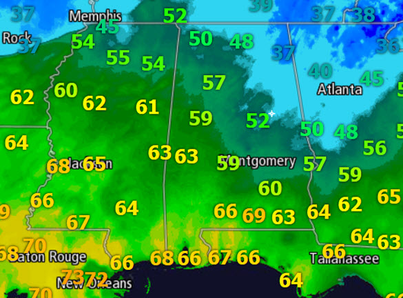
After a wild week of weather in the state, we are in a transition period today. Temps are finally above freezing across the entire state, and we are actually seeing quite the range in temperatures from the Gulf Coast to the Tennessee Valley today. Currently there is over a 30 degree temperature range. Locations across the North Alabama that saw the ice yesterday continue to see improving conditions as temps continue to climb well above freezing.
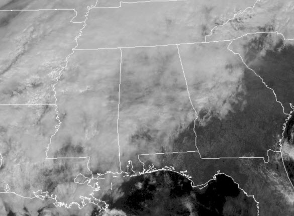
It remains a cloudy day, and though the cloud covers remains in place, we will remain under the influence of warm air advection and we will continue to see our temps warm today, as well as see our moisture levels increase. That means the clouds will hang around all day, and we will actually see them increase in coverage and thickness.
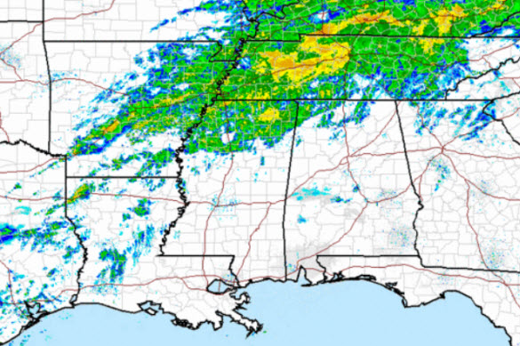
Underneath all those clouds we are seeing precipitation falling across much of the Mississippi and Tennessee Valleys. This precip will be spreading into Central Alabama later today and into tonight. We will see periods of rain, and yes maybe even hear some rumbles of thunder later tonight. With temps above freezing there will be no issues with wintry precip the next 24 hours in Alabama. Just make sure you have the umbrella handy.
Category: Alabama's Weather
About the Author (Author Profile)
Macon, Georgia Television Chief Meteorologist, Birmingham native, and long time Contributor on AlabamaWX. Stormchaser. I did not choose Weather, it chose Me. College Football Fanatic. @Ryan_StinnetSubscribe
If you enjoyed this article, subscribe to receive more just like it.


