Evening Radar Check
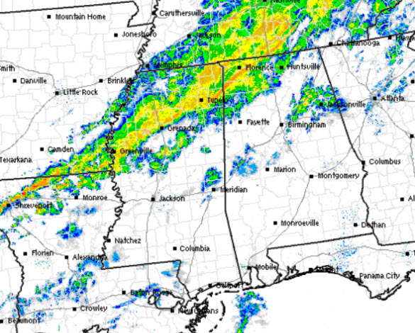
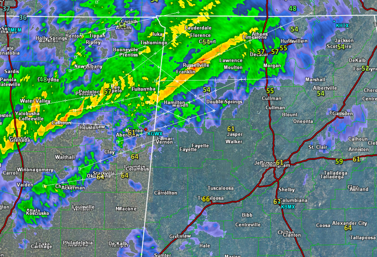
Rain is moving into Alabama this evening and will continue to overspread much of North-Central Alabama. There are even a few thunderstorms embedded within the rain shield. Through the evening and into the overnight hours, expect the rain to increase in coverage as we are all in store for a soaking.
With some of the storms, there will certainly be lightning, but gusty winds, very heavy rainfall, and even some small hail will be possible. We are not expecting any severe storms in Alabama, but certainly a few strong storms will be possible the next several hours.
As we zoom in on the radar, we do note at this time, the more intense activity is stretching from near Athens, back to the southwest towards Tupelo and back towards the Interstate 55 corridor in Central Mississippi. This main line continues to move off towards the southeast. Ahead of the main band of rain, temps are well into the 50s across North Alabama and 60s along the Interstate 20 corridor. Back behind this area, you will notice temps are in the 30s in Memphis. This colder air will arrive in Central Alabama on Sunday.
Click image to enlarge.
Category: Alabama's Weather
About the Author (Author Profile)
Macon, Georgia Television Chief Meteorologist, Birmingham native, and long time Contributor on AlabamaWX. Stormchaser. I did not choose Weather, it chose Me. College Football Fanatic. @Ryan_StinnetSubscribe
If you enjoyed this article, subscribe to receive more just like it.


