When To Get Off The Roads
The biggest question today…
And the answer is different for different cities and towns.
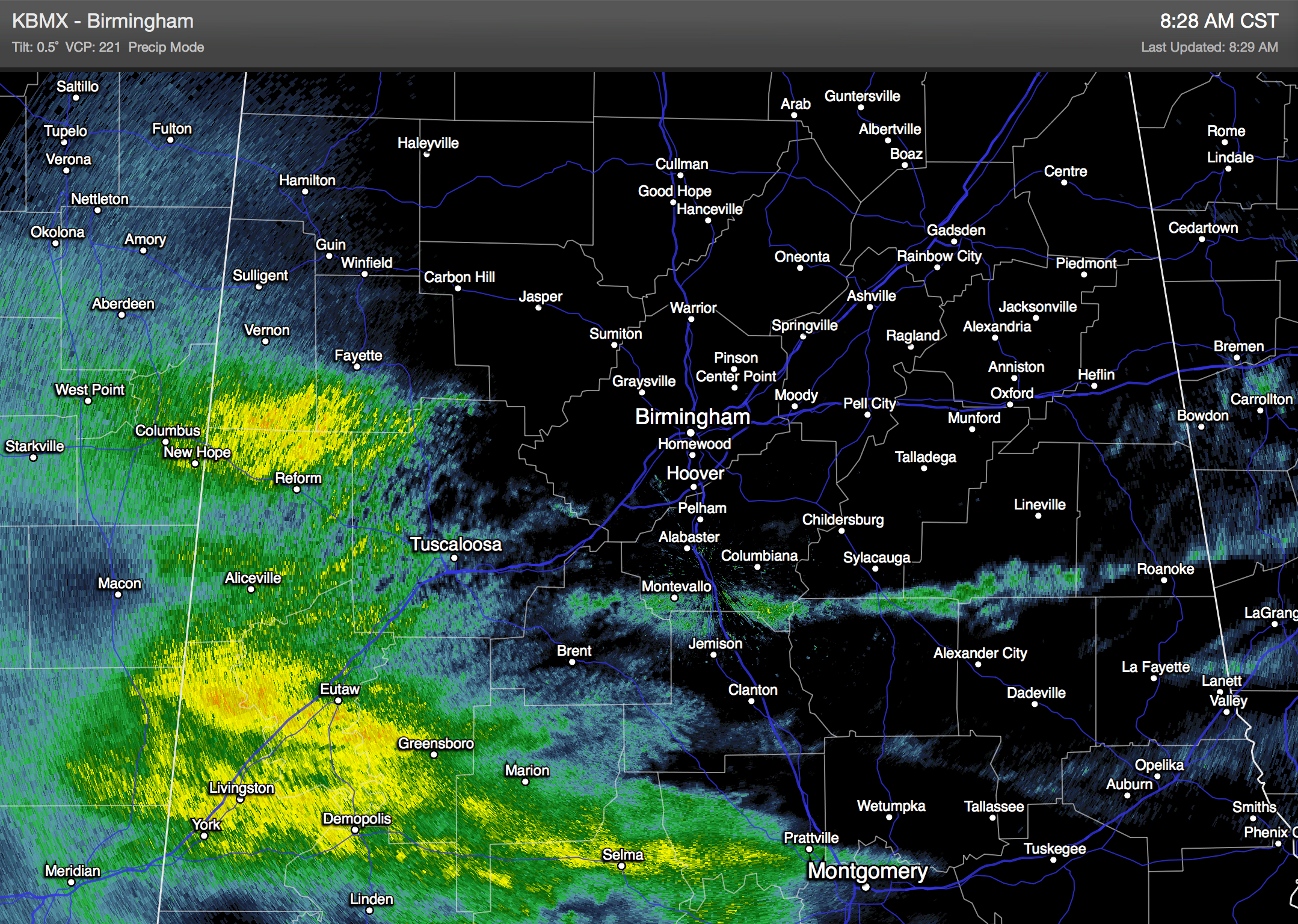
CURRENT RADAR: This is mostly rain, with some sleet mixed in, over West Alabama.
REMEMBER: We forecast this event to begin as rain, with the change to snow coming this afternoon over North Alabama.
RAIN/SNOW LINE: Needless to say, south of the rain-snow line it will be just a cold, rainy day and you can travel when you want to. The problem? The rain-snow line will be close to the cities of Birmingham, Tuscaloosa, and Anniston, and travel impact will vary GREATLY through these cities, most likely.
But, for this advice, we must take the course of least regret, and assume the rain-snow line will be about 30-40 miles south of I-20, which pretty much what we have in our ongoing forecast.
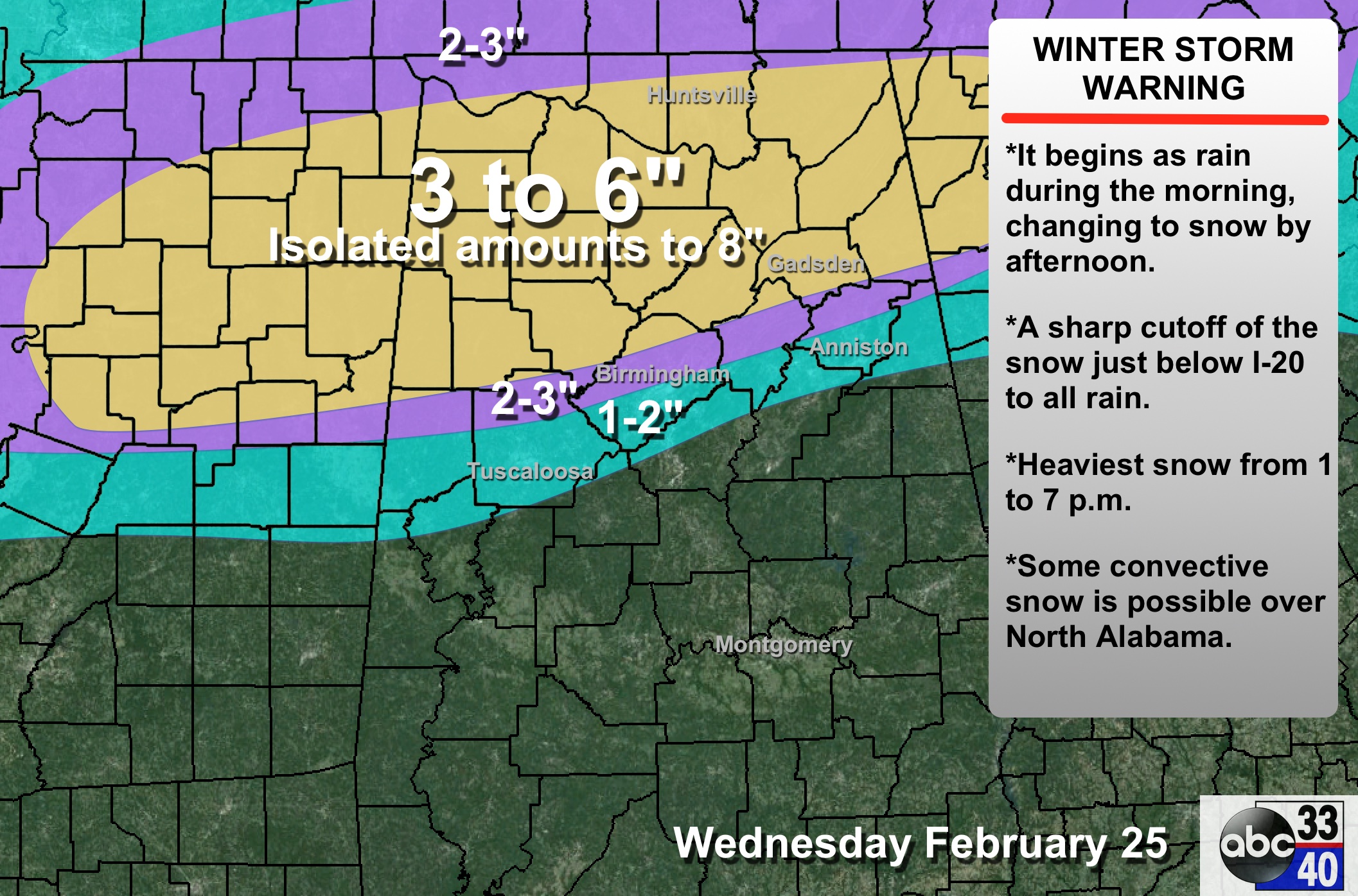
Let’s assume it will be snow in Tuscaloosa/Birmingham/Anniston. Here is the advice.
BE OFF THE ROADS BY…
Anywhere NORTH of I-20 by 11:00 a.m.
Tuscaloosa 11:00 a.m.
Birmingham 12:00 noon
Anniston 1:00 p.m.
You can extrapolate the hundreds of smaller communities. Bottom line is that we don’t advise driving from I-20 north after the midday hours today as heavy snow sets in this afternoon. Scroll down for much more information…
ALABAMA POWER IS READY, ARE YOU? Our friends at Alabama Power are monitoring the forecast closely, ready to deploy people and assets to quickly address any outages that might occur. Read a special message from Ike Pigott about their commitment to their customers.
Category: Alabama's Weather
About the Author (Author Profile)
James Spann is one of the most recognized and trusted television meteorologists in the industry. He holds the AMS CCM designation and television seals from the AMS and NWA. He is a past winner of the Broadcast Meteorologist of the Year from both professional organizations.Subscribe
If you enjoyed this article, subscribe to receive more just like it.


