Icing Issues Begin Over Northwest Alabama
An all new edition of the ABC 33/40 Weather Xtreme video is available in the player on the right sidebar of the blog. You can subscribe to the Weather Xtreme video on iTunes by clicking here.
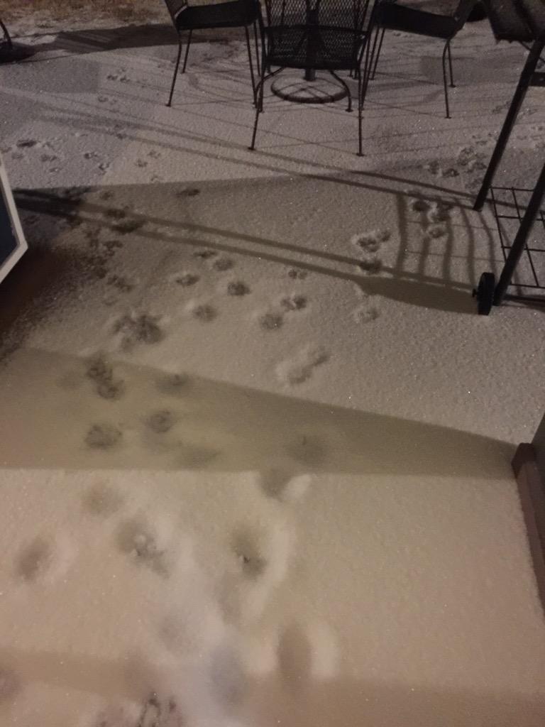
FREEZE LINE DROPPING SOUTH: It is below freezing now over much of Northwest Alabama, where freezing rain and sleet has been falling for a few hours. NWS Huntsville reports roads and bridges in Florence/Muscle Shoals are beginning to become icy and dangerous, and we are seeing many pictures of sleet/freezing rain accumulation down into Marion, Winston and Lamar Counties. Here is a look at sleet accumulation in Muscle Shoals early this morning.. (photo from @mrsburtonhhs)
THE DAY AHEAD: No change in our forecast. The freeze line has been right on time so far, and we project it to be around I-59 (Birmingham, Tuscaloosa, Gadsden) around 9:00 a.m. The freeze line will be close to Anniston by 10:00-11:00 a.m.
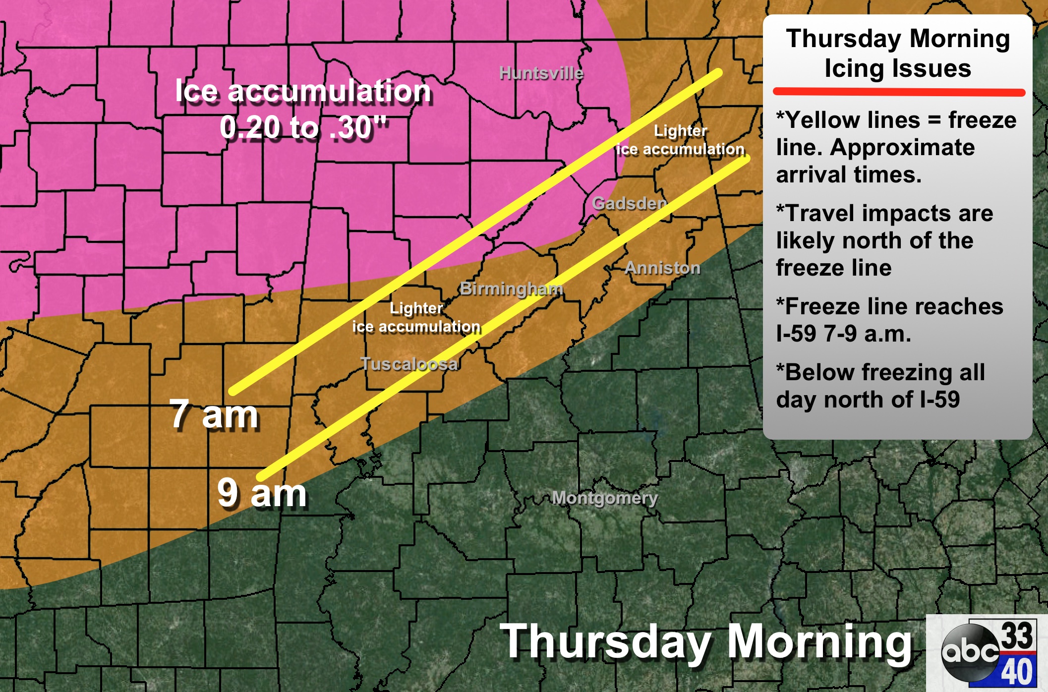
PLACEMENT: As we have stated here many times, the freeze line won’t be in a nice, straight line like we are showing on these maps… that is just a guideline. It could be a situation later this morning where northern sections of Birmingham, Tuscaloosa, and Anniston have freezing rain, sleet, and icy travel with 30 degrees, while the southern sections of these cities have 34 degrees and a cold rain.
IMPACT: There could be enough ice accumulation in a few spots over Northwest Alabama for scattered power outages, but the main issue will be hazardous travel due to ice on bridges and overpasses, and perhaps on some black top roads.
DURATION: Temperatures will remain below freezing over much of North Alabama through the day and tonight… temperatures rise above freezing by mid-morning tomorrow, when conditions improve.
TOMORROW AND THE WEEKEND: These three days will be dry and warmer. After beginning the day tomorrow in the 17-22 degree range, we rise into the upper 40s by afternoon with a good supply of sunshine. Saturday’s high will be close to 60, and low 60s are possible Sunday. We will see some high clouds around Sunday, but the low levels remain dry and for now we won’t mention any risk of showers.
NEXT WEEK: Highs will be mostly in the 60s through the week, and some rain is possible Tuesday, with the chance of wet weather continuing into at least Wednesday. See the Weather Xtreme video for maps, graphics, and more details.
ALABAMA POWER IS READY, ARE YOU? Our friends at Alabama Power are monitoring the forecast closely, ready to deploy people and assets to quickly address any outages that might occur. Read a special message from Ike Piggot about their commitment to their customers.
WEATHER BRAINS: Don’t forget you can listen to our weekly 90 minute netcast anytime on the web, or on iTunes. This is the show all about weather featuring many familiar voices, including our meteorologists here at ABC 33/40.
CONNECT: You can find me on all of the major social networks…
Facebook
Twitter
Google Plus
Instagram
We will have frequent updates throughout the day… stay tuned!
Category: Alabama's Weather
About the Author (Author Profile)
James Spann is one of the most recognized and trusted television meteorologists in the industry. He holds the AMS CCM designation and television seals from the AMS and NWA. He is a past winner of the Broadcast Meteorologist of the Year from both professional organizations.Subscribe
If you enjoyed this article, subscribe to receive more just like it.


