

Wet, Unsettled Weather Continues
An all new edition of the ABC 33/40 Weather Xtreme video is available in the player on the right sidebar of the blog. You can subscribe to the Weather Xtreme video on iTunes by clicking here.
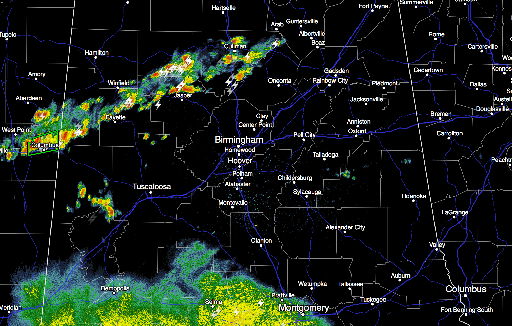
RADAR CHECK: A large mass of rain over South Alabama is moving northward, and other storms have fired up this afternoon in a band from near Columbus, Mississippi to Cullman. Looks like a large part of North and Central Alabama will see rain and thunderstorms later this afternoon and tonight, with potential for heavy rain in a few spots.
TOMORROW THROUGH FRIDAY: The weather will stay wet and unsettled with blanket of moist air in place across the Deep South. Giving specific start and stop times for the rain in any one given location is almost impossible, but just understand we will deal with occasional showers and thunderstorms on all three days. There will be some decent breaks in the rain, and you might even see a few rays of sunshine along the way, but be ready for rain at any hour of the day or night.
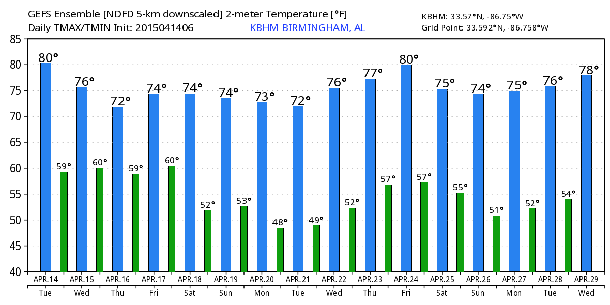
While a stronger storm is possible, the risk of organized severe weather remains low. Highs will remain mostly in the 70s, although cold air damming will bring cooler air in here Thursday; looks like we hold in the 60s all day Thursday from Birmingham east.
THE ALABAMA WEEKEND: Saturday will be another wet day with occasional showers and thunderstorms as an upper trough approaches; a strong storm is possible, but again with little bulk shear available the overall severe weather risk is small. Still looks like additional rain amounts of 3-4 inches are likely between now and Saturday, so some flooding issues are not out of the question with the ground being saturated.
Showers and storms should thin out Sunday, but rain is still possible at times, and any storms Sunday could produce hail due to cold air aloft associated with the upper trough, that should be right on top of us. Highs over the weekend will be in the 70s.
NEXT WEEK: We finally see drier weather. Monday looks rain-free, with a partly to mostly sunny sky. The weather will stay dry through mid-week with cool mornings; looks like we will see lows in the 40s early Tuesday and Wednesday morning. See the Weather Xtreme video for maps, graphics, and more details.
WEATHER BRAINS: Don’t forget you can listen to our weekly 90 minute netcast anytime on the web, or on iTunes. This is the show all about weather featuring many familiar voices, including our meteorologists here at ABC 33/40.
CONNECT: You can find me on all of the major social networks…
Facebook
Twitter
Google Plus
Instagram
I enjoyed seeing the first graders today at Alexandria Elementary School in Calhoun County… be looking for them on the Pepsi KIDCAM today at 5:00 on ABC 33/40 News! The next Weather Xtreme video will be posted here by 7:00 a.m. tomorrow….
Category: Alabama's Weather
About the Author (Author Profile)
James Spann is one of the most recognized and trusted television meteorologists in the industry. He holds the AMS CCM designation and television seals from the AMS and NWA. He is a past winner of the Broadcast Meteorologist of the Year from both professional organizations.Subscribe
If you enjoyed this article, subscribe to receive more just like it.


