

Passing Showers Through Weekend
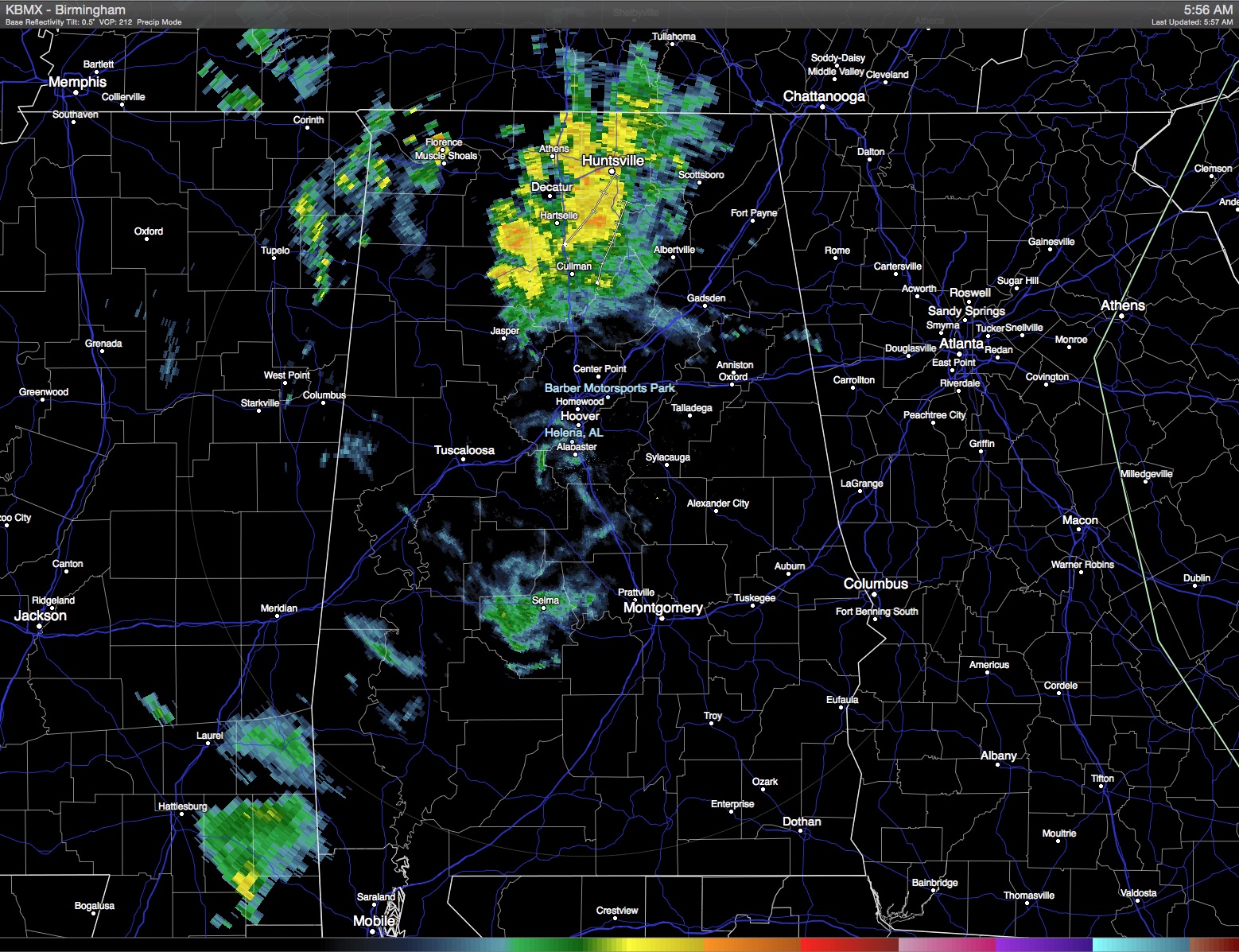
Quick radar check shows an area of showers in the Tennessee River Valley moving northward. Other scattered showers were occurring in the vicinity of Selma. Our moist air mass will lend itself to passing showers through the weekend, however, with the clouds in place our highs will be held into the lower half of the 80s.
Passing showers will also be the going weather for the beach area today with only a few peeks at the sun. The onshore flow is also creating a high risk for rip currents, so if you plan to be at the beach, be especially cautious if venturing into the water. The threat of a passing shower reduces on Sunday and into early next week, but there will still be a good amount of clouds with highs in the middle 80s with the daily threat of a scattered shower or thunderstorm.
The upper air pattern remained somewhat stagnate for the time being with a closed low over the western US. That closed low will be opening up and moving north to northeast today and will be the focus for a significant round of severe weather in the Central Plains where SPC has a moderate risk of severe weather in portions of Oklahoma, Kansas, and South Central Nebraska. The risk of severe storms diminishes to the standard slight risk on Sunday as the upper low moves into the Great Lakes.
For us, the upper ridge will be holding in place as the upper closed low opens up and moves into the Great Lakes. While this will help to dampen the upper ridge somewhat, the overall meandering of the upper ridge should keep our heights fairly stable so no real change in temperatures with highs in the 80s. And with a slight west to southwest flow aloft, clouds will be remaining with us until midweek. Passing showers will mean that not everyone gets rain, however, with the heavier showers some spots could see some locally heavy rain with amounts of one inch or slightly more possible.
With the upper ridge dampened somewhat at midweek, we should see a brief break in the chances for showers. Not sure the chance of rain will drop to zero, but it does look like Wednesday should be a dry day for most of us. The upper ridge remains along and just west of the Mississippi River for the latter part of the week, so the forecast will have to show some small daily chances for showers driven primarily by the heat of the day. It won’t be especially hot, however, with highs holding in the 80s and lows in the 60s for Central Alabama. These values should be pretty close to our 30-year averages of 81 for highs and 60 for lows.
As we edge out into voodoo country, not much change in the overall upper air pattern, so the summer-like pattern with showers appears likely to stick with us into the latter part of May.
I expect to post the next Weather Xtreme Video here on Sunday morning. You can always check back here for later updates on Central Alabama weather.
-Brian-
Category: Alabama's Weather
About the Author (Author Profile)
Brian Peters is one of the television meteorologists at ABC3340 in Birmingham and a retired NWS Warning Coordination Meteorologist. He handles the weekend Weather Xtreme Videos and forecast discussion and is the Webmaster for the popular WeatherBrains podcast.Subscribe
If you enjoyed this article, subscribe to receive more just like it.


