

Showers and Storms Moving North Through West Alabama
A warm humid airmass covers Alabama and the Deep South this afternoon. The cumulus field over Georgia was about as uniform and beautiful as you will ever see with fairly stable conditions in place over the Peach State. To the west over our state, there was more vertical development in clouds thanks to higher moisture levels, a little more upper level wind energy out ahead of the western trough and interactions with the outflow boundaries from last night’s Texas storms and the seabreeze front off the Gulf Coast.
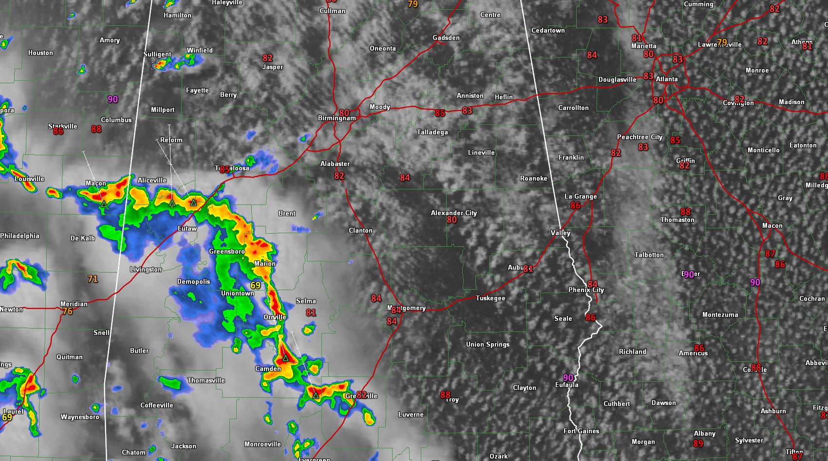
Showers and storms had fired over southeastern Mississippi and southwestern Alabama. These storms look like they will work northeastward, remaining mainly west of I-65 through 7-8 p.m. when they will move into Tennessee. They will reach the Tuscaloosa area between 4 and 5 p.m. with a good bit of lightning.
Wind shear is virtually absent and mid level lapse rates are poor, so significant strong storms are not expected, but we can’t rule them out because there is a good bit of dry air aloft, which thunderstorms like in order to produce damaging winds
Temperatures at we approach mid-afternoon are just above 80F in the I-20 corridor, limited by the cloud cover. The mercury will rise another couple of degrees before the day is out.
Category: Alabama's Weather
About the Author (Author Profile)
Bill Murray is the President of The Weather Factory. He is the site's official weather historian and a weekend forecaster. He also anchors the site's severe weather coverage. Bill Murray is the proud holder of National Weather Association Digital Seal #0001 @wxhistorianSubscribe
If you enjoyed this article, subscribe to receive more just like it.


