

Heavy Storms in the Birmingham Metro
UPDATE 4:30 PM
The NWS has issued an Areal Flood Advisory for Jefferson County.
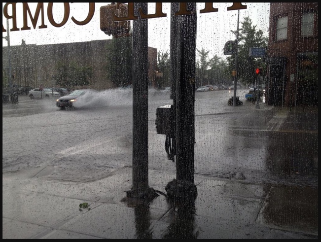
Here is a picture of flooding downtown on 2nd Avenue in the Loft District from @IngeTingle:
ORIGINAL POST
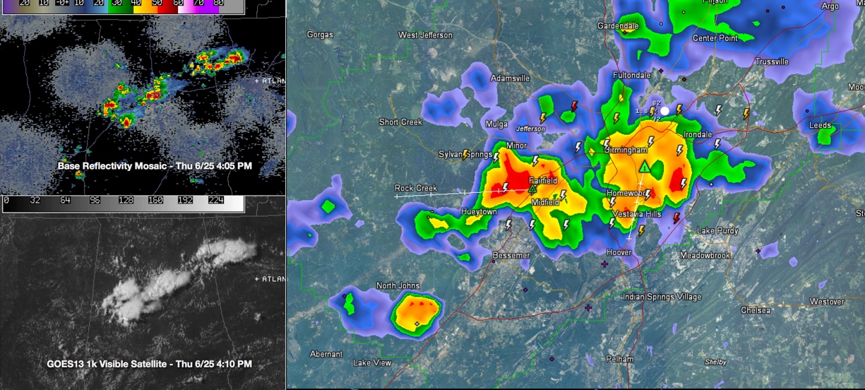
Strong thunderstorms are over the Birmingham Metro area at this hour. Much of the southern half of the Metro is being affected right now, including Downtown, Avondale, Mountain Brook, Homewood and Vestavia are getting heavy rain and lightning.
Power has been knocked out in parts of Avondale.
Over western sections, storms have rapidly intensified near Pleasant Grove, extending into neighboring sections of Dolomote, Fairfield and Midfield.
Storms that affected the Tuscaloosa area earlier have split into two camps, one that has moved into Pickens County. The other is moving into Hale County.
Storms west of I-65 are moving southwest slowly. More propagating than moving, but propagating southwest.
In Northeast Alabama, storms are heavy over Cherokee County. Those are moving southeast.
Gusty winds, torrential rains and lots of deadly lightning will be the rule with the bigger storms. Be inside as they approach. Be careful on roads. Heavy downpours are leading to local urban flooding.
The storms are not severe and aren’t generally expected to become, but with summer storms you can never be certain!
Category: Alabama's Weather
About the Author (Author Profile)
Bill Murray is the President of The Weather Factory. He is the site's official weather historian and a weekend forecaster. He also anchors the site's severe weather coverage. Bill Murray is the proud holder of National Weather Association Digital Seal #0001 @wxhistorianSubscribe
If you enjoyed this article, subscribe to receive more just like it.


