Fay holds together over Florida
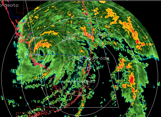
A radar loop from Miami, from 6 am to 130 pm, is shown above. Note the eye in the tropical storm, even over land.
Fay has already been one of the most interesting and challenging tropical storms I can remember…maybe since Hurricane Elena in 1985 (I was 11 years old). The storm made landfall aroound 4 am CDT, with sustained winds of 60 mph and a central pressure of 989 mb, and now has sustained winds of 65 mph and a central pressure of 986 mb! The storm has strengthened over land.
One of the things that typically weakens a tropical storm over land is friction…and south Florida is very flat land, reducing friction. Another is the loss of input of water vapor from the sea surface…but the Everglades are swampy, it has Lake Okeechobee to work with, and the Gulf and the Atlantic are not far away, either. This is fascinating. Is it possible that Fay could become a hurricane while over Lake Okeechobee this afternoon? Probably not.
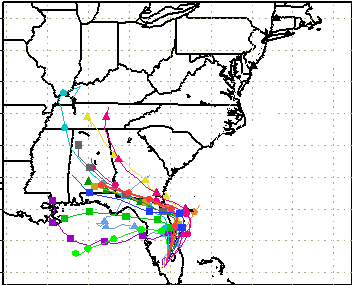
The track forecast is still very difficult, and it is still possible that Alabama will feel at least some effects from Fay, if only rain. Here are the 18 UTC model tracks.
Our students and staff from UAH are set up in Jacksonville…they should get a good look at this storm, maybe as a hurricane. I stayed behind to catch up on work…but I sometimes miss the excitement of being there.
Category: Uncategorized
About the Author (Author Profile)
Subscribe
If you enjoyed this article, subscribe to receive more just like it.


