Wet At Times Through Mid-Week
RADAR CHECK: As expected, rain and storms are rather widespread across Alabama today…
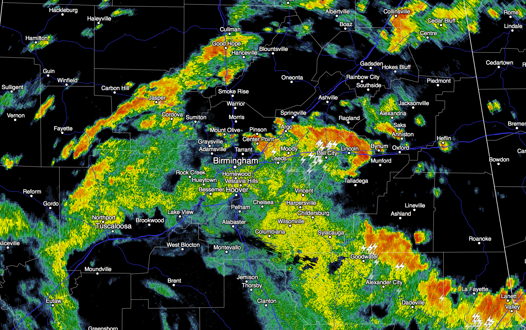
Storms are well below severe limits, but the stronger ones are producing torrential rain and a good bit of lightning. Rain and storms are moving northeast, and we will maintain a good chance of rain at times through the night. Temperatures are only in the 70s due to the clouds and rain. Quite a break from the summer heat.
REST OF THE WEEK: The broad upper feature responsible for today’s wet weather won’t change much, so our weather will remain wet at times all the way through at least Friday. Expect periods of rain daily, along with a few thunderstorms. There will be some good breaks in the rain, and the sun could peek out at times, but the overall pattern will be wet. Additional rain amounts of 2-3 inches are likely through the end of the week.
We should note a strong upper trough will pass north of Alabama this week, and will bring the risk of severe storms to parts of the Great Plains and the Midwest, but the dynamic forcing with that feature should remain well to the north of us, and severe weather is not expected to be an issue here.
And, on the positive side, because of the lack of sun we expect highs to remain below 90 through Friday.
THE ALABAMA WEEKEND: The upper trough over the region will weaken, so we should begin to see some good intervals of sunshine Saturday and Sunday, but scattered showers and storms remain likely, especially during the afternoon and evening hours. We project highs between 87 and 90 degrees both days.
Next week should be warmer and drier, although the risk of at least “scattered, mostly afternoon and evening showers and storms” will need to stay in the forecast. See the Weather Xtreme video for maps, graphics, and more details.
AT THE BEACH: About 3 to 5 hours of sunshine daily on the coast from Gulf Shores west to Panama City Beach for the rest of the week, with a few passing showers and thunderstorms likely. Highs will be in the 80s, and the sea water temperature this afternoon at the Dauphin Island Sea Lab is 82 degrees.
See the complete Gulf Coast 7 Day Planner here. The Gulf Coast Beach Forecast is presented by Gulf Shores Plantation by Mandoki Hospitality Vacation Rentals. Escape to Gulf Shores Plantation where memories last a lifetime.
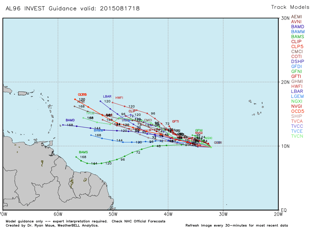
TROPICS: The wave in the eastern Atlantic has a decent chance of becoming Tropical Storm Danny later this week… it will move to the west/northwest just south of a layer of very dry air. It remains to be seen if this will impact the U.S., or any land mass.
WEATHER BRAINS: Don’t forget you can listen to our weekly 90 minute netcast anytime on the web, or on iTunes. This is the show all about weather featuring many familiar voices, including our meteorologists here at ABC 33/40. We will produce this week’s show tonight at 8:30 CT live from Norman, OK… you can watch it on “James Spann 24/7” on cable systems around the state, or on the web here.
CONNECT: You can find me on all of the major social networks…
Facebook
Twitter
Google Plus
Instagram
Look for the next Weather Xtreme video here by 7:00 a.m. tomorrow…
Category: Alabama's Weather
About the Author (Author Profile)
James Spann is one of the most recognized and trusted television meteorologists in the industry. He holds the AMS CCM designation and television seals from the AMS and NWA. He is a past winner of the Broadcast Meteorologist of the Year from both professional organizations.Subscribe
If you enjoyed this article, subscribe to receive more just like it.


