Mostly Dry Through Mid-Week
RADAR CHECK: Showers are almost impossible to find on radar this afternoon across the great state of Alabama; a few isolated showers remain possible through the evening, but most communities will be rain-free. Temperatures are in the 80s; today is the 16th consecutive day with a high below 90 degrees at Birmingham.
TOMORROW THROUGH FRIDAY: An upper ridge will build, meaning hotter afternoons and few showers. We can probably just remove any risk of rain tomorrow and Wednesday; expect a good supply of sunshine both days through scattered clouds with a high not too far from 90 degrees. Any afternoon showers or thunderstorms Thursday and Friday will be pretty widely spaced, otherwise we will have a mixture of sun and clouds both days, and the high will remain close to 90 degrees.
LABOR DAY WEEKEND: Moisture levels will increase, so we will have to deal with scattered showers and thunderstorms Saturday through Monday. The chance of any one spot getting wet each day will be about one in three, and afternoon highs will drop back into the mid to upper 80s. There will be some good intervals of sunshine each day, but just be ready for a passing shower or storm from time to time.
FOOTBALL WEATHER: College football begins this weekend. Auburn opens up at home against Louisville; the game is Saturday at 2:30 in Atlanta in the Georgia Dome, so we can promise no rain for the game, but outside the dome showers are possible with afternoon temperatures in the 80s. Alabama will take on Wisconsin Saturday night at 7:00 (the game is on ABC 33/40) at AT&T Stadium in Arlington, Texas… the day will be sunny and hot in the Dallas/Fort Worth metroplex with a high in the mid 90s… cooling down into the 70s Saturday night.
NEXT WEEK: The week looks cooler, with highs in the 80s and lows in the 60s, with some risk of scattered showers. See the Weather Xtreme video for maps, graphics, and more details.
GULF COAST WEATHER: Mostly sunny weather on the coast today and tomorrow from Panama City Beach west to Gulf Shores… then about 6 to 8 hours of sunshine daily Wednesday through the Labor Day weekend, along with the risk of a few scattered thunderstorms daily. No tropical storms or depressions to worry about. Highs on the immediate coast will be in the upper 80s, and the sea water temperature early this morning at the Dauphin Island Sea Lab is 84 degrees.
See the complete Gulf Coast 7 Day Planner here. The Gulf Coast Beach Forecast is presented by Gulf Shores Plantation by Mandoki Hospitality Vacation Rentals. Escape to Gulf Shores Plantation where memories last a lifetime.
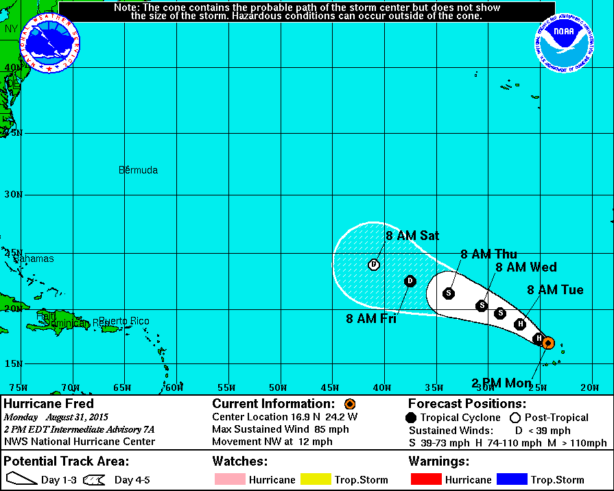
TROPICS: Hurricane Fred is in the far eastern Atlantic around the Cape Verde Islands with 85 mph winds; it will slowly weaken in coming days as it moves northeast, and is expected to dissipate over the Central Atlantic in about five days. No threat to land.
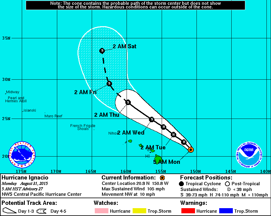
Over in the Pacific, Hurricane Ignacio will pass north of the Hawaiian Islands in coming days..
WEATHER BRAINS: Don’t forget you can listen to our weekly 90 minute netcast anytime on the web, or on iTunes. This is the show all about weather featuring many familiar voices, including our meteorologists here at ABC 33/40. We will produce this week’s episode tonight at 8:30 CT… you can watch it on “James Spann 24/7” on cable systems around the state, or on the web here.
CONNECT: You can find me on all of the major social networks…
Facebook
Twitter
Google Plus
Instagram
Look for the next Weather Xtreme video here by 7:00 a.m. tomorrow…
Category: Alabama's Weather
About the Author (Author Profile)
James Spann is one of the most recognized and trusted television meteorologists in the industry. He holds the AMS CCM designation and television seals from the AMS and NWA. He is a past winner of the Broadcast Meteorologist of the Year from both professional organizations.Subscribe
If you enjoyed this article, subscribe to receive more just like it.


