Pacific Moisture
Often times you may hear meteorologists in the Central US or Southeast US talk about the Pacific moisture coming our way. NOAA just recently tweeted out a picture that I thought illustrated the track of Pacific moisture quite clearly.
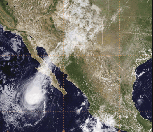
In this image, moisture is streaming out of the top of Tropical Storm Kevin and moving northeastward across Baja California, extreme northwestern Mexico, and finally New Mexico and the Oklahoma and Texas Panhandles. This particular image shows the course of the moisture very well because there is no other moisture mixing in with what is coming off Kevin, so it clearly delineates where the moisture originates and where it goes.
-Brian-
Category: Alabama's Weather
About the Author (Author Profile)
Brian Peters is one of the television meteorologists at ABC3340 in Birmingham and a retired NWS Warning Coordination Meteorologist. He handles the weekend Weather Xtreme Videos and forecast discussion and is the Webmaster for the popular WeatherBrains podcast.Subscribe
If you enjoyed this article, subscribe to receive more just like it.


