Great Weekend; Looking Dry Next Week
A peek at the current surface pressure map, and I think you’ll agree that we have a sprawling high pressure system centered over Pennsylvania creating good weather across most of the eastern half of the US. Other than some rain in the extreme Northwest US and over the southern tip of Florida, the nation is enjoying good weather. Highs today should climb into the lower 60s.
Great weather in Atlanta today, too, if you are attending the SEC Championship game. There will be a good supply of sunshine with the afternoon high around 60. No weather concerns for the game since it is played inside the Georgia Dome.
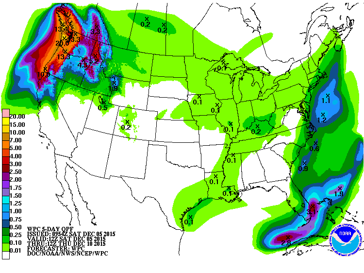
Our five-day QPF chart pretty much tells the story for the next week with no rain forecast for North and Central Alabama.
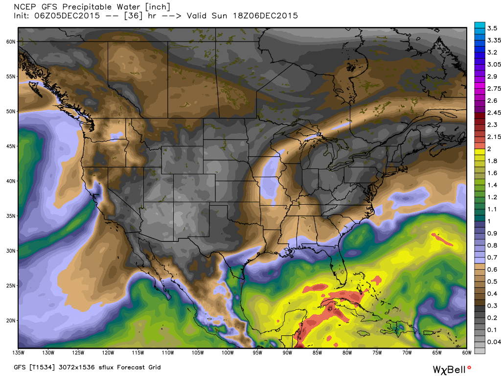
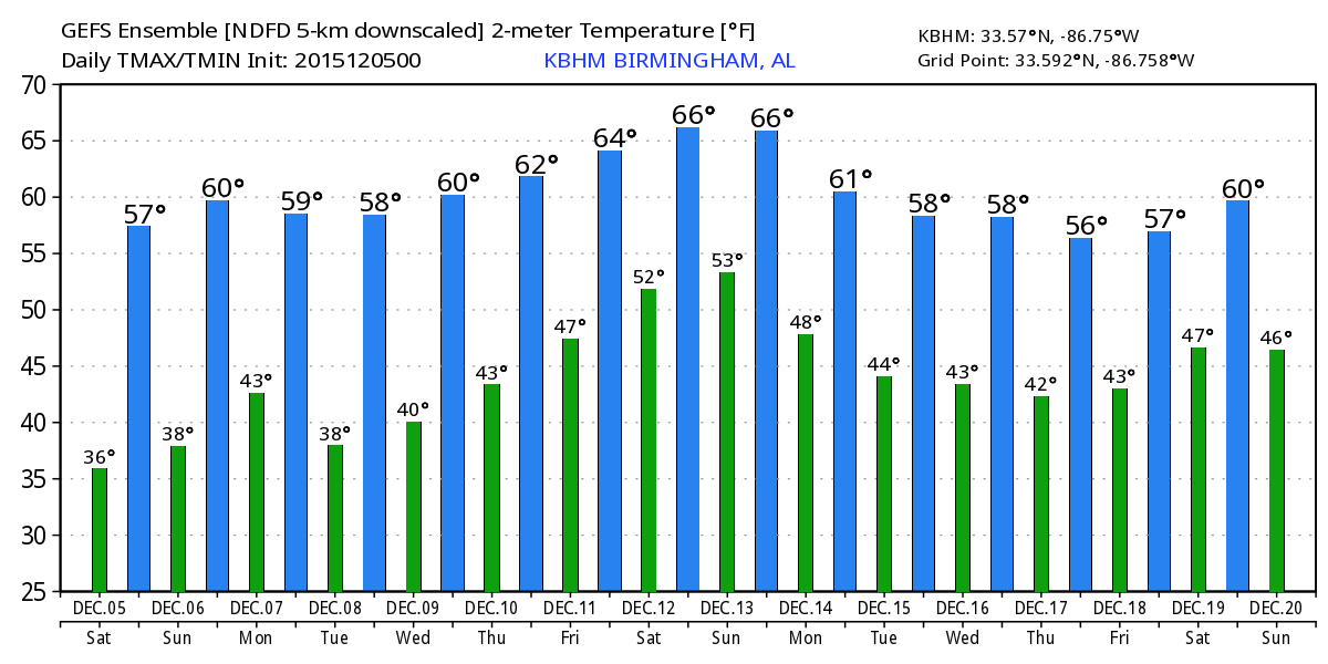
The weather forecast remains dry primarily because of a lack of moisture. The upper air pattern for the next week will see a number of troughs moving briskly through the west to east flow. However, other than some clouds, these systems will have very little moisture to work with, so the outlook is for dry weather. The parade of upper level troughs will keep our temperatures in check. While we’re expecting to see highs in the 60s and lows mainly in the 40s, these values are just slightly warmer than what we typically see in early December. 30-year averages for Birmingham are 59 for highs and 38 for lows.
Changes begin to creep into the picture as we end the upcoming week and head into next weekend. Not surprising, the GFS and the European are a little out of phase. The GFS is faster in bringing moisture back into the picture while the ECMWF is a little slower. I suspect we’ll see some adjustment to the forecast, but for now, there’s a chance of rain for next weekend.
For beach-goers, beautiful weather for the next seven days along the beaches of Alabama and Northwest Florida, though it will be a little chilly. The next chance of rain won’t come until late next week when a slow moving weather system threatens to bring a drenching to the Gulf Coast. The best chance for rain appears to come next weekend. Highs all week will be in the 60s. Lows will be in the 40s through Wednesday and then climb back into the 50s. Water temperatures have fallen back into the 60s. See the complete Gulf Coast 7 Day Planner here. The Gulf Coast Beach Forecast is presented by Gulf Shores Plantation by Mandoki Hospitality Vacation Rentals. Escape to Gulf Shores Plantation where memories last a lifetime.
The long range outlook continues to show an active weather pattern with a fairly steady pattern of upper air troughs zipping across the United States. These troughs show some fairly substantial magnitudes, so we may see the pattern become wetter for week 2 as these troughs appear likely to tap into Pacific moisture. The good news, though, is that nothing appears particularly extreme with lows in the 30s and highs in the 50s for much of Week 2.
It’s the first Saturday of December, so I’m really looking forward to emceeing the annual Helena Christmas parade. This will be the 40th edition of the parade and the weather will be absolutely perfect, so plan to come out for the parade with begins promptly at 1 pm. And special thanks to the Altoona Christmas parade folks for the invitation to their parade last night. The weather was a trifle nippy, but that did not keep people away. There was a great crowd and lots of elements to their fine parade.
I plan to have the next edition of the Weather Xtreme Video posted here first thing on Sunday morning. Have a great day and Godspeed.
-Brian-
Category: Alabama's Weather
About the Author (Author Profile)
Brian Peters is one of the television meteorologists at ABC3340 in Birmingham and a retired NWS Warning Coordination Meteorologist. He handles the weekend Weather Xtreme Videos and forecast discussion and is the Webmaster for the popular WeatherBrains podcast.Subscribe
If you enjoyed this article, subscribe to receive more just like it.


