

Nice Warm-Up Today
COLD START: Some of the colder spots are below freezing this morning; Vic Bell at Black Creek reports 27, and Haleyville is at 29. But, the dry air over Alabama will heat very effectively today, and we project a high in the mid 60s this afternoon with a good supply of sunshine. Makes it hard to dress with this kind of weather. But, certainly not unusual for Alabama.
TOMORROW: A short wave will scoot across North Alabama, bringing some scattered clouds, and it just might squeeze out a few isolated showers over the northern counties by afternoon. We will insert that into the forecast, but understand the air is very dry and most places won’t see any rain. Tomorrow’s high will be in the low 60s with a few cloudy periods during the day.
THURSDAY/FRIDAY/SATURDAY: These three days will be dry with a warming trend; we reach the upper 60s Thursday, and low 70s Friday and Saturday. We will approach record highs as the weekend begins… these are the records for Birmingham:
December 11 76 (1931)
December 12 78 (1971)
FYI… the warmest December temperature on record at Birmingham is 80 degrees… recorded on December 7, 1951 (and, no, I wasn’t doing weather on TV back then).
Based on about 100 years of data, the average high this time of the year is in the upper 50s.
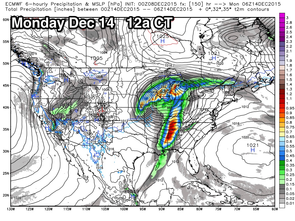
STRONG STORMS SUNDAY: A dynamic weather system will impact Alabama late in the weekend. Dewpoints will surge into the 60s Sunday, and strong wind fields develop. The low level jet (5,000 feet off the ground) will surge to over 50 knots over the northern counties of the state, and we will need to monitor radar closely for strong storms. No, it isn’t unusual having that kind of weather in December; this is the core of the late fall tornado season in Alabama.
As usual, the prime limiting factor is the amount of surface based instability and poor lapse rates. Seems like we can expect a line of strong storms Sunday afternoon or Sunday night, with the primary threat coming from strong straight line winds. Models don’t agree well on timing; the GFS hints the best chance of rain comes during the day, while the ECMWF holds it off until Sunday night. We should have better clarity as the event gets closer. See the Weather Xtreme video for more details.
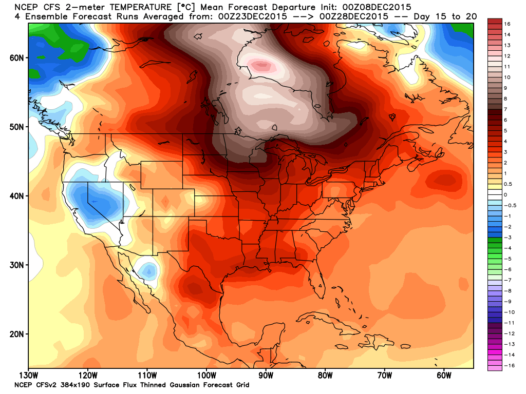
NEXT WEEK: The weather looks cool and dry Monday and Tuesday with highs in the 50s, next chance of rain comes around Wednesday December 16 with a passing cold front.
CHRISTMAS THOUGHTS: The pattern still suggests no invasion of true Arctic air into the lower 48 late in the month; best chance of a white Christmas seems to be out west around the Rocky Mountain states.
AT THE BEACH: Mostly sunny days, fair nights on the coast from Panama City Beach over to Gulf Shores through Saturday; showers return later in the weekend. See the complete Gulf Coast 7 Day Planner here. The Gulf Coast Beach Forecast is presented by Gulf Shores Plantation by Mandoki Hospitality Vacation Rentals. Escape to Gulf Shores Plantation where memories last a lifetime.
WEATHER BRAINS: Don’t forget you can listen to our weekly 90 minute netcast anytime on the web, or on iTunes. This is the show all about weather featuring many familiar voices, including our meteorologists here at ABC 33/40. Scroll down for the show notes on the new episode we recorded last night.
CONNECT: You can find me on all of the major social networks…
Facebook
Twitter
Google Plus
Instagram
Look for the next Weather Xtreme video here by 4:00 this afternoon… enjoy the day!
Category: Alabama's Weather
About the Author (Author Profile)
James Spann is one of the most recognized and trusted television meteorologists in the industry. He holds the AMS CCM designation and television seals from the AMS and NWA. He is a past winner of the Broadcast Meteorologist of the Year from both professional organizations.Subscribe
If you enjoyed this article, subscribe to receive more just like it.


