

Another Warm Day for Central Alabama
Second verse same as the first!! It is going to be another warm day across the Southeast US with the afternoon highs once again threatening record values. But just like we saw on Saturday, a fairly substantial cloud cover will limit the amount of sunshine we get, so most records will probably still be standing when the day is over. Our 30-year average highs for this time of year run around 57 degrees, so we’ll still be 15 to 18 degrees above those values.
As we noted yesterday, we’ll see a cool down with the first front due to pass through Central Alabama Monday morning. That will bring our temperatures down about 10 to 12 degrees, but we’ll still be warm enough to stay above those 30-year averages. The second front expected Thursday morning should provide a second level of cooling that will take us to highs and lows just a bit below the 30-year averages with highs in the lower and mid 50s and lows in the lower 30s.
Today we’ll see a stout southerly wind this afternoon and tonight with a wind advisory in place for all of Central and North Alabama from mid-afternoon through 4 am on Monday with the wind at 15 to 25 mph with wind gusts to 35 mph. The sky will be mostly cloudy but we stay warm with highs in the lower and middle 70s.
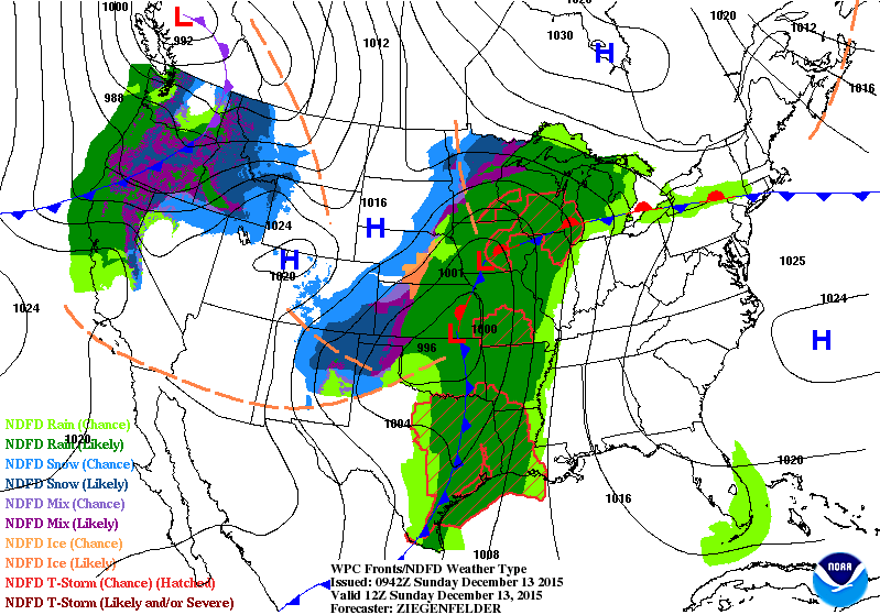
The surface low will move from the Central Plains today into the Great Lakes area Monday as the cold front moves across the Southeast US. As we stated yesterday, the instability is limited while shear values remain relatively high, so there is still a low chance for severe weather. Most of what we see will see will be the strong gradient wind ahead of the front along with some pretty good rain. Rainfall amounts with this first front should be in the half to one and a half inch range. Rain should enter the state in the 9 pm to midnight time frame this evening and be exiting the eastern sections of Alabama in the 1 pm to 3 pm time period.

An upper level ridge together with a surface high will fill in behind the front late Monday bringing us good weather for Tuesday and the first portion of Wednesday.
A second upper low and associated trough will come into the picture quickly right behind the one tonight and early Monday. Yet another front will move through Central Alabama late Wednesday and early Thursday bringing us another shot at rain. There still remains some question as to how much moisture will return, so for now it looks like rainfall will be somewhat limited with the second system with around one half inch possible for Central Alabama.
The upper air pattern changes a good deal behind this second system as a broad trough becomes established over the East Coast Friday and Saturday. This will really bring in some cool, dry air as the upper flow goes northwesterly coming from Central Canada into the Southeast US. Temperatures are not expected to reach any record values, however, it will really feel cold since we have been running so warm for the last several days and will stay above seasonal values until late Thursday.
By Sunday, we see an upper ridge replacing the trough, so we should see a fairly quick warm up into the first of week 2.
Showers and storms are in the forecast tonight, then cooler weather for the new work week. Showers with a late week front, and then much cooler next weekend. See the complete Gulf Coast 7 Day Planner here. The Gulf Coast Beach Forecast is presented by Gulf Shores Plantation by Mandoki Hospitality Vacation Rentals. Escape to Gulf Shores Plantation where memories last a lifetime.
Looking into voodoo country, there will be no rest for weather folks with a pattern that remains pretty progressive with a continuous parade of upper air troughs. The GFS paints one around the 22nd of December. By the 25th, the Southeast US is under a strong ridge, so Christmas Day should see good weather for Central Alabama with temperatures at or slightly above the late December averages. But on the 25th we’ll have our eyes on another low latitude closed low coming out of the Southwest US. That one promises some active weather for the Lower Mississippi River Valley around the 27th. And close on the heels of that one will be yet another one around the 29th.
James Spann will have the next Weather Xtreme Video posted here on Monday morning. Check back with us often as we post updates on the ever changing weather. Be sure to do at least one act of random kindness today. Enjoy the day and Godspeed.
-Brian-

Category: Alabama's Weather
About the Author (Author Profile)
Brian Peters is one of the television meteorologists at ABC3340 in Birmingham and a retired NWS Warning Coordination Meteorologist. He handles the weekend Weather Xtreme Videos and forecast discussion and is the Webmaster for the popular WeatherBrains podcast.Subscribe
If you enjoyed this article, subscribe to receive more just like it.


