

Warmer, Wetter Weather Ahead
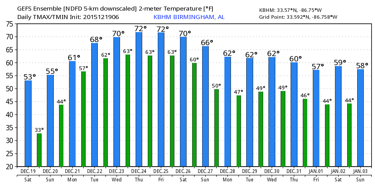
With a high centered over about Meridian, MS, we’ve see temperatures fall well into the 20s this morning. Our Skywatcher at Black Creek reported 20 for his low at last check, and at Noccalula Falls the temperature had dropped to 24. So you’re going to need some extra layers if you plan to head out early this morning. The clear, crisp morning should evolve into a sunny afternoon with temperatures climbing well into the 50s. The average lows and highs this time of year are 55 and 36, so we’re way below for the low and just about on it for the high.
Jacksonville State hosts Sam Houston State in the semifinals of the FCS playoff at Burgess Snow Stadium at 3:00 pm. The weather should be just about perfect for football with a clear, cool day. Temperatures will fall from near 52 degrees at kickoff to about 43 by the final whistle.

Sunday becomes a transition day for us. As the surface high moves east of Alabama, we’ll see the surface wind come around to the southeast as we begin the process of increasing moisture levels across the Southeast US. Aloft, the 500 millibar flow will become more southwesterly in response to a trough over the Rockies. We should remain dry Sunday as temperatures come up nicely with the afternoon highs near 60.
The warming trend continues Monday with a good southerly surface flow bringing Gulf moisture into the Lower Mississippi River Valley while the upper flow remains stuck with a southwesterly flow. This combination should continue to boost precipitable water values bringing us into a very wet regime. A short wave moving across the Ohio Valley should increase the chances for rain during the afternoon and evening on Monday. This flow also brings up temperatures with lows around 49 and highs in the lower 60s.
From here into the next weekend, the pattern remains pretty much stuck. A deep trough will be developing over the Southwest US through Saturday which keeps us tapped into Pacific moisture. Surface lows in the central portion of the country together with a surface high well into the Atlantic keeps the low level moisture pumping into the Southeast US from the Gulf of Mexico. With a parade of weak troughs in the upper air flow, we’ll see rain chances continue into next weekend.

With precipitable water (PW) values rising into the 1.2 to 1.5 range at mid-week with even higher values over South Alabama, we’re going to have to be watching the potential for flood issues. PW values climb even higher Friday and Saturday which spell a flood threat with the prolonger period favoring precipitation. There are many issues to evaluate, but I will not be surprised if we see some type of flash flood watch later this week. Initial rainfall estimates for Central Alabama through Wednesday are 1.5 to 2 inches with another 1 to 1.5 inches possible by Saturday.
Needless to say our chance of a white Christmas are about zero. While it may be wet with showers a possibility, it will also be warm Christmas Day with highs well into the 60s – some places may even push the lower 70s depending on clouds and the timing of precipitation.
Heavy rain is also the word along the beaches of Alabama and Northwest Florida this week. A nice weekend is in store with sunny skies with highs in the 60s and lows in the 40s. Things go downhill along the coast Monday with showers showing up. There will be a couple of bouts of heavy rain, likely centered on Monday night and Wednesday. Showers will linger into Thursday. Rainfall amounts will average 3 to 4 inches along the coast and into South Alabama. Highs will be in the 70s next week, cooling down after Christmas Day. Water temperatures are in the lower 60s. The rip current threat will be moderate through the period, with some red flags likely Wednesday. See the complete Gulf Coast 7 Day Planner here. The Gulf Coast Beach Forecast is presented by Gulf Shores Plantation by Mandoki Hospitality Vacation Rentals. Escape to Gulf Shores Plantation where memories last a lifetime.
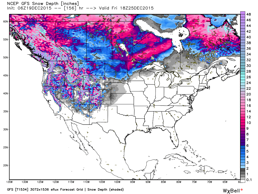
The big trough and closed low over the Southwest US on Saturday will finally come out across the Lower Mississippi Valley on Monday or early Tuesday. We’re really getting into voodoo country, but if the system is as strong as the GFS is indicating, we could see a pretty big severe weather event. After that system comes by, the pattern into early January, 2016, sets up with a ridge over the eastern US with a series of troughs coming across the western US.
I’ll be filling in for Meaghan Thomas this weekend, so you can catch the latest forecast update at 6 and 10 pm today on ABC 3340. I expect to have the next Weather Xtreme Video posted here first thing Sunday morning. Have a great day, and be sure to perform at least one act of random kindness today. Godspeed.
-Brian-
Category: Alabama's Weather
About the Author (Author Profile)
Brian Peters is one of the television meteorologists at ABC3340 in Birmingham and a retired NWS Warning Coordination Meteorologist. He handles the weekend Weather Xtreme Videos and forecast discussion and is the Webmaster for the popular WeatherBrains podcast.Subscribe
If you enjoyed this article, subscribe to receive more just like it.


