

Keep In Touch With the Weather Today
Merry Christmas everyone!
As you open your presents on this Christmas morning, please keep in mind that we have an active weather situation across the area. The long track killer tornado that affected Mississippi and parts of Tennessee on Wednesday serves as a reminder that this time of year can produce deadly weather.
Folks, it’s not supposed to be 72F like it is at Birmingham or 73F like it is at Tuscaloosa on Christmas morning in Central Alabama.
We have a “slight risk” severe weather outlook from the SPC, their standard severe weather forecast, for areas generally along and north of I-59 today, including Tuscaloosa, Birmingham and Gadsden as well as Jasper, Hamilton, Cullman, the Quad Cities and Huntsville. This risk area is for a risk of damaging winds and even tornadoes.
A tornado watch is currently being considered by the NWS for a large area along and north of I-20 from northeastern Louisiana across Central Mississippi to West Central Alabama. It would likely include Tuscaloosa and Birmingham as well as Jasper and Hamilton.
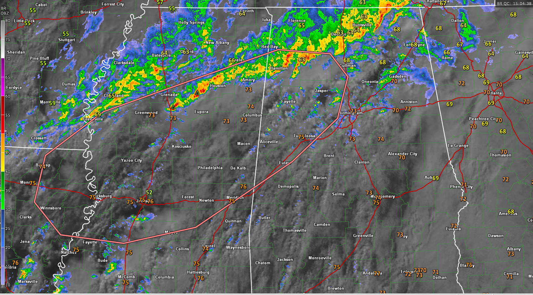
There is a tornado warning right now in North Central Mississippi east of Greenwood for a radar indicated tornado. That storm is moving into an area of much higher low level shear. This storm will move toward Sweatman, Slate Spring, Calhoun City and Vardaman. Dewpoints are near 70F and the storm appears to be riding along the instability boundary, with CAPE values going from 500 j/kg to over 1,000 j/kg. This activity might eventually work into places like Marion and Lamar Counties as well as Northwest Alabama.
This corridor concerns me the most right now with differential heating setting up between the rain cooled air to the north and warm, moist tropical air to the south which is getting heated by some breaks in the clouds over Central Mississippi and West Central Alabama. A severe thunderstorm warning was needed briefly for parts of Marion and Lamar Counties around the 8:00 hour.
Instability values across West Central Alabama are already into the 1000-2000 j/kg range, which is not good considering it is this early in the morning. As the activity over northern Mississippi and northern Alabama sags into Central Alabama today, problems will ensue.
Heavy rain continues across the Tennessee Valley of Northwest Alabama. So far no flood warnings, but there is a flash flood watch in effect. 2.76 inches of rain just reported in Toney.
Overnight northward moving convection prompted a flash flood warning for Chilton, Shelby and Talladega Counties. Flooding is reported in Columbiana and Talladega.
Please stay in touch with the weather throughout the day as you go through your holiday activities. Keep your severe weather plan in mind and have a source for warnings.
Category: Alabama's Weather, Severe Weather
About the Author (Author Profile)
Bill Murray is the President of The Weather Factory. He is the site's official weather historian and a weekend forecaster. He also anchors the site's severe weather coverage. Bill Murray is the proud holder of National Weather Association Digital Seal #0001 @wxhistorianSubscribe
If you enjoyed this article, subscribe to receive more just like it.


