Midfield Tornado Given Preliminary Rating of EF2 (Top Winds 130 mph)
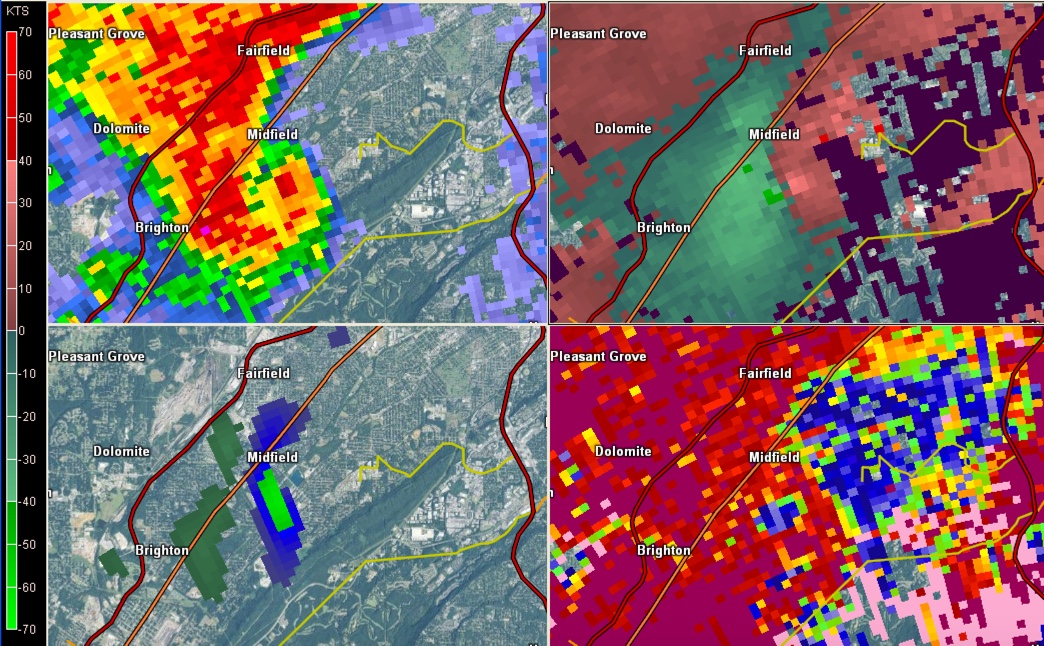
Radar image from BMX Doppler radar at 4:57 p.m. yesterday when Midfield Tornado was on the ground showing (clockwise from top left) hook echo, velocity couplet, tornado debris signature and intense rotation. Click image to enlarge.
NWS Survey teams have been hard at work this morning checking the damage from yesterday’s tornadoes across Central Alabama.
They found that the Coaling Tornado in Tuscaloosa County was an EF-0 with top winds of 75 mph. It was on the ground for five miles and and a path width of 150 yards.
The team is still assessing the damage from the Midfield Tornado, but has reported a preliminary assessment of EF-2, estimating max winds of 130 mph.
The damage is in the West Brownsville and Grasselli Heights neighborhoods just east of Midfield.
More information as we get it.
Category: Alabama's Weather, Severe Weather
About the Author (Author Profile)
Bill Murray is the President of The Weather Factory. He is the site's official weather historian and a weekend forecaster. He also anchors the site's severe weather coverage. Bill Murray is the proud holder of National Weather Association Digital Seal #0001 @wxhistorianSubscribe
If you enjoyed this article, subscribe to receive more just like it.


