

More on the Midfield Tornado
Isn’t technology amazing?
Take a fantastic drone video of damage from yesterday’s Midfield Tornado shot by SkyBama. Match it up against Google Maps Street View, and you get some amazing before and after comparisons and seat of the pants assessments of the damage caused by the tornado.
I have no formal training in damage assessment, but I assigned some potential EF rating numbers to the drone video footage and mapped it on Google maps after matching the before and after imagery.
You can click on any image to enlarge it.
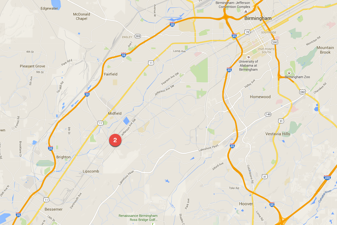
Here is the location of the tornado on a map of the Birmingham area:
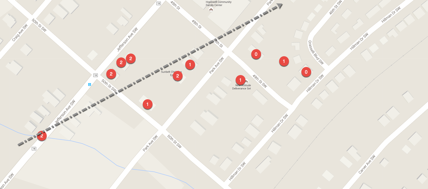
Here is a zoomed in map of the main damage area with my rating assessment markers:
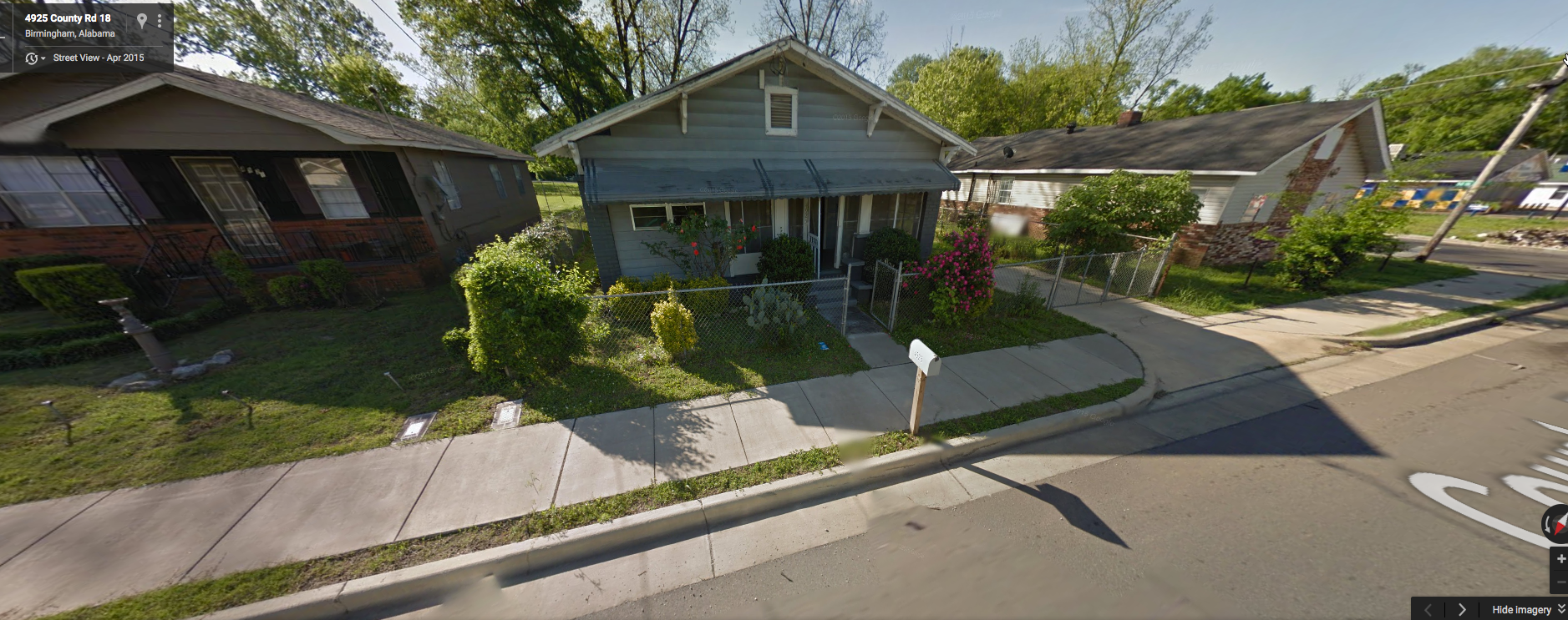
Here is a before image of the heaviest damage area at 50th Street and Jefferson Avenue SW from Google Street View:
Here is what it looked like this morning:
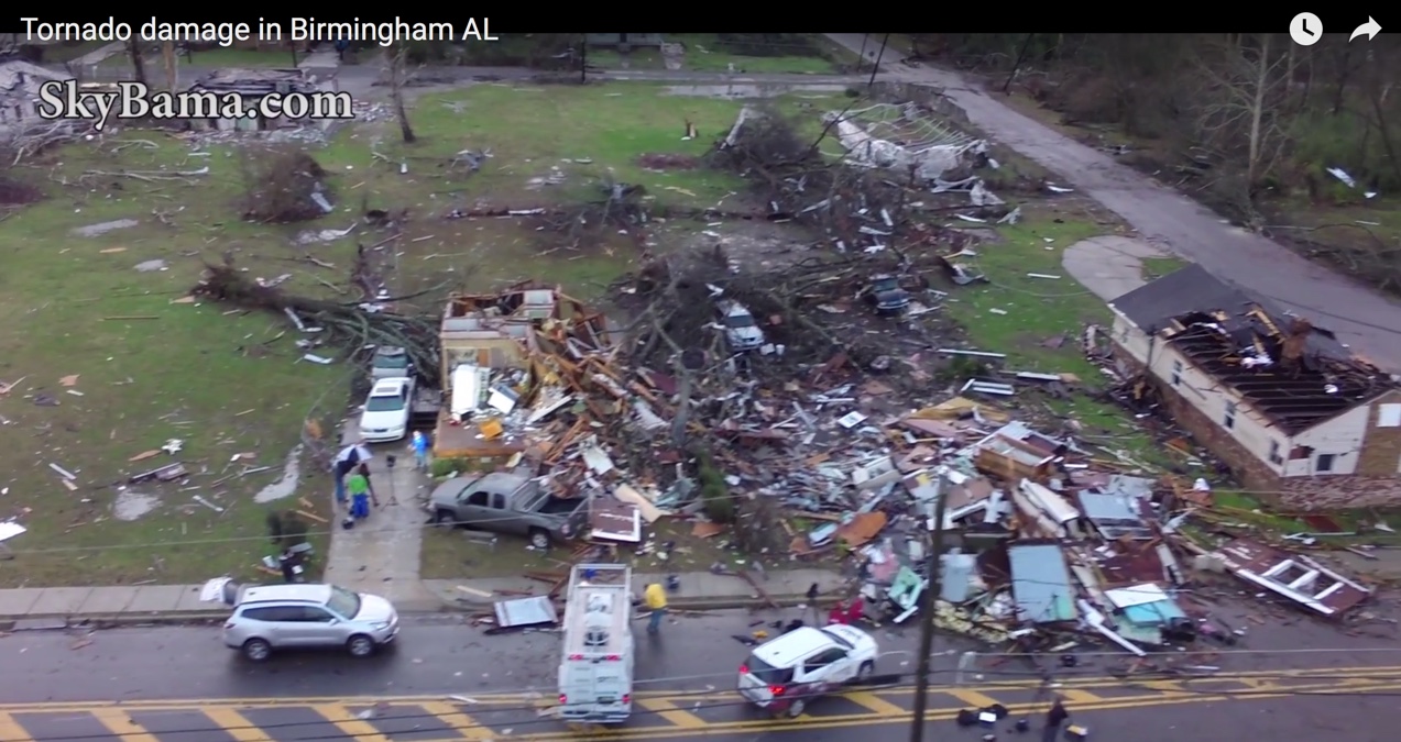
The complete drone video:
UPDATE AT 3:45 PM
The NWS has completed their assessment. Here are the results:
.MIDFIELD TORNADO (JEFFERSON COUNTY)…
RATING: EF-2
ESTIMATED PEAK WIND: 130 MPH
PATH LENGTH /STATUTE/: 0.86 MILES
PATH WIDTH /MAXIMUM/: 500 YARDS
FATALITIES: 0
INJURIES: 2
START DATE: DEC 25 2015
START TIME: 455 PM CST
START LOCATION: 0.2 N BROWNVILLE
START LAT/LON: 33.4437 / -86.9135
END DATE: DEC 25 2015
END TIME: 505 PM CST
END LOCATION: 1.0 NE EAST OF BROWNVILLE
END_LAT/LON: 33.4453 / -86.8989
A SECOND TORNADO THEN TOUCHED DOWN WITH A FAIRLY BRIEF BUT WIDE
DAMAGE PATH, WITH A CORE OF CONCENTRATED SIGNIFICANT DAMAGE. INITIAL
DAMAGE WAS FOUND NEAR DOWNEY STREET AND 51ST STREET, WHERE TREES
WERE TOPPLED AND SNAPPED. THIS DAMAGE WAS RATED AT EF-1 INTENSITY.
THE TORNADO THEN TRACKED NORTHEAST WHERE EF-2 DAMAGE OCCURRED ALONG
JEFFERSON AVENUE SW AND PARK AVE SW, BOUNDED BY 50TH STREET TO THE
SOUTH AND 49TH STREET TO THE NORTH. HERE, RESIDENTIAL HOMES WERE
HEAVILY DAMAGED, WITH TWO HOMES FLATTENED. MANY TREES WERE ALSO
SNAPPED AND UPROOTED. A RAPID DECLINE IN DAMAGE INTENSITY WAS
OBSERVED AS THE TORNADO MOVED NORTHEAST, WITH EF-1 AND EF-0 DAMAGE
CONSISTING OF ROOF DAMAGE, AS WELL AS SNAPPED AND UPROOTED TREES
STRETCHING FROM GRASSELLI BOULEVARD TO CARVER AVENUE SW AND 45TH
STREET SW. THERE WERE A TOTAL OF ABOUT 50 HOMES IMPACTED OR DAMAGE,
WITH APPROXIMATELY 15 THAT WERE UNINHABITABLE.
MORE SURVEYS ARE LIKELY IN THE COMING DAYS IN BIBB AND BARBOUR
COUNTIES.
EF SCALE: THE ENHANCED FUJITA SCALE CLASSIFIES
TORNADOES INTO THE FOLLOWING CATEGORIES.
EF0…WEAK……65 TO 85 MPH
EF1…WEAK……86 TO 110 MPH
EF2…STRONG….111 TO 135 MPH
EF3…STRONG….136 TO 165 MPH
EF4…VIOLENT…166 TO 200 MPH
EF5…VIOLENT…>200 MPH
Category: Alabama's Weather, Severe Weather
About the Author (Author Profile)
Bill Murray is the President of The Weather Factory. He is the site's official weather historian and a weekend forecaster. He also anchors the site's severe weather coverage. Bill Murray is the proud holder of National Weather Association Digital Seal #0001 @wxhistorianSubscribe
If you enjoyed this article, subscribe to receive more just like it.


