New Day One is Out
The Storm Prediction Center has issued their Day One Convective Outlook for today (Monday).
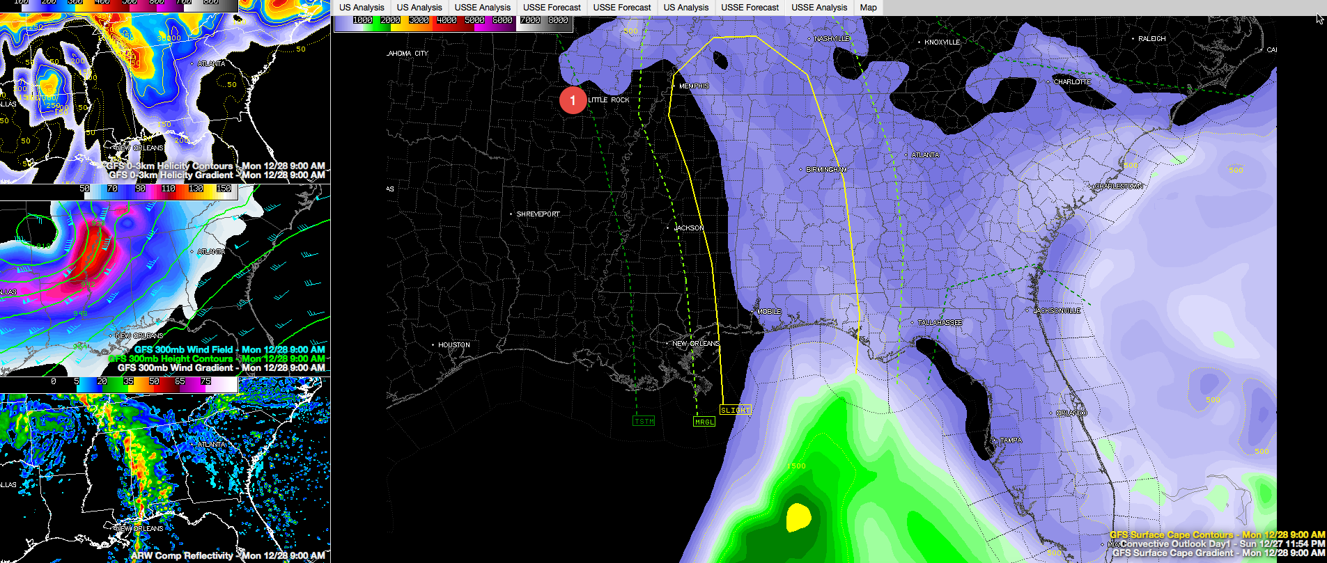
As expected, a slight risk outlook is posted for the western three fourths of Alabama. Areas west of a line from Guntersville to Ashland to Tuskegee to Ozark are included in the risk, which is the SPC’s standard severe weather forecast.
Click image to enlarge.
This graphic shows the outlook superimposed on the GFS forecast of CAPE (instability) at 9 a.m. CST later today in the large panel. The stop left panel shows wind shear. The middle left panel shows expected winds at the jet stream level. The bottom left panel shows the forecasted radar for 9 a.m. CST.
A line of thunderstorms will push into Alabama between 8-9 a.m. and will progress across the state. Ahead of the system, precipitable water values will be between 1.4-1.8 inches, which is off the scale for December, so moisture will not be a problem. Instability values will be on the low side, running around 500 j/kg, but certainly high enough to support thunderstorm updrafts. Wind shear values will be decent, although the best support will be exiting to the north during the day. During the day, we will find ourselves in the right exit region of a 120 knot jet streak, which will enhance upward motion. A weakening low level jet will be advancing across the state in advance of the line of storms.
WHAT DOES ALL THIS MEAN? There is a chance of damaging winds and even isolated tornadoes with the line of thunderstorms as it advances across the state today. It will be most clouds and windy, and wind advisories are in effect. Temperatures are starting out near 70F and will not rise much during the day, because they didn’t fall very much overnight. Dewpoints are in the middle 60s, so the atmosphere has a humid feel. Showers have spread across much of the area west of I-65 and we are just waiting on the line of storms.
TRAGIC TOLL: More people have died in the past four days across the United States from tornadoes than had died the entire other 350 days of the year. While widespread severe weather is not expected, let’s make sure we don’t add to that tragic toll today. Please review your severe weather safety plans and stay abreast of developing weather conditions today. Be in a place to receive warnings and act if one is issued for you.
Category: Alabama's Weather, Severe Weather
About the Author (Author Profile)
Bill Murray is the President of The Weather Factory. He is the site's official weather historian and a weekend forecaster. He also anchors the site's severe weather coverage. Bill Murray is the proud holder of National Weather Association Digital Seal #0001 @wxhistorianSubscribe
If you enjoyed this article, subscribe to receive more just like it.


