Cold Again Today
The week ahead is going to seem really quiet compared to the weather events of the last couple of days. But sometimes quiet is good, so we can get rested up for the next big event!
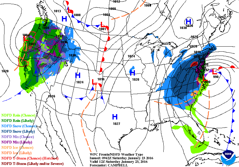
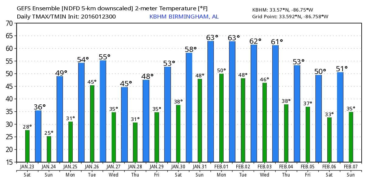
Today will be cold with highs not getting out of the upper 30s for much of Central Alabama. Clouds should hand tough for the morning and early afternoon before we see some peeks at the sun during the waining hours of the afternoon. And as long as we have clouds we may see a few flurries, but the winter weather is essentially over. The snowstorm affecting the Mid-Atlantic States will be winding down today, too, giving those folks a chance to dig out from what will probably go into the record books.
By Sunday the upper low moves well out into the Atlantic as we begin to come under a ridge aloft and starting the warming process. Sunday morning will be pretty chilly with the morning lows falling back into the lower 20s. And that means some of those typically colder spots could see lows in the 17 to 19 range. Definitely not as cold as the last system, but with the surface high situated across the Ohio and Tennessee River valleys, we should have good radiational cooling conditions. Highs Sunday should feel great as we warm up into the upper 40s.
Monday the surface high pushes off into the Southwest Atlantic and that will bring the surface wind around to the south and allow us to really warm up. Look for the lows to be around freezing, but by afternoon we should be well into the middle and upper 50s.
Late Monday into Tuesday an upper trough will push by well to our north, but that will take a surface low into the Great Lakes and drag a cold front into Alabama. There does not appear to be much instability with the system with the main upper dynamics well north of us, so it looks like just rain showers with the potential for one half to three quarters of an inch of rain.
The models begin to diverge on their solutions at mid-week. While their solutions are similar, there are variances on just how far north the precipitation is likely to get. A portion of the trough moving across the Great Lakes on Wednesday hangs back over Texas and intensifies on Thursday along the Central Gulf Coast. This should generate a surface low in the eastern Gulf that will move into the Southwest Atlantic on Thursday. The Euro is a little more aggressive with its solution and generates the surface low closer to the Central Gulf Coast. While similar in their overall patterns, the differences would mean some rain for us if the Euro is correct. For now I’ll stick with the GFS and keep the rain chances over South Alabama.
Friday the upper trough moves off the US East Coast bringing us under a cooler northwesterly flow. But the pattern is active and we quickly come under a ridge Saturday with the upper flow going southwesterly while the surface flow goes southerly resulting in a nice warmup for next weekend with highs potentially pushing the 60-degree mark.
And active is how I see the pattern as we venture into voodoo country. Active, but also absent from any real cold or heat. A fairly powerful upper closed low comes out of the Four Corners area around February 2nd generating a powerful surface system in the Central Plains. This one looks pretty strong, perhaps strong enough to generate severe weather for the Lower Mississippi River Valley while providing the ingredients for some winter weather for the Midwest. The upper flow goes practically zonal around the 5th, but there is another trough in the pipeline coming across the Central US around the 7th.
Due to some personal plans, I expect to be a little later with the Weather Xtreme Video on Sunday morning. Enjoy the day and stay warm. Be sure to be proactive in taking care of any pets that normally stay outside by providing them with a nice warm place today and tonight. Godspeed.
-Brian-
Category: Alabama's Weather
About the Author (Author Profile)
Brian Peters is one of the television meteorologists at ABC3340 in Birmingham and a retired NWS Warning Coordination Meteorologist. He handles the weekend Weather Xtreme Videos and forecast discussion and is the Webmaster for the popular WeatherBrains podcast.Subscribe
If you enjoyed this article, subscribe to receive more just like it.


