Slight Risk Expanded Northward
The new SPC severe weather outlook has expanded the slight risk category northward in Alabama.
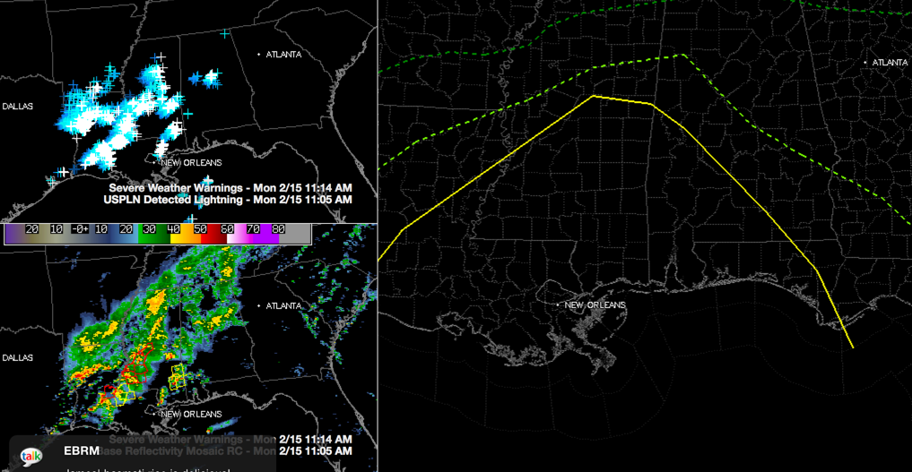
It now includes areas south of a line from Aliceville to Eutaw to Orrville to Grenville to Geneva.
The marginal risk now is extended north to a line from Sulligent to Winfield to Lake View to Montevallo to Clanton to Tuskegee to Hurtsboro. This includes Fayette, Brent, Tuscaloosa and Montgomery.
The northward extent of the severe weather is going to be defined by the northward progress of the warm front. The surface low right now is between Greenwood and Columbus MS. The warm front extends southeastward to Tuscaloosa and Montgomery.
0.40 inches at the Shelby County Airport. That is about what you can expect as the nice rain area with embedded thunder ahead of the warm front continues to move across the Birmingham Metro area.
Four tornado warnings and a few severe thunderstorm warnings are in effect across southern Mississippi right now. Surface CAPE values are above 1000 joules/kg over southern Mississippi. Instability is increasing rapidly over Southwest Alabama.
Category: Alabama's Weather, Severe Weather
About the Author (Author Profile)
Bill Murray is the President of The Weather Factory. He is the site's official weather historian and a weekend forecaster. He also anchors the site's severe weather coverage. Bill Murray is the proud holder of National Weather Association Digital Seal #0001 @wxhistorianSubscribe
If you enjoyed this article, subscribe to receive more just like it.


