North Central Alabama in the Clear, Tornado Warning for Phenix City
Things have calmed considerably across North Central Alabama this evening.
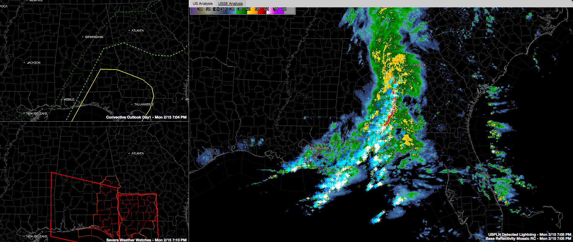
Click image to enlarge.
The main line of storms extends from east of Oxford to Roanoke to Lanett and into Southeast Alabama. A menacing radar feature, called a line echo wave pattern has developed southwest of Columbus GA. This”kink” in the line is indicative of a higher tornado threat. A tornado warning was just issued for Lee and Russell Counties. This is south of the Auburn/Opelika area.
The back edge of the moderate rain is east of a line from Oneonta to Pell City to Goodwater to Montgomery. Rain has ended west of there.
I picked up 1.28 inches of rain in Vestavia. The Birmingham Airport has 1.19 through 6 p.m.
The only remaining severe weather threat is across the southeastern part of the area. The SPC has already trimmed the marginal risk back to cover areas from Five Points in Chambers County to Jackson’s Gap in Tallapoosa County to just east of Montgomery to just east of Georgiana in Butler County to just east of Brewton in Conecuh County.
The best chance for severe weather continues over far Southeast Alabama, south of a line from Eufaula to Troy to Andalusia.
The tornado watch continues for the following counties in the County Warning Area of the NWS Birmingham: Barbour, Lee and Russell.
Category: Alabama's Weather, Severe Weather
About the Author (Author Profile)
Bill Murray is the President of The Weather Factory. He is the site's official weather historian and a weekend forecaster. He also anchors the site's severe weather coverage. Bill Murray is the proud holder of National Weather Association Digital Seal #0001 @wxhistorianSubscribe
If you enjoyed this article, subscribe to receive more just like it.


