Model Differences Still Abound
When I do the Weather Xtreme Video, it is based on the 06Z model run of the GFS and the 00Z run of the ECMWF (European). For the last several days there has been model inconsistencies and differences which leads to a lack of confidence in the weather forecast we make. This morning I noted that the GFS and the European were in much closer agreement on the weather system which is anticipated to affect us late Tuesday into Wednesday. Well, that has changed once again as the 12Z runs on both models are again very different.
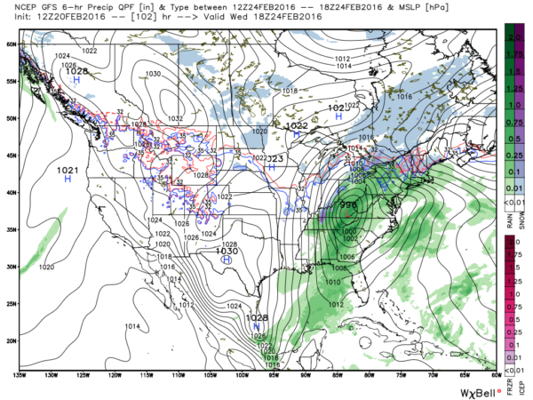
Here is the surface chart from the GFS valid at 18Z on Wednesday, February 24th.
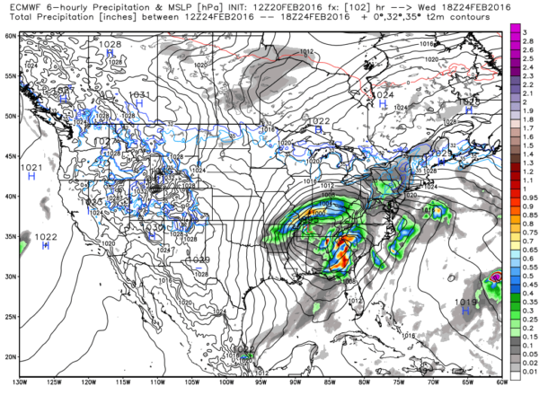
And here is the surface chart for the same valid time from the European model.
Upon close examination you can see the surface low is over eastern Kentucky and Northeast Tennessee while the European has surface low just west of Nashville. That’s a pretty big difference. The GFS has the front all the way into the eastern section of Georgia while the European has the front still in eastern Alabama. Once again a fairly substantial difference.
The agreement that I see in both models is that either pattern is likely to bring the potential for severe storms to the Southeast US from Tuesday into Wednesday. But the model differences mean that it is extremely difficult to nail down a time or place for the greatest threat just yet. Maybe by the 06Z model run tomorrow morning the two models will be in closer agreement enhancing the confidence in the forecast for mid-week.
-Brian-
Category: Alabama's Weather


