Severe Thunderstorm Watch Issued
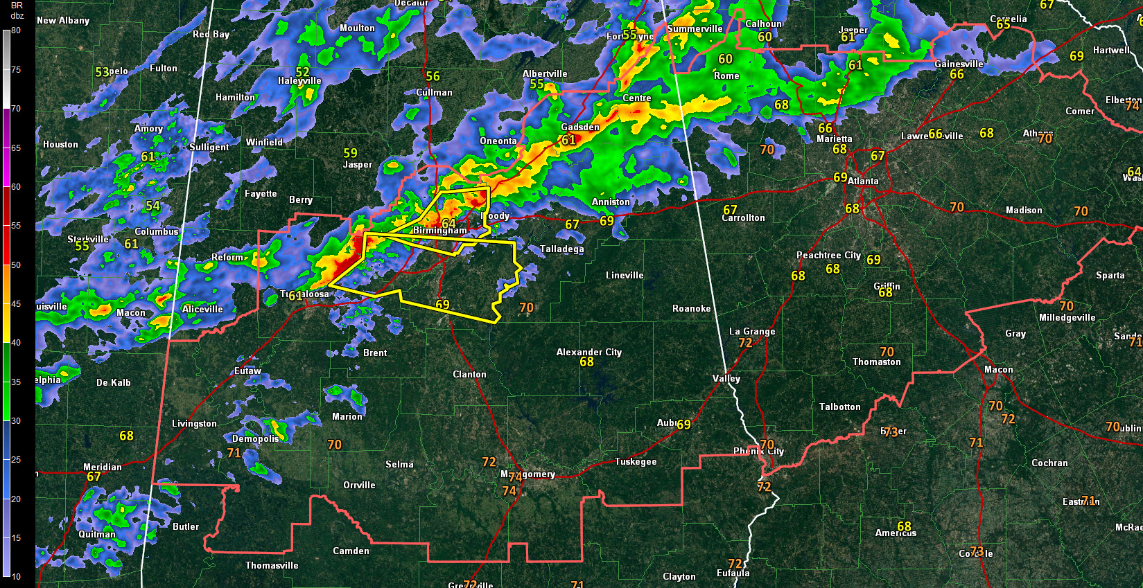
The NWS has issued a severe thunderstorm watch now for Central Alabama. Counties include: Autauga, Bibb, Calhoun, Chambers, Cherokee, Chilton, Clay, Cleburne, Coosa, Dallas, Elmore, Etowah, Greene, Hale, Jefferson, Lee, Lowndes, Macon, Marengo, Montgomery, Perry, Randolph, Shelby, St. Clair, Sumter, Talladega, Tallapoosa, Tuscaloosa until 1:00 AM CST.
Instability values are between 500-1,000 joules/kh now across Central Alabama and there is a decent amount of overall wind shear for organized thunderstorms. One such storm is entering the Birmingham Metro now with a good potential for damaging winds and large hail. Tops on that storm are approaching 40,000 feet.
Winds at about 5000 feet approaching 60 mph and it will be easily for thunderstorm circulations to bring those winds to the ground.
Category: Alabama's Weather, Severe Weather
About the Author (Author Profile)
Subscribe
If you enjoyed this article, subscribe to receive more just like it.


