Radar Update at 6:30
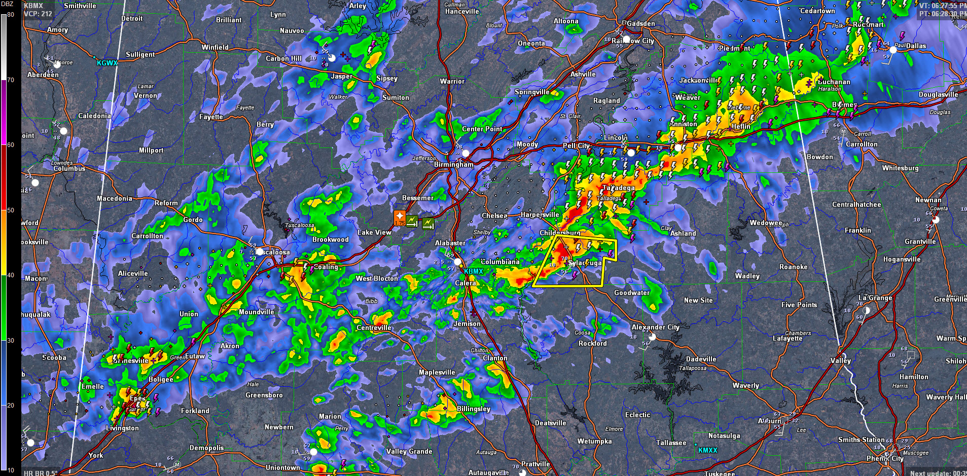
The line of storms now extends from Heflin to Talladega to Childersburg/Sylcacauga, Calera, Centreville, Coaling and onto Eutaw and Boligee.
The strongest storms are in East Alabama for now. A sever thunderstorm warning remains in effect for Talladega County. The worst of the weather is arriving in Sylacauga now.
The storm is Sumter County may become severe at any time. It is near Epes. It will move near Boligee and Forkland.
Areas behind the main line are out of the threat now. Areas in and ahead of the line of storms have a continued severe thunderstorm threat until the line passes. The watch officially remain in effect until 1 am.
Category: Alabama's Weather, Severe Weather
About the Author (Author Profile)
Bill Murray is the President of The Weather Factory. He is the site's official weather historian and a weekend forecaster. He also anchors the site's severe weather coverage. Bill Murray is the proud holder of National Weather Association Digital Seal #0001 @wxhistorianSubscribe
If you enjoyed this article, subscribe to receive more just like it.


