

Meteorological Bonanza
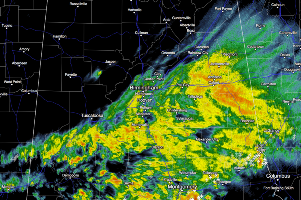
EVERYTHING BUT THE KITCHEN SINK: The system moving through Alabama today has clearly over performed… over the past 12 hours we have experienced…
RAIN: Amounts have been higher than forecast; looks like many places will go over one inch. The rain is now tapering off along the I-59 corridor…
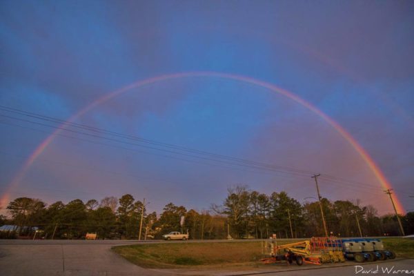
RAINBOWS: Several early morning rainbows were seen across North Alabama as the sun was rising in the east, and rain was approaching from the west.
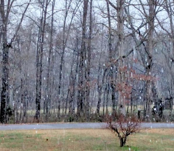
SLEET: As the precipitation started this morning, evaporative cooling (same process that makes you feel cold when you get out of the shower) dropped temperatures enough 2000-5000 feet off the ground for ice pellets. Sleet is a stratiform type of precipitation.
SNOW: The lower 5,000 feet was even colder over Northeast Alabama, and snowflakes came down in parts of Blount, Etowah, Calhoun, Cherokee, DeKalb, Jackson, and Marshall counties. Surface temperatures were above freezing and there was no impact.
HAIL: Even with cold air near the surface, the air was extremely cold aloft, and we had elevated thunderstorms that produced hail through parts of Central Alabama. Hail covered U.S. 280 briefly north of Alex City, and at least one wreck happened due to the hail accumulation. Hail is a product of convection.
GRAUPEL: This is “soft hail”; precipitation that forms when supercooled droplets of water are collected and freeze on falling snowflakes, forming balls of rime.
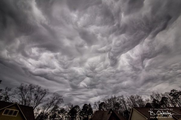
UNDULATUS ASPERATUS: The sky was remarkable before the precipitation started this morning, and these wavy, chaotic clouds formed overhead.
TOO COLD: We forecast highs in the low 50s across Central Alabama today; some places are only in the upper 30s at mid-afternoon, including Alexander City and Calera.
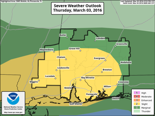
SEVERE STORMS OVER SOUTH ALABAMA? And, if that is all not enough, we could see a few severe thunderstorms over far South Alabama this evening where unstable air has moved onshore.
All in all, a remarkable day for weather watchers.
TOMORROW: Clouds will most likely linger into the morning, but the sky becomes partly to mostly sunny by afternoon with a high in the mid to upper 50s.
THE WEEKEND: Expect a sunny sky Saturday and Sunday with a warming trend; highs will be in the 64-68 degree range both days.
NEXT WEEK: Global models continue to suggest rain and storms will stay just west of Alabama much of the week; it will be breezy and very mild around here with highs in the 70s. A few showers could show up late in the week over West Alabama, but the big rains stay to the west of here. See the Weather Xtreme video for maps, graphics, and more details.
AT THE BEACH: After a round of rain and storms tonight, it will be dry with sunny days and fair nights tomorrow through early next week from Gulf Shores over to Panama City Beach. Highs in the 60s… See a very detailed Gulf Coast forecast here.
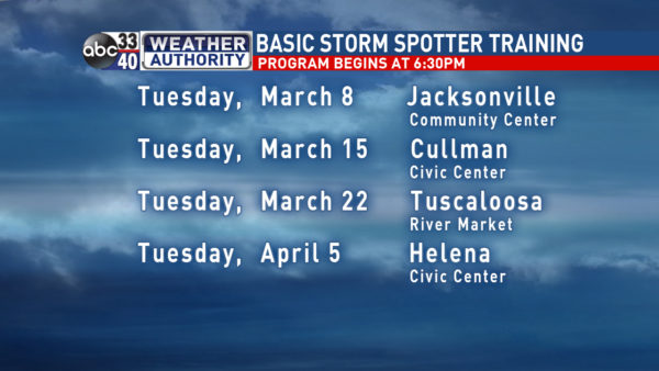
STORM SPOTTER TRAINING: We are offering basic SKYWARN training at four locations across North/Central Alabama in March and April, followed by the big event, Storm Spotter Xtreme on Saturday, April 9 at the BJCC from 9am to 2pm. This will feature both the basic and advanced SKYWARN classes, along with a session from Kevin Laws of the Birmingham NWS office. And, if you come, you get free admission to the Alabama International Auto Show, going on at the BJCC that same day. There is no cost and no need to register. Just show up with a curious mind. Kids 10 and older will also enjoy this if they love weather and want to learn more. Please help us make the severe weather warning process better!
WEATHER BRAINS: Don’t forget you can listen to our weekly 90 minute netcast anytime on the web, or on iTunes. This is the show all about weather featuring many familiar voices, including our meteorologists here at ABC 33/40.
CONNECT: You can find me on all of the major social networks…
Facebook
Twitter
Google Plus
Instagram
I had a great time today visiting with the 6th graders at Opelika Middle School… look for the next Weather Xtreme video here by 7:00 a.m. tomorrow…
Category: Alabama's Weather
About the Author (Author Profile)
James Spann is one of the most recognized and trusted television meteorologists in the industry. He holds the AMS CCM designation and television seals from the AMS and NWA. He is a past winner of the Broadcast Meteorologist of the Year from both professional organizations.Subscribe
If you enjoyed this article, subscribe to receive more just like it.


