Alabama 811 | Know What's Below.

Archive for April, 2010

Keeping Eye on Mississippi Storm

Keeping Eye on Mississippi Storm

| April 30, 2010 @ 11:01 pm | 8 Replies

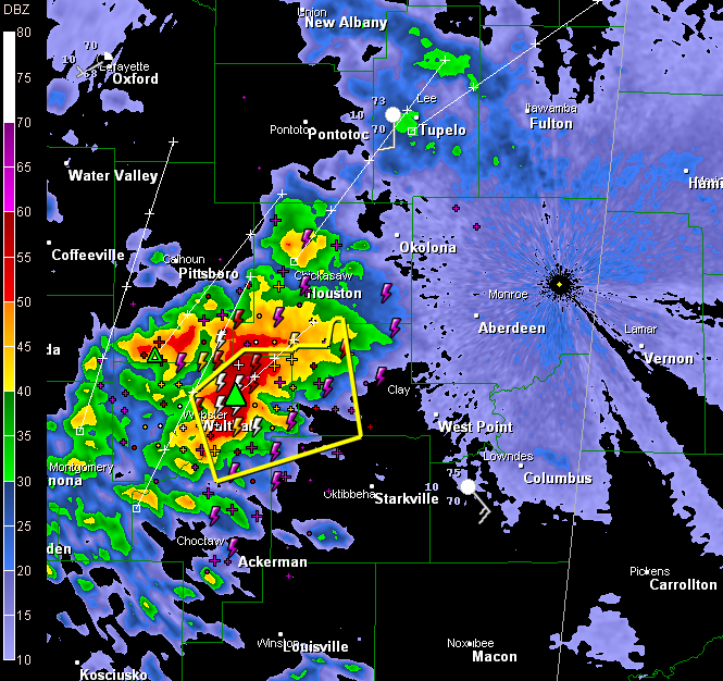
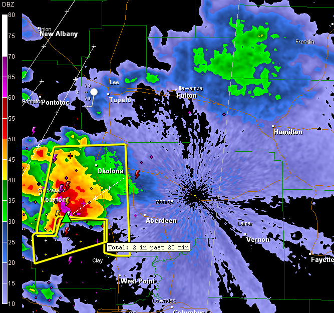
The large storm complex over northern Mississippi passing north of Aberdeen is showing a high probability of severe hail, possibly as large as grapefruit size (4 inches). We hope that it will weaken as it moves into Northwest Alabama, but no sign of that so far. The complex is moving northeast very slowly, at about […]

Read More

Ominous Radar Signature South of Little Rock

Ominous Radar Signature South of Little Rock

| April 30, 2010 @ 10:50 pm | 7 Replies

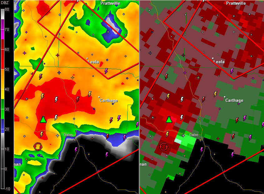
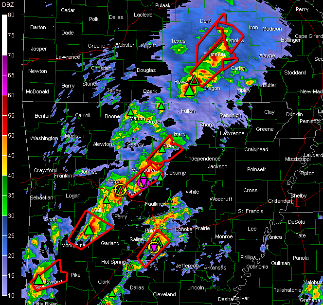
Tornado warning for storm south southwest of Little Rock… Thanks to Kevin Laws from the NWS for sending me a radar color table that mimics the one in the NWS AWIPS display. When I upgraded my GR Level III software last week, it substituted a less desirable color table.

Read More

East End AR Damage

East End AR Damage

| April 30, 2010 @ 9:58 pm | 2 Replies

The Fire Department at East End, AR was destroyed by a tornado earlier tonight. Fortunately all the firefighters and some of their family members were ok, but the building and some of the equipment was destroyed. East End is 15 miles south of Little Rock. Our sister station, KATV, is streaming live here. We have […]

Read More

Eastern Mississippi Storm

Eastern Mississippi Storm

| April 30, 2010 @ 9:51 pm | 1 Reply

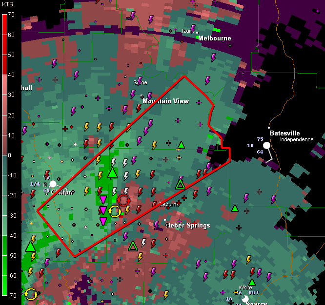
Heads up Northwest Alabama… The storm passing northwest of Starkville has had a tornado warning on it. It is moving northeast and will affect Northwest Alabama around 11 p.m. It will affect areas from northern Lamar or Marion County Lots of lightning in this nasty storm. A severe thunderstorm warning is in effect for parts […]

Read More

From Jim Cantore’s Twitter Account…

From Jim Cantore’s Twitter Account…

| April 30, 2010 @ 9:37 pm | 24 Replies

Read More

Tornado Threat in Western Alabama Overnight?

Tornado Threat in Western Alabama Overnight?

| April 30, 2010 @ 9:23 pm | 1 Reply

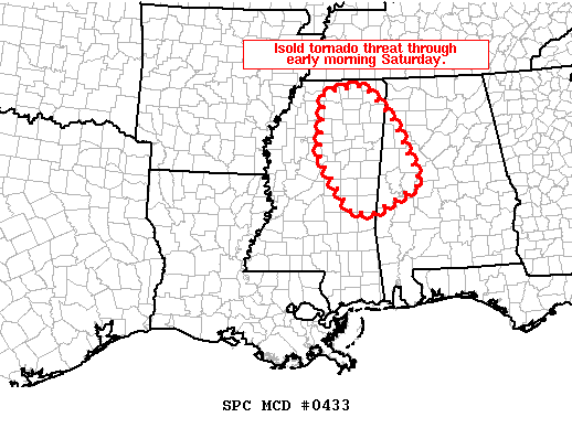
MESOSCALE DISCUSSION 0433 NWS STORM PREDICTION CENTER NORMAN OK 0905 PM CDT FRI APR 30 2010 AREAS AFFECTED…NRN/ERN MS…WCNTRL AL CONCERNING…SEVERE POTENTIAL…WATCH POSSIBLE VALID 010205Z – 010300Z TSTMS HAVE DEEPENED ALONG NRN EDGE OF RETURNING LLVL GULF/CARIBBEAN MOISTURE ACROSS NRN/ERN MS THIS EVENING. EXPECT THAT STORMS WILL CONTINUE TO SLOWLY INTENSIFY ALONG ERN EDGE OF […]

Read More

St. Louis Under the Gun

St. Louis Under the Gun

| April 30, 2010 @ 9:14 pm | 2 Replies

The Cardinals are playing the Reds tonight at Busch Stadium in St. Louis. KMOV in St. Louis is streaming live and reports that people in the stadium are being advised to seek shelter in the concourse areas. This is mainly due to lightning. The most dangerous storm is crossing into Illinois from Missouri, just south […]

Read More

Busy, Busy NWS Offices

Busy, Busy NWS Offices

| April 30, 2010 @ 9:04 pm | 1 Reply

* An amazing 28 Tornado Warnings in just the last two hours, many of them in Arkansas and Missouri. * Willow Springs, Missouri has been hard it. All of the town is without power and much of the county. * Closer to home, NWS Jackson has issued a Tornado Warning for North Choctaw County and […]

Read More

Reports From Arkansas

Reports From Arkansas

| April 30, 2010 @ 8:54 pm | Reply

Some reports from Arkansas… …8:23 p.m….tornado confirmed on the ground near Culpepper in Van Buren County. …Likely tornado passing just east of Little Rock. Passed very close to the LIT airport. Suspected tornado is in the I-440 River Bridge area. Power flashes observed in the past few minutes at 440 and the road to England/Scott. […]

Read More

Bad Night in Arkansas/Missouri

Bad Night in Arkansas/Missouri

| April 30, 2010 @ 8:25 pm | 1 Reply

Look at all the tornado warnings tonight across Arkansas and Missouri. Numerous strong indications of tornadoes on Doppler radar across that region tonight. A tornado was reported just after 7 p.m. at Cleveland. A home was destroyed just before 7 p.m. at Dora, MO. The SPC has upgraded the severe weather outlook over much of […]

Read More

Severe Weather Again

Severe Weather Again

| April 30, 2010 @ 7:56 pm | 2 Replies

The Storm Prediction Center has posted a Slight Risk of severe weather for the remainder of tonight in these areas: NE Texas North half of Louisiana Arkansas Most of Missouri All of Illinois Almost all of Wisconsin Extreme NW Mississippi West edge of both Tennessee and Kentucky Within that Slight Risk is an Enhanced Moderate […]

Read More

Oil Spill and Coastal Winds

Oil Spill and Coastal Winds

| April 30, 2010 @ 3:51 pm | 1 Reply

Due to the high interest in the oil spill, here is a roundup of wind reports along and offshore from observations at 3 o’clock this afternoon. Wind is very important in an event like this… The wind will be getting stronger as we go through the weekend. Brookley Field/Mobile…SE 14 mph (all speeds in MPH) […]

Read More

Alabama Tornado Info

Alabama Tornado Info

| April 30, 2010 @ 2:56 pm | 2 Replies

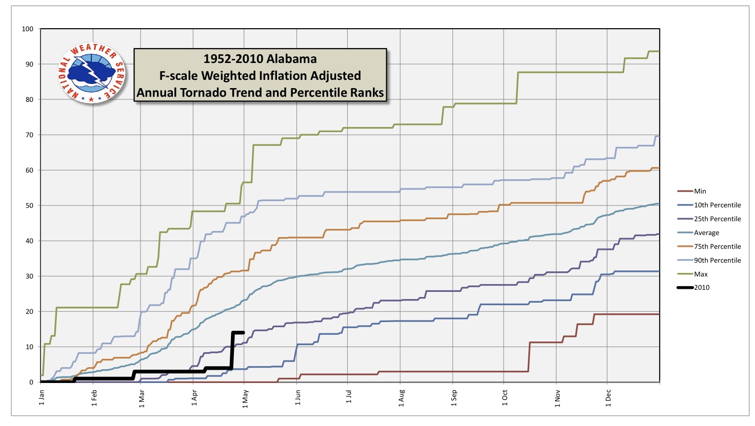
**No afternoon Weather Xtreme video this afternoon… please scroll down for the morning discussion, which is still very valid** Thanks to Jim Westland of the Birmingham NWS for this very interesting read… Back before the big tornado outbreak last weekend, it looked like we were in a tornado drought of sorts, with only 4 tornadoes […]

Read More

Oil Spill

Oil Spill

| April 30, 2010 @ 8:00 am | 15 Replies

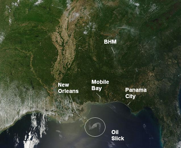
This satellite image from yesterday shows the oil spill off the Louisiana Coast resulting from the explosion and sinking of the Deepwater Horizon Oil Rig. Late reports last night indicated that the oil had reached the mouth of the Mississippi River. The leak is reportedly 5,000 barrels per day, or about 200,000 gallons. If you […]

Read More