

Matthew Impact – Florida Atlantic Coast
Hurricane Matthew will bring life threatening conditions to the immediate Florida Atlantic coast late tonight and tomorrow…
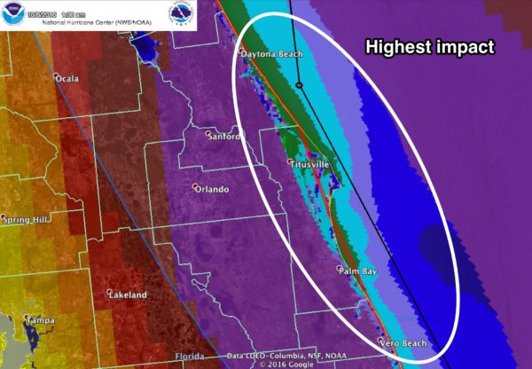
The main concern is the coastal area from roughly West Palm Beach north to Daytona Beach; this is what can be expected there.
STORM SURGE: A surge of 6 to 9 feet is likely, which will bring coastal flooding and beach erosion. This will inundate low lying areas.
WINDS: Winds could gust to 125 mph, with potential to destroy mobile homes, bring structural damage, and widespread power outages which be of long duration. Windows in high rise buildings along the coast (condos, hotels, etc) could shatter due to flying debris.
RAIN: Amounts of 5 to 8 inches are likely along the immediate coast, with flooding likely.
TIMING: Conditions will deteriorate along the coast late tonight; the worst of the weather will come tomorrow. The weekend will be calm with sunny weather Saturday and Sunday.
TO THE WEST: The impact will drop off on the “good” west side of the circulation center as you go farther inland. Orlando will deal with winds of 30-50 mph tomorrow (higher gusts are likely, however), with lots of rain, but probably not enough rain for widespread flooding. Disney World officials have advised those at the Fort Wilderness campground that they must leave by 11 a.m. ET today; camping is not a good idea in these conditions. There has been no word from Disney about whether its theme parks will close tomorrow. But the good news is that the weekend will be beautiful as the hurricane moves away. Tampa will see generally under 1/2 inch of rain, with winds under 30 mph.
TO THE NORTH: Matthew will impact Jacksonville, Savannah, and Charleston as well, but conditions there won’t be as extreme.
Forecasting impact with a hurricane moving parallel to the coast is much more challenging that one moving into the coast at a perpendicular angle. A small deviation to the right or left will make a huge difference in impact, but in this case you have to prepare for a worst case scenario. If you are in this zone, be sure and follow advice from local officials.
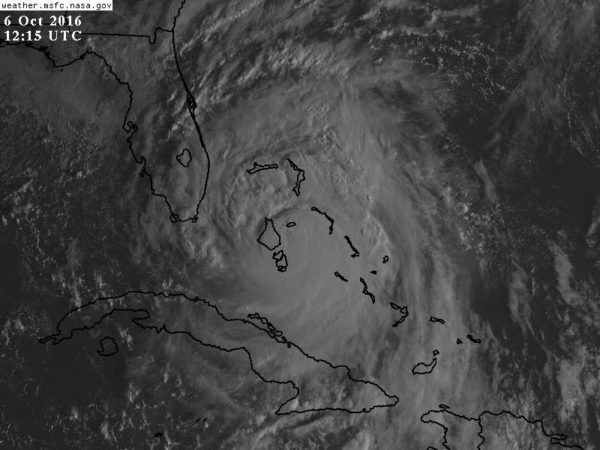
Here is an early morning look at the sun coming up over Matthew, which is hammering the Bahamas early this morning…
Category: Tropical
About the Author (Author Profile)
James Spann is one of the most recognized and trusted television meteorologists in the industry. He holds the AMS CCM designation and television seals from the AMS and NWA. He is a past winner of the Broadcast Meteorologist of the Year from both professional organizations.Subscribe
If you enjoyed this article, subscribe to receive more just like it.


