Matthew Moves Closer to FL, While Central AL is Still Warm & Dry
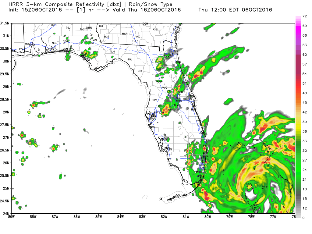
15z HRRR Run – Composite Reflectivity
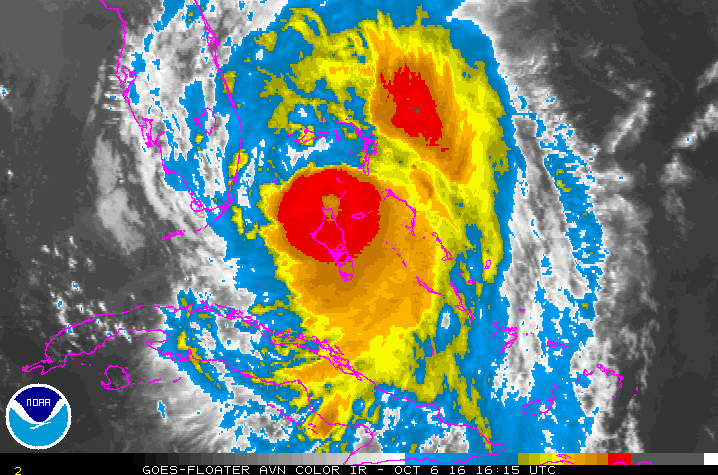
HURRICANE MATTHEW:
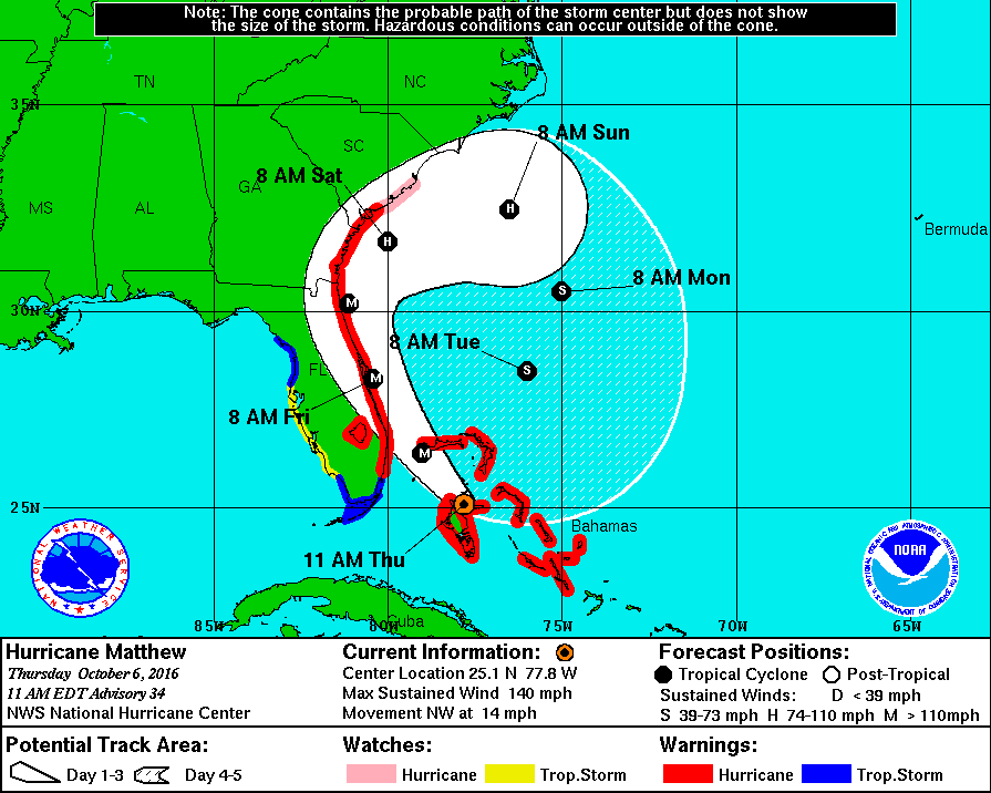
As of 11:00 AM CDT, Hurricane Matthew has returned to category 4 strength, with 140 MPH maximum sustained winds, and with a minimum pressure of 940 mb. Movement at this time is northwest at 14 MPH. Current forecast track from the NHC continues to have the eye of Matthew moving to the northwest along the Atlantic Coast of the Florida Peninsula with a brief landfall near Cape Canaveral as a major hurricane sometime tomorrow morning, before re-emerging over the water and and starting its clockwise loop on Saturday morning as a weaker hurricane.
Hurricane warnings are up from just north of Golden Beach, Florida, to Edisto Beach, South Carolina, and for all of Lake Okeechobee. Hurricane watches are up for Edisto Beach to South Santee River in South Carolina. Tropical storm warnings are up in Florida from Chokoloskee to Golden Beach, the Florida Keys from Seven Mile Bridge eastward, Florida Bay, and from Anclote River to Suwannee River.
Hurricane-force conditions are first expected to reach the hurricane warning areas by late today and will spread northward within the warning area through Friday. Tropical storm conditions can be expected within the next few hours. Storm surge can be up to six to nine feet, and large waves generated by the hurricane will cause water to rise well-ahead and well-away from the track of the eye. Areas along the Atlantic Coasts of Florida, Georgia, and South Carolina could expect rainfall amounts of eight to twelve inches. Life-threatening flooding could occur.
As of 8:00 PM EDT tonight, Orlando International Airport will cease commercial service, and airport and air carrier personnel will be preparing the airport and airfield to sustain the heavy impact by securing equipment and vehicles, tying down jet bridges, removing debris from airfield and curb areas, and securing and lowering cranes in the construction areas. They anticipate to resume commercial service on Saturday depending on clean up, staff availability, and aircraft and crew availability.
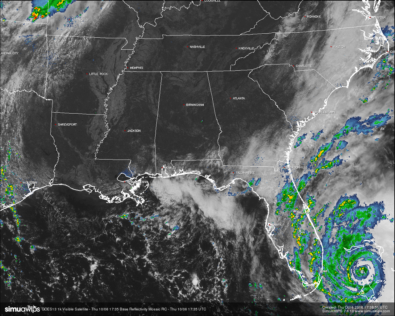
Matthew will be no threat to the Gulf of Mexico or to the weather in Alabama. For the latest updates, be sure to follow all of our social media and news outlets.
ANOTHER DRY AND WARM DAY WITH A LITTLE BREEZE:
Yes, it may be a beautiful day outside today for Central Alabama, but its not good news for our drought situation. Today will be the 18th consecutive day without measurable rain, and with the way that the weather patterns are setting up according to the forecast models, it may stretch out to 30 days. Skies will continue to be mostly clear to clear, and afternoon highs will get up into the mid and upper 80s.
NO AIR QUALITY ALERT TODAY:
Ozone and Particulate Matter 2.5 levels will be too low to raise the “Code Yellow” Air Quality Alert for the Birmingham metropolitan area today. No actions needed.
TEMPERATURES ACROSS CENTRAL ALABAMA AT THIS HOUR:
Birmingham 82
Tuscaloosa 84
Gadsden 81
Anniston 81
Cullman 81
Alexander City 77
Auburn 79
Selma 81
Montgomery 82
NORMS AND RECS FOR TODAY IN BIRMINGHAM:
The normal high for October 6th is 78, while the normal low is 55. The record high for today was set back in 1954 at 94. The record low was set back in 1980 at 36.
TOMORROW’S FORECAST:
It will be a carbon copy of today’s weather… Sunshine will be out in full force with another day with no rain. Afternoon highs will be in the mid 80s for most, with a few places reaching the upper 80s.
HEADED TO THE BEACH:
Sunny days, fair nights on the coast from Panama City Beach to Gulf Shores through early next week; no impact at all from Matthew. Highs in the 80s. See a very detailed Gulf Coast forecast here.
BARBER VINTAGE MOTORCYCLE FESTIVAL:
This event runs from tomorrow through Sunday at the Barber Motorsports Park. Highs in the mid 80s tomorrow and Saturday, cooling into the mid to upper 70s Sunday. Sunny days, clear nights. Get ticket information right here.
TROPICS:
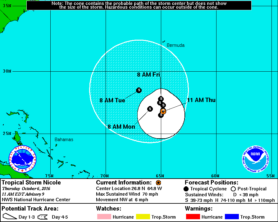
With Matthew being the main weather story, Tropical Storm Nicole will go down as the forgotten storm, and she will give us no reason for us to remember her by either. Nicole will just meander around in the zone from Puerto Rico and Bermuda with no impact to land over the next five days.
ON THIS DAY IN 1985:
A tropical wave, later to become Tropical Storm Isabel, struck Puerto Rico. As much as 24 inches of rain fell in 24 hours, and the severe flooding and numerous landslides resulting from the rain claimed about 180 lives.
THE BLOG IS ON TWITTER:
Be sure to follow the Alabama Wx Weather Blog on Twitter. Just click here to start following our feed.
WEATHERBRAINS:
This is the weekly netcast that’s all about weather featuring many familiar voices, including our meteorologists at ABC 33/40. You can listen anytime on the web, or on iTunes. You can find it here.
ADVERTISE WITH US:
Deliver your message to a highly engaged audience by advertising on the AlabamaWX.com website. The site enjoyed 10.2 MILLION pageviews in the past 12 months. Don’t miss out! We can customize a creative, flexible and affordable package that will suit your organization’s needs. Contact Bill Murray at (205) 687-0782.
Category: Alabama's Weather
About the Author (Author Profile)
Scott Martin is an operational meteorologist, professional graphic artist, musician, husband, and father. Not only is Scott a member of the National Weather Association, but he is also the Central Alabama Chapter of the NWA president. Scott is also the co-founder of Racecast Weather, which provides forecasts for many racing series across the USA. He also supplies forecasts for the BassMaster Elite Series events including the BassMaster Classic.Subscribe
If you enjoyed this article, subscribe to receive more just like it.


