

Latest Weather Xtreme Video: Nice Warmup After a Cold Friday
The official high temperature at the Birmingham Shuttlesworth International Airport yesterday was 52 which established a new record low maximum temperature for May 5th. It also tied the coldest May day on record set on May 3, 1921. Yesterday was the day we should all keep in our memory for when the temperatures start peaking in the middle and upper 90s in July and August.
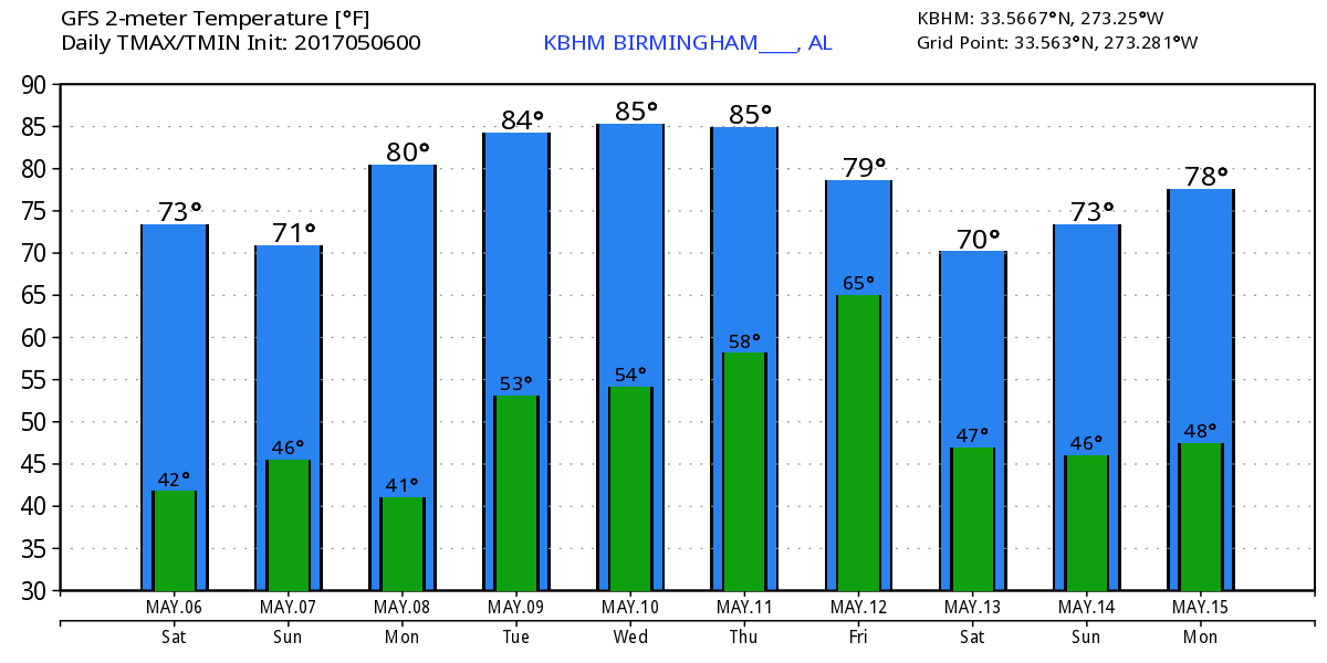
The day is starting out clear and chilly with morning lows mainly in the lower 40s which is about 13 degrees below our seasonal average. After a record-setting cold day on Friday, temperatures should rebound nicely into the middle 70s today with plenty of sunshine. This will make for great weather for the Nascar races at Talladega this weekend. Thunderstorms are forecast across North Georgia and Southeast Tennessee with weak instability and could produce marginally severe weather with damaging wind the primary danger.
The big upper trough along the East Coast will continue to move away from us Sunday but it will retain a little influence. Morning lows Sunday will dip back into the upper 40s with the afternoon highs once again in the middle 70s.
For much of the week ahead, Central Alabama and the Southeast US will find an upper trough the principal feature in our weather pattern. The upper trough will see temperatures climb once again into the 80s.
The main weather action is forecast to come on late Thursday and Friday. A trough over the Southwest US Tuesday and Wednesday will make its way eastward on Thursday as a surface low forms over the Texas Panhandle. The surface low will move eastward to a position over East Tennessee on Friday at midday. This will cause clouds to be on the increase Thursday with rain and thunderstorms becoming likely Thursday night and into Friday. SPC does outline a risk for severe storms primarily in the ArkLaTx region on Day 6, Thursday into early Friday. Clouds and rain should bring temperatures down once again at least into the 70s on Thursday and Friday.
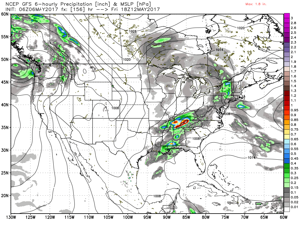
The upper low scoots by fairly quickly as the surface low moves northeastward into the Mid-Atlantic states Saturday. This should allow rapid improvement in our weather during the latter part of Friday with great weather once again for Saturday and Sunday across the Southeast US. Highs will likely be mainly in the 70s.
Looking out into voodoo country, the GFS is very bullish on establishing an upper ridge over the eastern half of the country and keeping it there throughout Week 2. The ridge is forecast to be very strong, so traveling weather systems will be staying well north of Central Alabama. With this upper air pattern, much of Week 2 could be dry and fairly warm.
Beach weather is looking great for the next 5 to 6 days with sunshine and highs around the 80-degree mark. For a detailed look at the weather from Fort Morgan over to Panama City Beach, click here to see the Beach Forecast Center page. Save Up To 25% on Spring Break Beach Vacations on the Alabama Gulf Coast with Brett/Robinson! The Beach Forecast is partially underwritten by the support of Brett/Robinson Vacation Rentals in Gulf Shores and Orange Beach. Click here to see Brett/Robinson’s best beach offers now!
I expect to have the next Weather Xtreme Video posted here by 7 am or so on Sunday morning. I hope you have a great day. Godspeed.
-Brian-
Category: Alabama's Weather, ALL POSTS, Weather Xtreme Videos
About the Author (Author Profile)
Brian Peters is one of the television meteorologists at ABC3340 in Birmingham and a retired NWS Warning Coordination Meteorologist. He handles the weekend Weather Xtreme Videos and forecast discussion and is the Webmaster for the popular WeatherBrains podcast.Subscribe
If you enjoyed this article, subscribe to receive more just like it.


