

January 25, 1940 – The 1940 Cold Wave
On the morning of January 25, 1940, the headlines on the Birmingham Age-Herald screamed that more cold was in store for the state. And it had already been very cold.
Since an arctic cold wave invaded the state on the night of the 18th, overnight lows had been in the teens or single digits every morning except for the morning of the 23rd when the low was 24F. The average temperature of 21.3 for the seven day period ending January 25, 1940 still stands as the ninth coldest seven day period in Birmingham history.
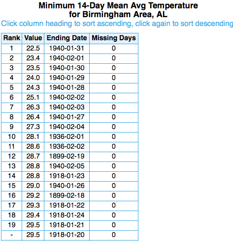
The 1940 cold wave still holds most of the cold wave records in Magic City history, including seven of the ten coldest seven day periods, the three coldest ten day periods as well as seven of the top ten coldest ten day periods and the top nine coldest fourteen day periods as well.
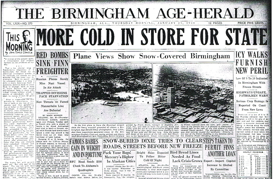
On the morning of the 25th, another trace of snow had been added to the mantle of white that blanketed the city. The morning low was 8F and the mercuty once again barely made it to 20F at the Weather Bureau Office atop the hill overlooking downtown in Fountain Heights. There would be three days between the 18th and 31st that the mercury would only reach 20F. By the morning of the 26th, the mercury would register 1F, the coldest of the protracted cold spell.
Category: Alabama's Weather, Met 101/Weather History
About the Author (Author Profile)
Bill Murray is the President of The Weather Factory. He is the site's official weather historian and a weekend forecaster. He also anchors the site's severe weather coverage. Bill Murray is the proud holder of National Weather Association Digital Seal #0001 @wxhistorianSubscribe
If you enjoyed this article, subscribe to receive more just like it.


