

Hit and Miss, Slow Moving Storms
An all new edition of the ABC 33/40 Weather Xtreme video is available in the player on the right sidebar of the blog. You can subscribe to the Weather Xtreme video on iTunes by clicking here.
RADAR CHECK: It is the classic case of scattered thunderstorms on a summer afternoon in Alabama today. Many neighborhoods remain dry, a few have been soaked. Even some small hail reported with the stronger storms today.
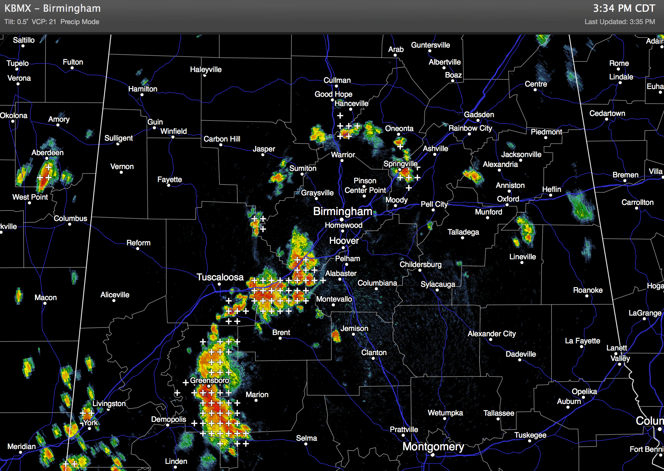
Storms once again are moving very little, and they will fizzle out later this evening after the sun goes down. Away from the storms, temperatures are mostly in the low 90s.
REST OF THE WEEK: The weather won’t change much through Friday. Storms might be a little fewer in number tomorrow as the air aloft will be slightly warmer. Highs remain in the 90-90 degree range, and most of the scattered storms will come from about 1:00 until 8:00 p.m. The risk of any one spot getting wet tomorrow and Friday is in the 20-30 percent range.
OUR WEEKEND: The classic summer pattern rolls along. Look for a mix of sun and clouds Saturday and Sunday with “scattered, mostly afternoon and evening showers and thunderstorms”. Highs at or just over 90 degrees both days.
NEXT WEEK: Showers and storms should become more numerous next week as the upper ridge continues to weaken and the air becomes more unstable. Afternoon highs should drop back into the upper 80s by mid-week due to the clouds and showers. See the Weather Xtreme video for the maps, graphics, and details.
GULF COAST WEATHER: An isolated shower this morning over Mobile Bay produced a waterspout just north of Fort Morgan… (photo by Becky Overton)

The weather looks great through the weekend on the coast from Panama City over to Gulf Shores. Yes, there will be a few widely scattered storms around, but each day should feature a good supply of sunshine. Highs on the coast in the upper 80s, with low 90s inland.
TROPICS: Tropical storm formation is not expected across the Atlantic basin through the weekend.
CONNECT: You can find me on all of the major social networks…
Facebook
Twitter
Google Plus
Instagram
WEATHER BRAINS: Don’t forget you can listen to our weekly 90 minute netcast anytime on the web, or on iTunes. This is the show all about weather featuring many familiar voices, including our meteorologists here at ABC 33/40.
Look for the next Weather Xtreme video here by 7:00 a.m. tomorrow….
Category: Alabama's Weather
About the Author (Author Profile)
James Spann is one of the most recognized and trusted television meteorologists in the industry. He holds the AMS CCM designation and television seals from the AMS and NWA. He is a past winner of the Broadcast Meteorologist of the Year from both professional organizations.Subscribe
If you enjoyed this article, subscribe to receive more just like it.


