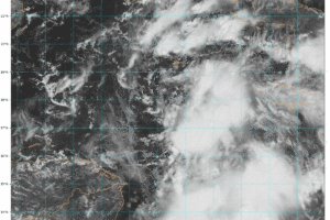
Tropics Update: Hurricane Hunters Gathering Important Data
Here is the latest on what will eventually become Helene!
Owner of Tornado Talk. Radio broadcast meteorologist with The Storm Report. WeatherBrains Panelist. B.S. Meteorology from Penn State University.

Here is the latest on what will eventually become Helene!
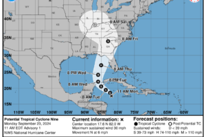
After watching the model runs for the past several days, we now have our first advisory from the NHC on the potential tropical cyclone.
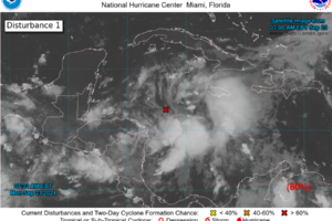
We have invest 97L in the NW Caribbean. Showers and thunderstorms are gradually becoming more organized. We will be tracking this all week!
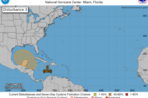
Just a quick tropics update with a focus on that area in the NW Caribbean/Southern Gulf. This is where the various models are still showing low pressure forming sometime early/mid next week.
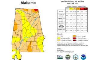
The U.S Drought Monitor has issued their latest update. Tropical moisture from Hurricane Francine did help a bit in some areas with the drought conditions. One to locally two-category drought reductions occurred especially where extreme rainfall was seen. Sadly, some areas saw such extreme rain it led to massive flooding. Here is this week’s snapshot: […]
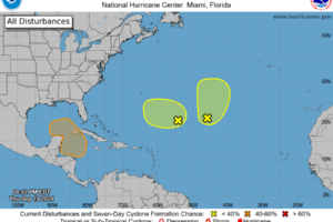
Doing a check of the tropics as the models have been consistent in showing some development of low pressure early next week over the NW Caribbean.

We had a great show Monday Night! Kim and James A. were LIVE from the NWA annual meeting in Irving, Texas.
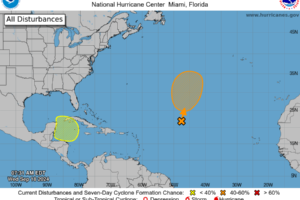
Keeping our eyes on two areas for possible tropical development over the next 7 days. A lot of uncertainties but bears watching especially by the middle parts of next week.
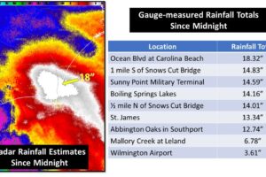
It has been a record-setting day across parts of of the North Carolina Coast with massive, life-threatening flooding. Folks, sometimes you don’t need what seems like an truly organized system, or a named system. You just need the right ingredients to come together to cause a major event.

Panelists Kim Klockow-McClain & James Aydelott will be leading the show from The RON. Join us LIVE at 8p ET/7p CT for what will be a lively discussion with several guests!
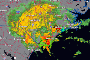
What is happening with this low near the South Carolina and North Carolina is proof that it doesn’t need to have a name to cause major problems. Radar estimates and volunteer rain gages are showing over 15 inches of rain may have fallen in Carolina Beach, NC.
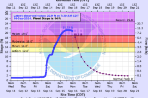
The stage this morning was 20.8 feet with the maximum stage over the past 24 hours at 21.3 feet.
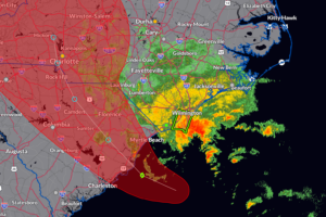
Been reviewing the 4am and 7am CDT updates from the National Hurricane Center on the low off the South Carolina Coast and Gordon.
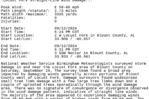
The NWS Birmingham surveyed the damage in this area and determined straight-line wind damage around 50-60 mph.
 Our long time friend, mentor, and charter Weather Factory member, J.B. Elliott, passed away on May 11, 2015. Click HERE to read James' tribute.
Notifications

