Alabama 811 | Know What's Below.

Archive for June, 2013

Mid-Evening Radar Update

Mid-Evening Radar Update

| June 30, 2013 @ 9:01 pm

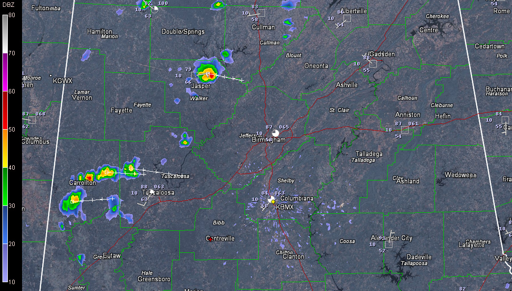
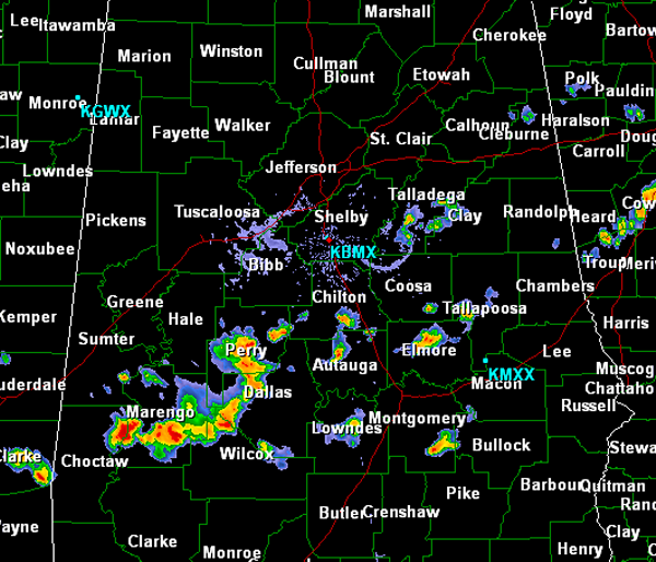
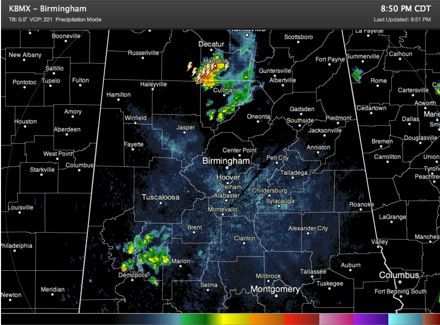
Storms are fairly concentrated in two places tonight, including Morgan County in North Alabama and Greene and Hale Counties in West Central Alabama. Showers have weakened over Walker County. The storms over Morgan County are near the vortex of the upper level disturbance that has triggered the showers today. It is moving to the northeast. […]

Read More

Isolated Showers Forming

Isolated Showers Forming

| June 30, 2013 @ 2:52 pm

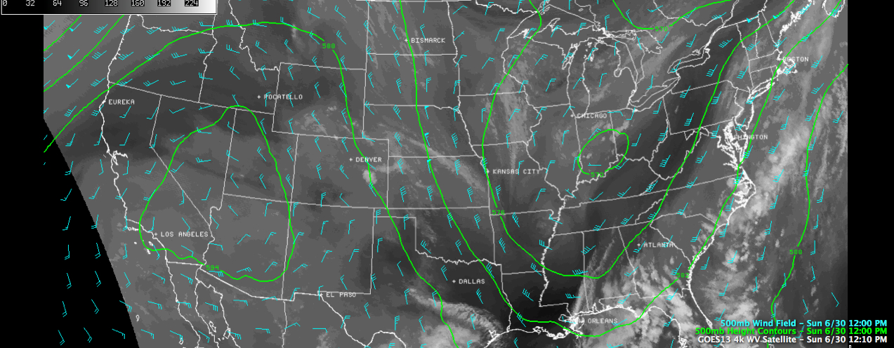
Isolated showers are forming across western Alabama this afternoon ahead of a southeastward diving upper disturbance that is near Memphis at this hour. They extend northward along a curved line into Central Tennessee west of Nashville. The heaviest shower was just northeast of Jasper in Walker County, moving east toward Arkadelphia. No lightning yet, but […]

Read More

A Noonday Update

A Noonday Update

| June 30, 2013 @ 12:26 pm

As we sail into afternoon here in Central Alabama, here is a quick look at the Alabama weather situation. Yesterday’s cold front lies across southeastern Alabama with a surface low tracking along it southwest of Atlanta. The front isn’t going to go much further to the south though. Another weak surface low was east of […]

Read More

Just Where Will the Showers Be?

Just Where Will the Showers Be?

| June 30, 2013 @ 6:38 am

An all new edition of the ABC 33/40 Weather Xtreme video is available in the player on the right sidebar of the blog. You can subscribe to the Weather Xtreme video on iTunes by clicking here. The main forecast challenge for today is to determine exactly where the dividing line is between the drier air […]

Read More

Amazing Records Out West

Amazing Records Out West

| June 29, 2013 @ 10:45 pm

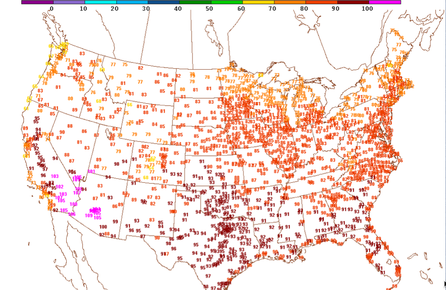
The western United States is sizzling under a huge 594 dkm upper level high pressure system. Lots of records fell on Friday, and even more today. Here is a representative listing of daily records for 6/29: 123F at Needles CA (June record) 122F at Palm Springs/Thermal CA 121F at Indio CA 118F at Las Vegas […]

Read More

For the Rest of the Evening

For the Rest of the Evening

| June 29, 2013 @ 5:31 pm

A quick look at the surface analysis shows the frontal boundary continues to drop south across the state today. The front was roughly along the Interstate 20 corridor across the state. It will continue to head south overnight and will actually bring a bit of drier air in behind it. That should translate into less […]

Read More

Scattered Storms to the South

Scattered Storms to the South

| June 29, 2013 @ 3:06 pm

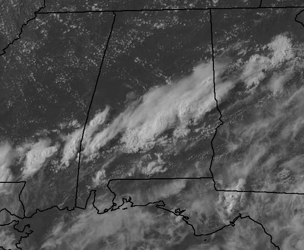
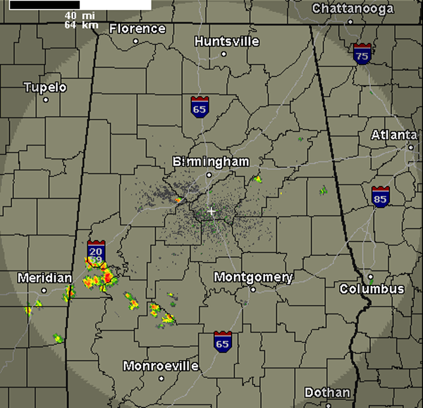
Depending where you are across North Central Alabama, the weather is quite different. Areas along and north of Interstate 20 are seeing mostly sunny skies. To the south, scattered showers and thunderstorms. These storms are widely scattered but are a bit more concentrated along the U.S. Highway 80 corridor from Marengo County to Dallas County. […]

Read More

A Few Isolated Storms Developing

A Few Isolated Storms Developing

| June 29, 2013 @ 1:26 pm

Some showers and storms have popped up early this afternoon across Central Alabama. There is one storm in northeast Tuscaloosa County along Interstate 20/59 and another shower in northern Talladega County. There is a cluster of more organized activity across Sumter and Marengo Counties, near Demopolis affecting highways 80 and 25. All activity is pushing […]

Read More

Late Morning Update

Late Morning Update

| June 29, 2013 @ 11:24 am

Just after 11 am, cumulus clouds had begun forming in the sky over North and Central Alabama while some low clouds and fog were finally dissipating in the area from Montgomery to Columbus, GA. With the morning soundings in, it sure looks like showers and thunderstorms will be confined to the southern portion of the […]

Read More

Weather Calmer Today

Weather Calmer Today

| June 29, 2013 @ 6:51 am

An all new edition of the ABC 33/40 Weather Xtreme video is available in the player on the right sidebar of the blog. You can subscribe to the Weather Xtreme video on iTunes by clicking here. Thunderstorms galore yesterday, but as an unusually deep trough carves out across the eastern US, it looks like our […]

Read More

Storms Pushing South

Storms Pushing South

| June 28, 2013 @ 10:34 pm

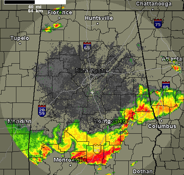
It has been a very active day and night for strong and severe storms across Alabama as there were numerous reports of tree and power line damage in many areas today. The worst of the weather continues to push south tonight with the most intense activity along and south of the Interstate 85 and Highway […]

Read More

All Counties Have Been Cleared from Watch

All Counties Have Been Cleared from Watch

| June 28, 2013 @ 9:50 pm

THE NATIONAL WEATHER SERVICE HAS CANCELLED THE SEVERE THUNDERSTORM WATCH FOR THE FOLLOWING COUNTIES: AUTAUGA DALLAS LOWNDES MARENGO THIS INCLUDES THE CITIES OF…DEMOPOLIS…FORT DEPOSIT…LINDEN… LOWNDESBORO…PRATTVILLE AND SELMA.

Read More

Rare Kelvin-Helmholtz Wave Clouds Here!

Rare Kelvin-Helmholtz Wave Clouds Here!

| June 28, 2013 @ 9:03 pm

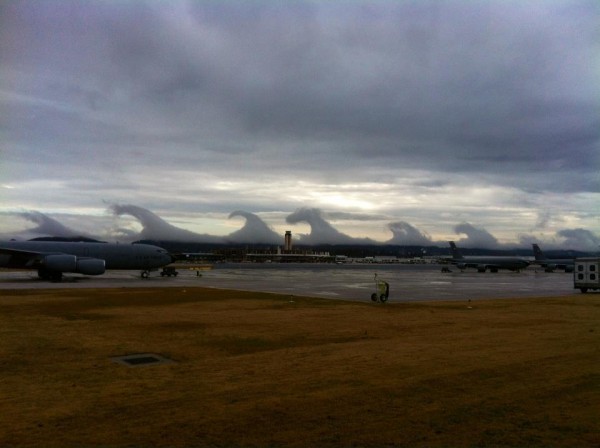
(This is an archived post from December 16, 2011.) These images were sent in by a number of our readers/viewers at midday… the first shot below is from the Alabama Air National Guard facility at the Birmingham-Shuttlesworth International Airport… This one is from I-65… Another image from an office in downtown Birmingham… From the Cloud […]

Read More

Watch Being Trimmed

Watch Being Trimmed

| June 28, 2013 @ 9:02 pm

THE NATIONAL WEATHER SERVICE HAS CANCELLED THE SEVERE THUNDERSTORM WATCH FOR THE FOLLOWING COUNTIES: CHILTON PERRY GREENE HALE SUMTER THIS INCLUDES THE CITIES OF…CLANTON…EUTAW…GREENSBORO… LIVINGSTON…MARION…MOUNDVILLE…UNIONTOWN AND YORK. SEVERE THUNDERSTORM WATCH REMAINS VALID UNTIL MIDNIGHT CDT TONIGHT FOR THE FOLLOWING COUNTIES: AUTAUGA DALLAS LOWNDES MARENGO THIS INCLUDES THE CITIES OF…DEMOPOLIS…FORT DEPOSIT…LINDEN… LOWNDESBORO…PRATTVILLE AND SELMA.

Read More