Alabama 811 | Know What's Below.

Archive for February 23rd, 2019

Areal Flood Warning Issued For Parts Of Cullman County Until 5:45AM

Areal Flood Warning Issued For Parts Of Cullman County Until 5:45AM

| February 23, 2019 @ 11:46 pm

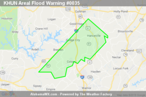
At 11:43 PM CST, reporting gauges indicate heavy rainfall today has resulted in flooding along the Mulberry Fork near Arkadelphia.

Read More

10:45 p.m. Look at Alabama’s Weather

10:45 p.m. Look at Alabama’s Weather

| February 23, 2019 @ 10:50 pm

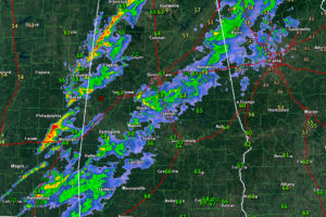
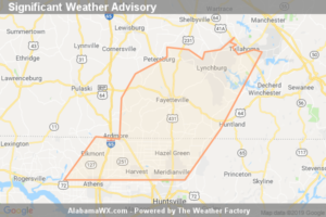
Rain and storms continue to push eastward across Central Alabama late tonight with lightning and heavy rain. The storms are not severe and are expected to continue to weakening overnight. Skies will clear on Sunday and it will turn cooler.
Read More

Significant Weather Advisory For Northwestern Madison,  Northeastern Limestone, Moore, Lincoln And Northwestern Franklin Counties Until 11:15 PM CST

Significant Weather Advisory For Northwestern Madison, Northeastern Limestone, Moore, Lincoln And Northwestern Franklin Counties Until 11:15 PM CST

| February 23, 2019 @ 10:29 pm

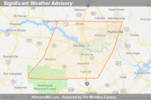
At 10:28 PM CST, Doppler Radar Was Tracking Strong Thunderstorms Along A Line Extending From Petersburg To Ardmore To Near Athens. Movement Was East At 30 Mph. Wind Gusts Up To 50 Mph Will Be Possible With These Storms.
Read More

Significant Weather Advisory For Southwestern Madison, Central Limestone, Morgan And Lawrence Counties Until 11:00 PM CST

Significant Weather Advisory For Southwestern Madison, Central Limestone, Morgan And Lawrence Counties Until 11:00 PM CST

| February 23, 2019 @ 10:17 pm

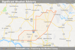
At 10:15 PM CST, Doppler Radar Was Tracking Strong Thunderstorms Along A Line Extending From Tanner To Near Moulton To Near Mount Hope. Movement Was East At 50 Mph. Winds In Excess Of 50 Mph Will Be Possible With These Storms.
Read More

Significant Weather Advisory For Northwestern Madison, Northern Limestone, Northwestern Moore And Lincoln Counties Until 10:30 PM CST

Significant Weather Advisory For Northwestern Madison, Northern Limestone, Northwestern Moore And Lincoln Counties Until 10:30 PM CST

| February 23, 2019 @ 9:48 pm

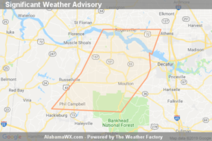
At 9:47 PM CST, Doppler Radar Was Tracking Strong Thunderstorms Along A Line Extending From Delrose To Ardmore To Near Rogersville. Movement Was East At 30 Mph. Winds In Excess Of 40 Mph Will Be Possible With These Storms.
Read More

Significant Weather Advisory For Southeastern Lauderdale, West Central Limestone, Southeastern Colbert, Eastern Franklin And Lawrence Counties Until 10:15 PM CST

Significant Weather Advisory For Southeastern Lauderdale, West Central Limestone, Southeastern Colbert, Eastern Franklin And Lawrence Counties Until 10:15 PM CST

| February 23, 2019 @ 9:46 pm

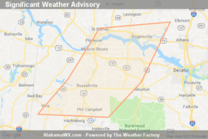
At 9:45 PM CST, Doppler Radar Was Tracking Strong Thunderstorms Along A Line Extending From Near Courtland To 10 Miles West Of Moulton To Phil Campbell. Movement Was East At 30 Mph. Winds In Excess Of 40 Mph Will Be Possible With These Storms.
Read More

Significant Weather Advisory For Southeastern Lauderdale,  Northwestern Limestone, Southeastern Colbert, Franklin And Northwestern Lawrence Counties Until 9:45 PM CST

Significant Weather Advisory For Southeastern Lauderdale, Northwestern Limestone, Southeastern Colbert, Franklin And Northwestern Lawrence Counties Until 9:45 PM CST

| February 23, 2019 @ 9:06 pm

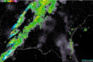
At 9:04 PM CST, Doppler Radar Was Tracking Strong Thunderstorms Along A Line Extending From Killen To Russellville To Hodges. Movement Was East At 40 Mph. Wind Gusts Up To 50 Mph Will Be Possible With These Storms.
Read More

9 p.m. Update:  All Alabama Counties Cleared from the Watch; No Warnings in Effect

9 p.m. Update: All Alabama Counties Cleared from the Watch; No Warnings in Effect

| February 23, 2019 @ 8:57 pm

All watches and warnings for Alabama have expired or have been canceled. A line of storms is pushing into western sections of the state and isolated reports of damaging winds are still possible.
Read More

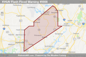
The Flash Flood Warning For Northwestern Jackson, Eastern Madison And Franklin Counties Will Expire At 8:30 PM CST
The Flash Flood Warning For Northwestern Jackson, Eastern Madison And Franklin Counties Will Expire At 8:30 PM CST

| February 23, 2019 @ 8:30 pm

The Flash Flood Warning For Northwestern Jackson, Eastern Madison And Franklin Counties Will Expire At 8:30 PM CST

Read More

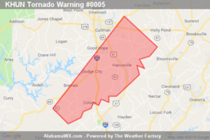
The Tornado Warning For Southeastern Cullman County Will Expire At 8:30 PM CST

The Tornado Warning For Southeastern Cullman County Will Expire At 8:30 PM CST

| February 23, 2019 @ 8:26 pm

The storm which prompted the warning has weakened below severe limits, and no longer appears capable of producing a tornado.
Read More

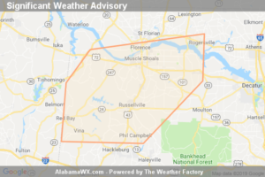
Significant Weather Advisory For Southeastern Lauderdale,  Colbert, Franklin And Northwestern Lawrence Counties Until 9:00 PM CST

Significant Weather Advisory For Southeastern Lauderdale, Colbert, Franklin And Northwestern Lawrence Counties Until 9:00 PM CST

| February 23, 2019 @ 8:19 pm

At 8:18 PM CST, Doppler Radar Was Tracking Strong Thunderstorms Along A Line Extending From Cherokee To Belgreen To Near Tremont. Movement Was East At 50 Mph. Winds In Excess Of 40 Mph Will Be Possible With These Storms.
Read More

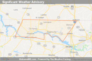
Significant Weather Advisory For Lauderdale, Northwestern Limestone And East Central Colbert Counties Until 8:30 PM CST

Significant Weather Advisory For Lauderdale, Northwestern Limestone And East Central Colbert Counties Until 8:30 PM CST

| February 23, 2019 @ 8:00 pm

At 8:00 PM CST, Doppler Radar Was Tracking Strong Thunderstorms Along A Line Extending From Near Underwood-petersville To Near Lexington To Near Athens. Movement Was Northeast At 70 Mph. Winds In Excess Of 40 Mph Will Be Possible With These Storms.
Read More

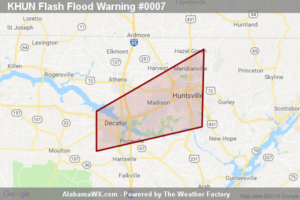
The Flash Flood Warning For Western Madison, Southeastern Limestone And Northern Morgan Counties Will Expire At 8:00 PM CST
The Flash Flood Warning For Western Madison, Southeastern Limestone And Northern Morgan Counties Will Expire At 8:00 PM CST

| February 23, 2019 @ 7:58 pm

The Flash Flood Warning For Western Madison, Southeastern Limestone And Northern Morgan Counties Will Expire At 8:00 PM CST

Read More

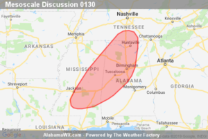
SPC Mesoscale Discussion: Tornado Watch 5… 6…

SPC Mesoscale Discussion: Tornado Watch 5… 6…

| February 23, 2019 @ 7:52 pm

An isolated severe threat will continue from central MS into central/northern AL and far south-central TN the next few hours.

Read More